


- Korte beschrijving
-
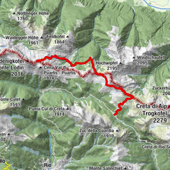
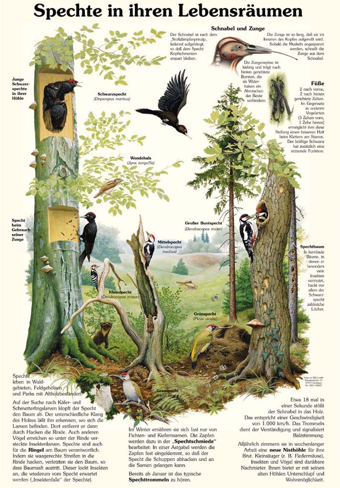
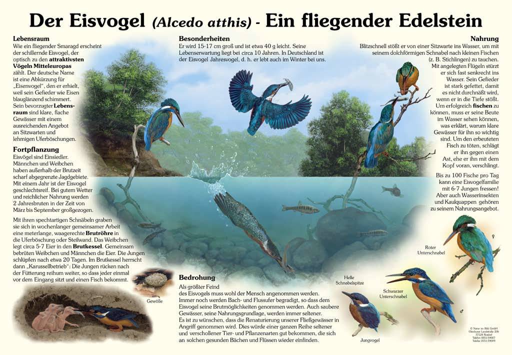
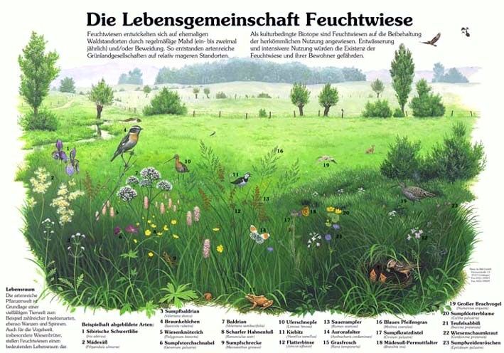
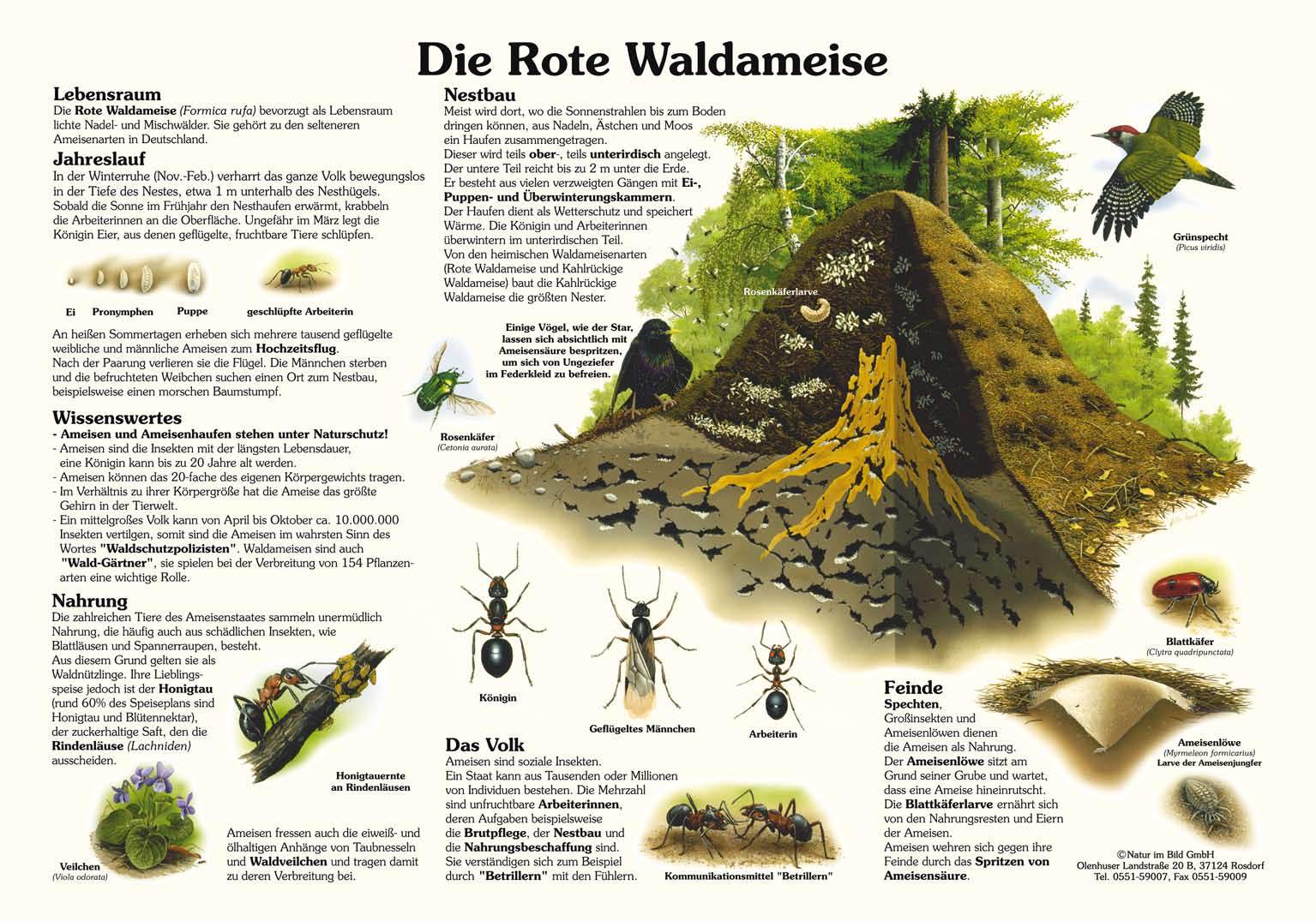
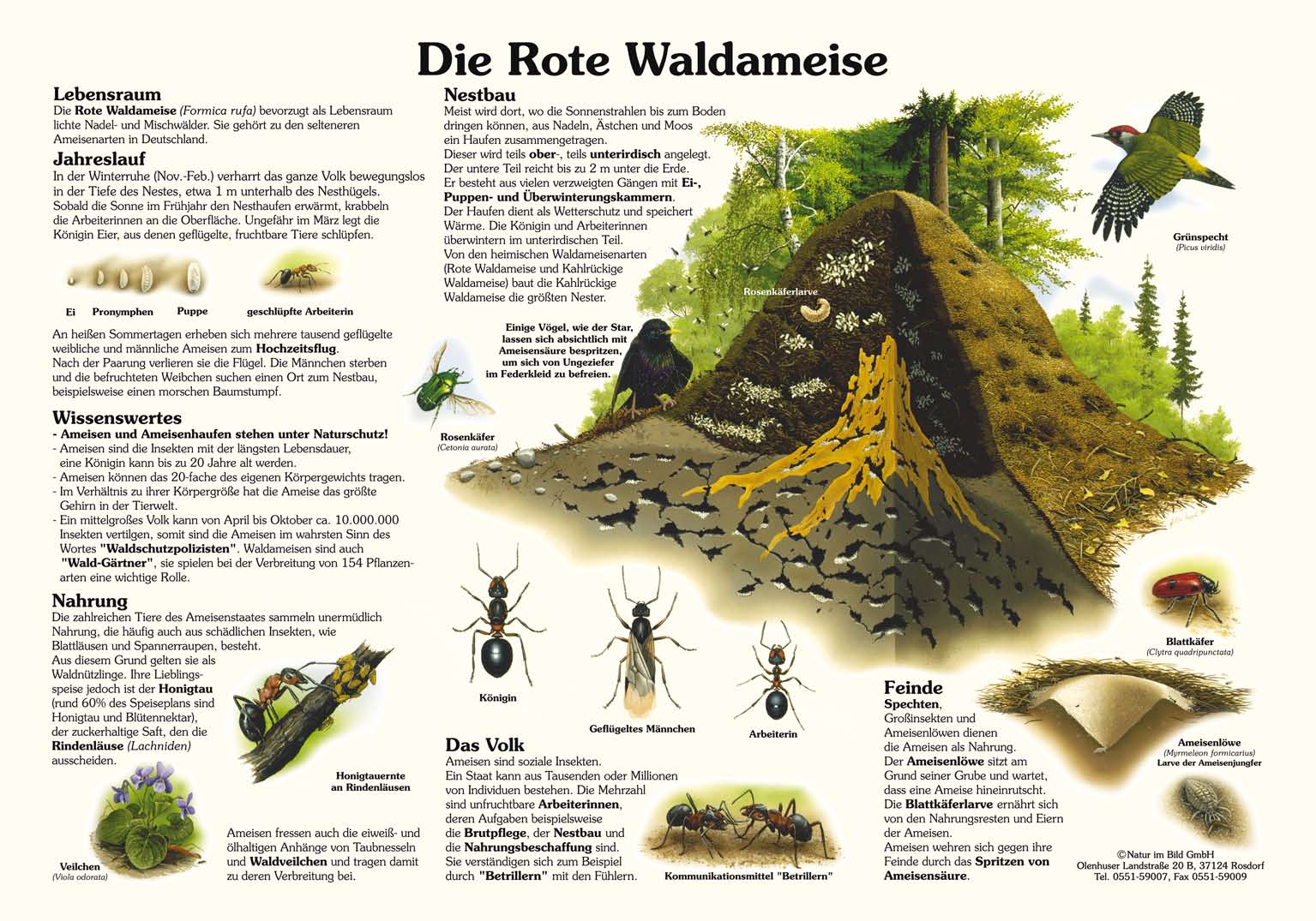
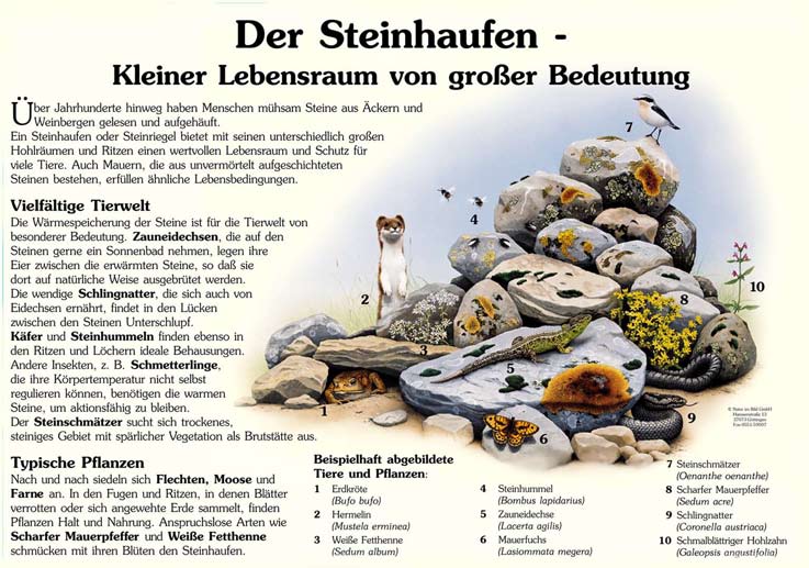
The nature trail and the aqua adventure trail, both are equipped with information displays, invite to a leisurely hiking tour and nature experience on a 4.5 km long circular route.
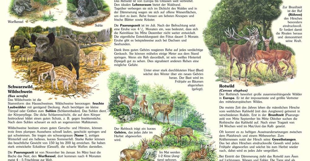
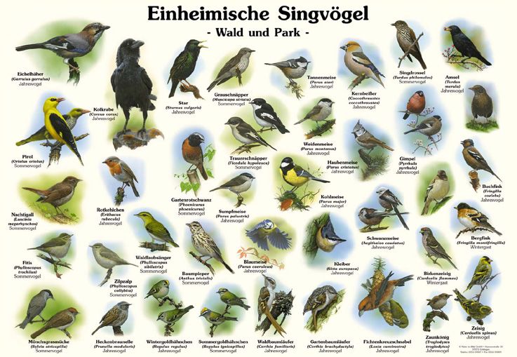
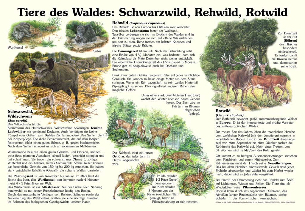
Just like the many visitors and nature enthusiasts would expect, the information displays contain images, details and interesting facts about the natural and cultural history of the location. The information on the displays is intended to inspire hikers to explore nature and to memorise the facts during their experience.
Several seating areas along the trail invite to a rest and provide the opportunity to observe nature.
- Moeilijkheid
-
gemakkelijk
- Waardering
-
- Route
-
Rattendorf
- Beste seizoen
-
janfebmrtaprmeijunjulaugsepoktnovdec
- Maximale hoogte
- 646 m
- Bestemming
-
Rattendorf, Brücke Zerminbach
- Hoogteprofiel
-


- Auteur
-
De rondleiding Nature Trail & Aqua Adventure Trail Rattendorf wordt gebruikt door outdooractive.com op.
GPS Downloads


Algemene info
Verfrissingsstop
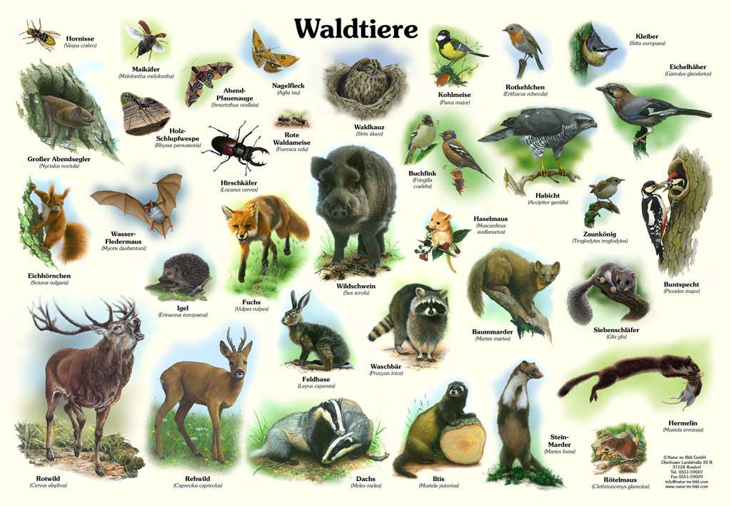
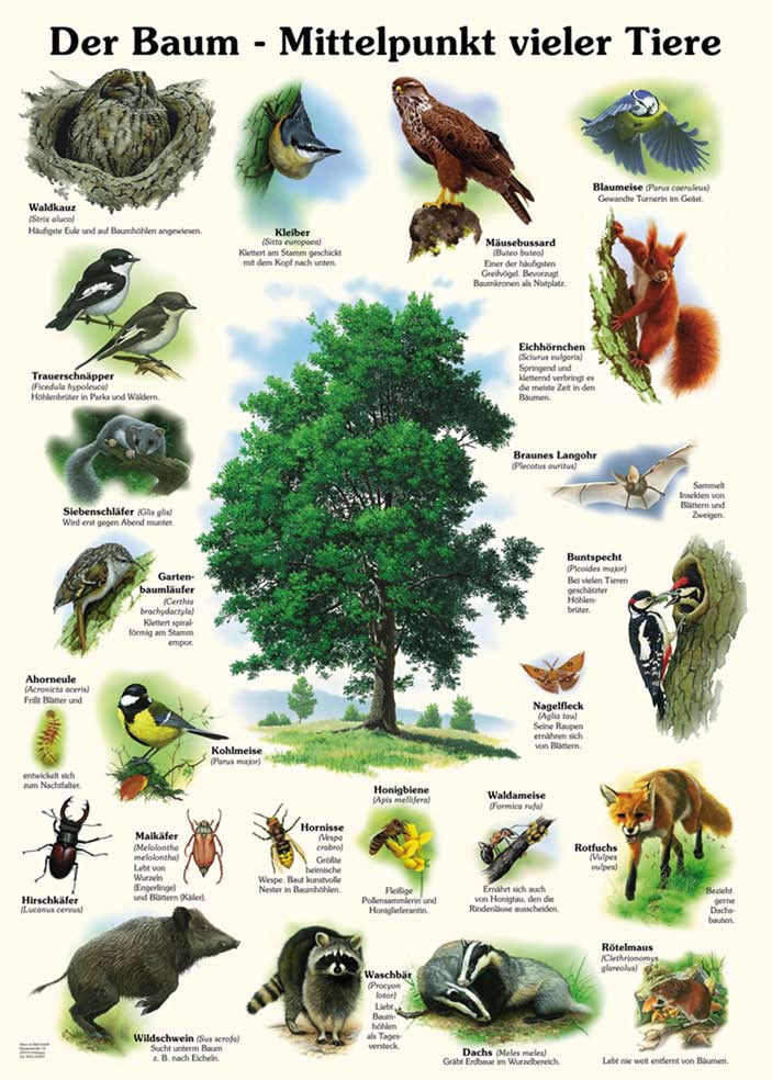
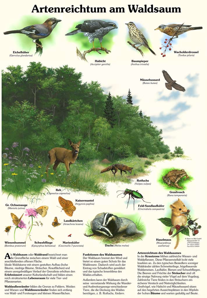
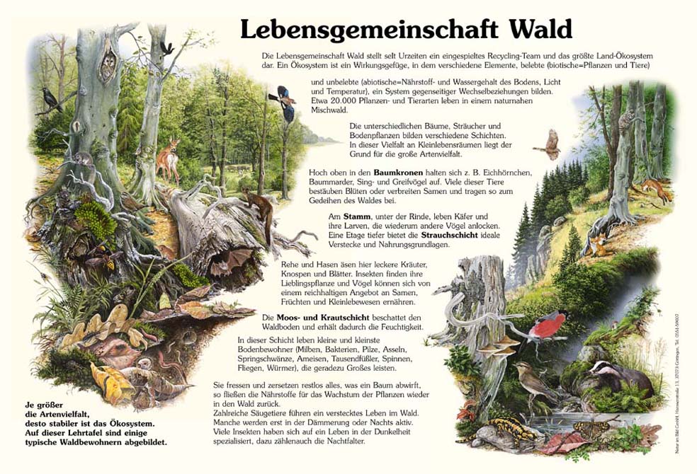
Flora
Fauna
Meer rondleidingen in de regio's