© Interlaken Tourismus - Melanie Studer

© Interlaken Tourismus - Melanie Studer

- Korte beschrijving
-
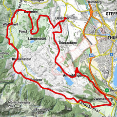
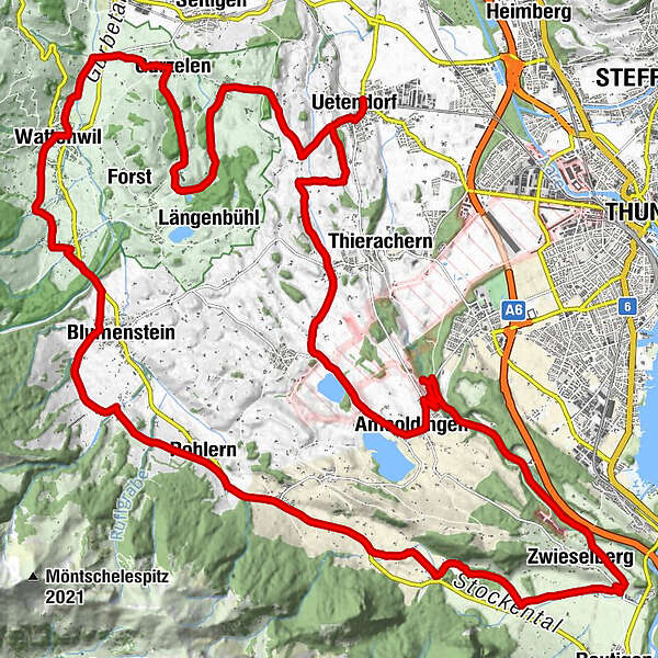
Ride over the Uetendorfberg until you reach the River Gürbe and Wattenwil, continuing along the northern flank of the Stockhorn range with magnificent views of the Stockental valley and Bernese Alps.
- Moeilijkheid
-
medium
- Waardering
-
- Route
-
Uetendorf (554 m)0,2 kmKreuz7,7 kmGurzelen (591 m)7,7 kmWattenwil (603 m)10,7 kmBlumenstein (659 m)14,7 kmPohlern (710 m)18,2 kmOberstocken (691 m)19,7 kmRestaurant Stockhorn21,4 kmNiederstocken (634 m)22,6 kmZwieselberg (660 m)27,1 kmAmsoldingen (637 m)33,5 kmUebeschi (685 m)35,9 kmGibliz39,5 kmWildenrütti39,7 kmUetendorf (554 m)40,3 km
- Beste seizoen
-
janfebmrtaprmeijunjulaugsepoktnovdec
- Maximale hoogte
- 738 m
- Bestemming
-
Uetendorf
- Hoogteprofiel
-
 © outdooractive.com

- Auteur
-
De rondleiding Stockental Route wordt gebruikt door outdooractive.com op.
GPS Downloads


Algemene info
Cultureel/Historisch
Meer rondleidingen in de regio's