- Korte beschrijving
-
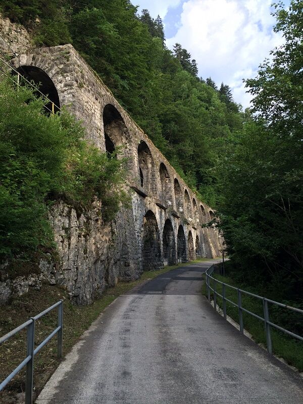
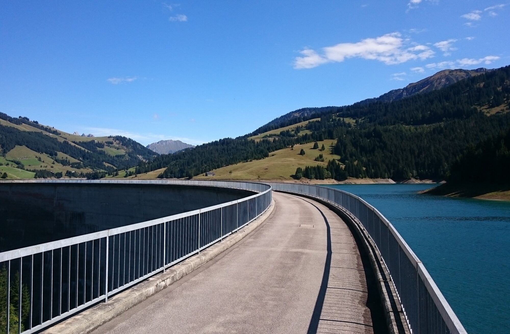
This round is going to be on solitary side streets, some with rough surface which sometimes remind of pavé sections in northern part of France or the Rapha Gentlemen Races. With the landscape impressions it is a special and beautiful tour.
- Moeilijkheid
-
zwaar
- Waardering
-
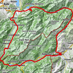
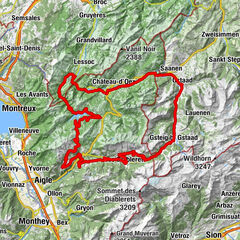
- Route
-
Gstaad (1.049 m)Pizerria Victoria0,1 kmEGW Evang. Gemeinschaftswerk0,4 kmSaanen (1.014 m)2,4 kmLes Revers (970 m)6,3 kmRougemont6,5 kmSaint-Nicolas7,0 kmFlendruz (980 m)8,5 kmFlendruz8,9 kmLes Combes (990 m)10,3 kmLes Granges11,6 kmRestolesgranges11,8 kmLes Granges-Gérignoz (1.003 m)11,9 kmChâteau-d'Oex13,8 kmLe Pré15,0 kmLes Moulins16,1 kmMontbovon (797 m)24,5 kmChapelle des Allières28,8 kmAllières (1.006 m)29,2 kmCroix de Fer29,7 kmPreysaz-au-Maidzo-Dessous33,0 kmLa Lécherette43,6 kmL'Étivaz47,6 kmChâteau-d'Oex55,5 kmChâteau-d'Oex (968 m)55,6 kmLes Bossons56,0 kmChateau-d'Oex La Palaz (980 m)56,6 kmLes Granges-Gérignoz (1.003 m)57,4 kmRestolesgranges57,5 kmLes Granges57,6 kmGérignoz58,4 kmSaint-Nicolas62,3 kmValrose62,6 kmRougemont62,8 kmSaanen (1.014 m)67,2 kmPizerria Victoria70,3 kmGstaad (1.050 m)70,4 km
- Beste seizoen
-
janfebmrtaprmeijunjulaugsepoktnovdec
- Maximale hoogte
- 1.411 m
- Bestemming
-
Gstaad, railway station
- Hoogteprofiel
-
 © outdooractive.com


-

-
AuteurDe rondleiding Tour de l'Hongrin wordt gebruikt door outdooractive.com op.
GPS Downloads


Algemene info
Verfrissingsstop
Veelbelovend
Meer rondleidingen in de regio's