Passo del Gallo - Val Mora: On the tracks of two highlights of the Val Müstair


- Korte beschrijving
-
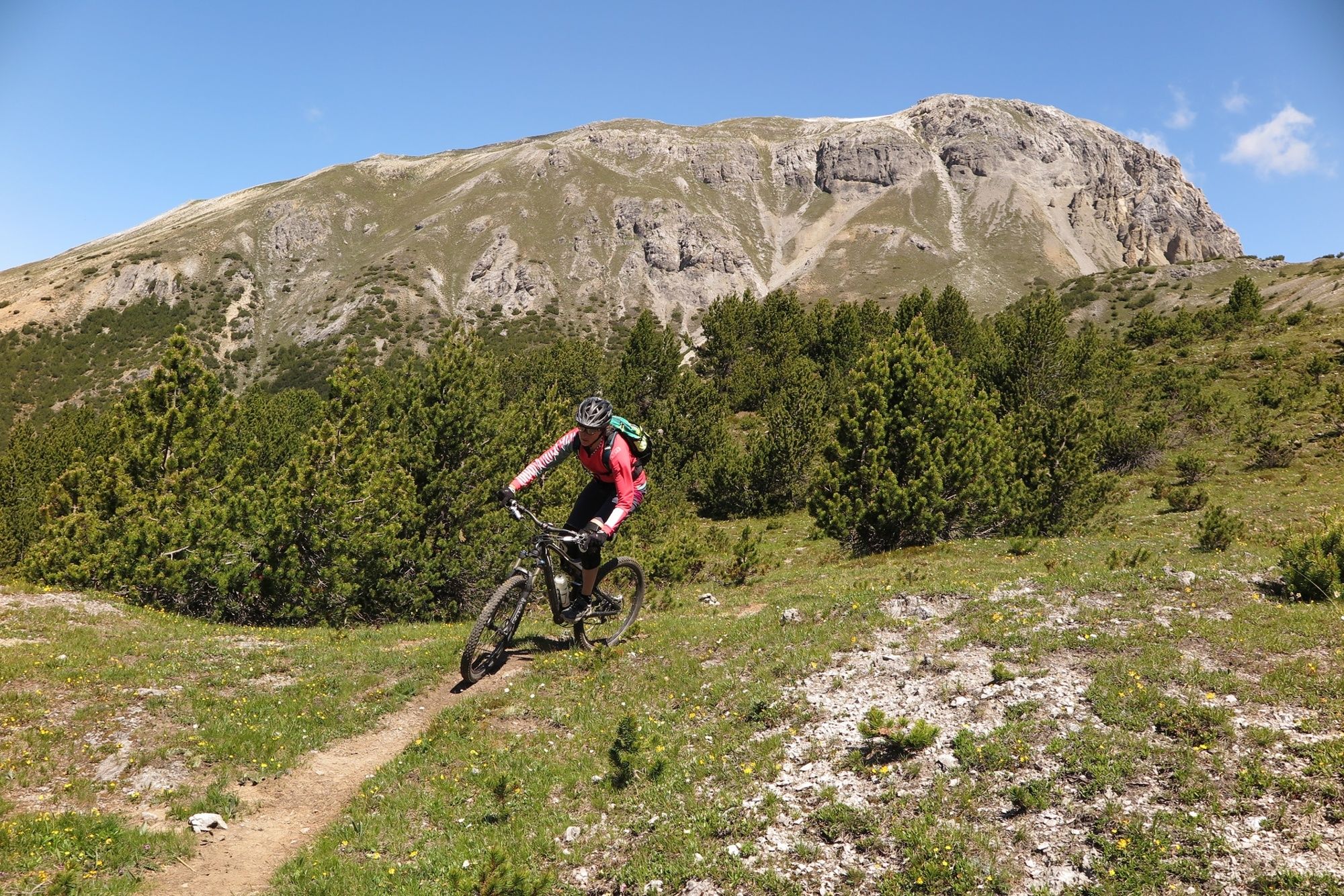
An extension of the classic tour "Val Mora - A Feeling of Canadian Wilderness", for those who are looking for more single trails and want to extend the tour a little bit.
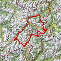
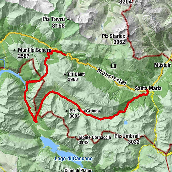
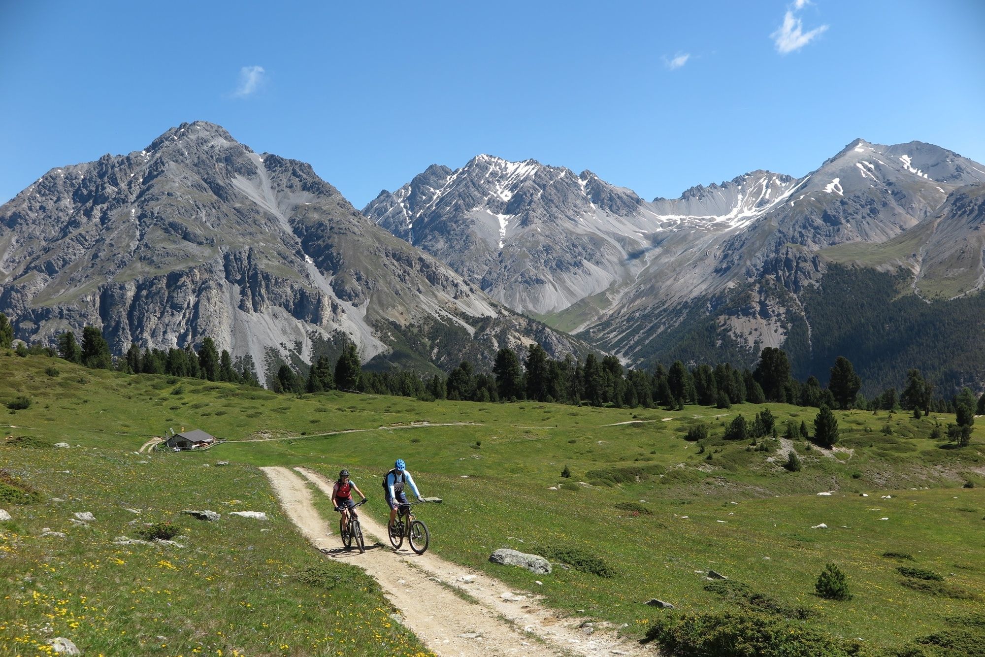
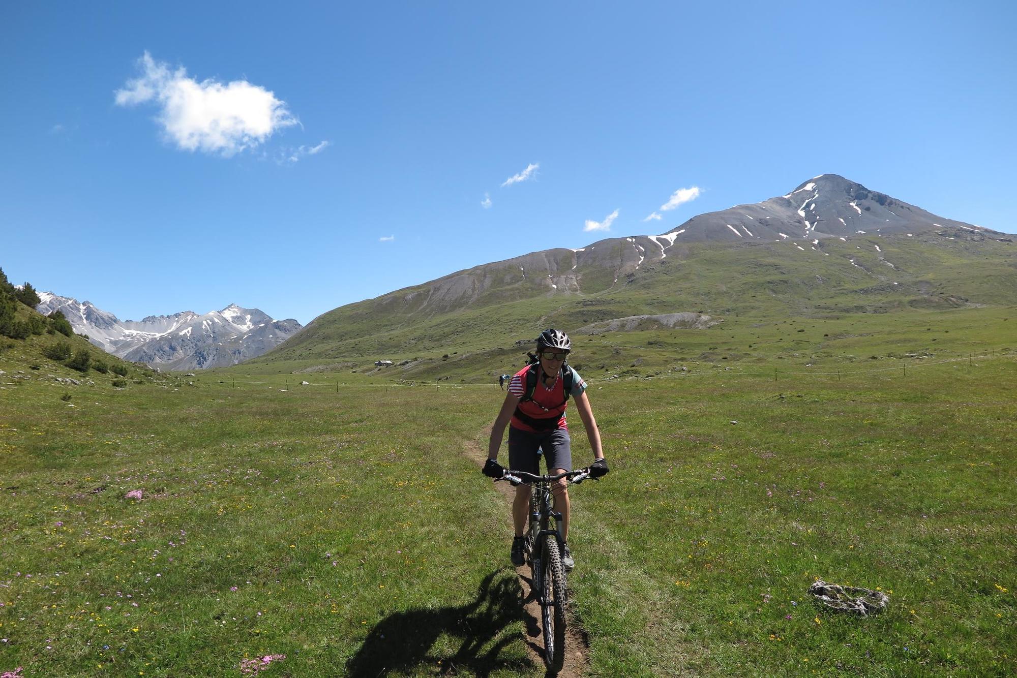
Starting point is the Ofenpass (Süsom Give), which can be reached by bus from Müstair or Zernez. The first highlight starts right next to the pass road! A flowing trail leads down to Buffalora, where the climb leads to Juf Plaun.
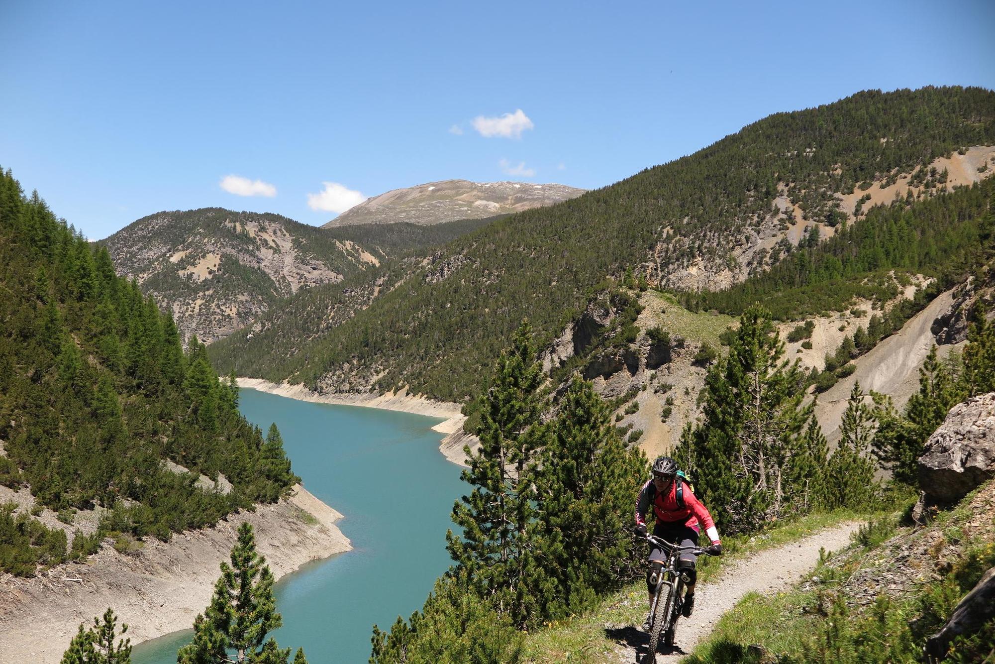
Instead of going directly into Val Mora, you reach the Passo del Gallo at the Italian border. The following trail with a view on the Lago dei Livignio is one of the best trails in the Alps. Nice flow and well laid out in the terrain! Only at the end of the trail there is a short sliding passage. Afterwards you reach the lake landscape Lago di Cancano, where there are also several inns.
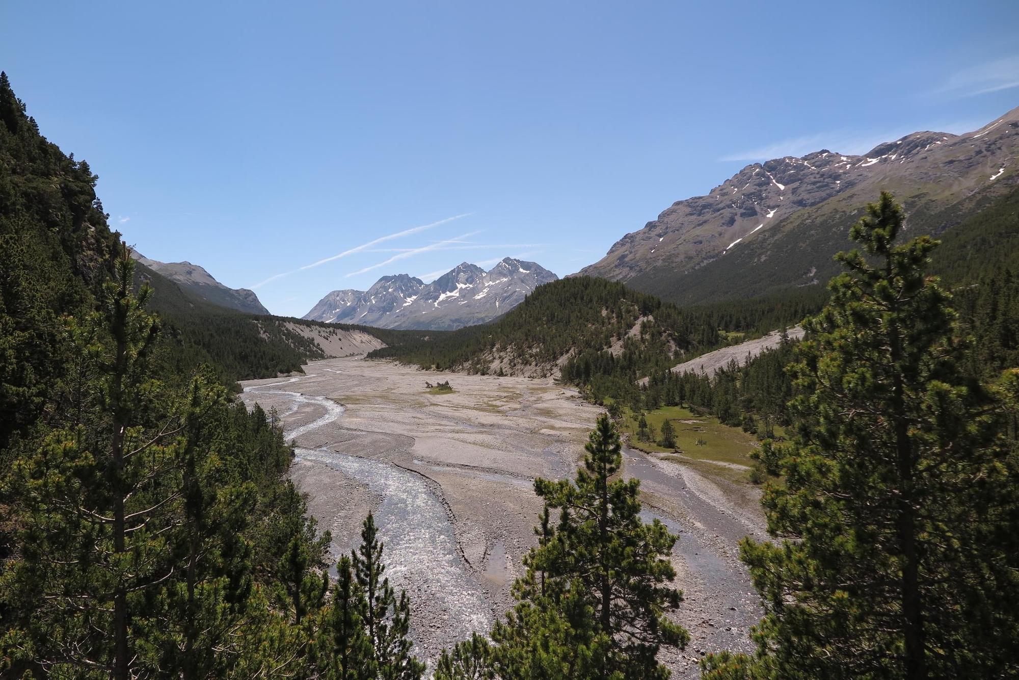
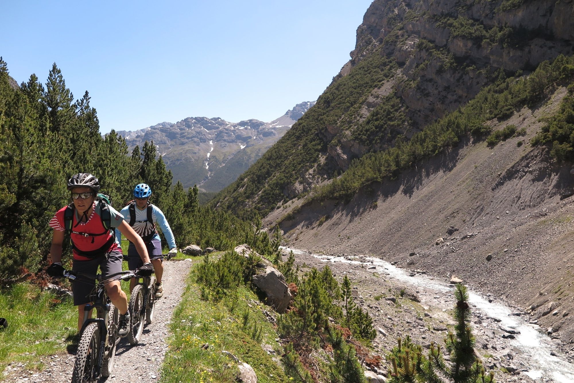
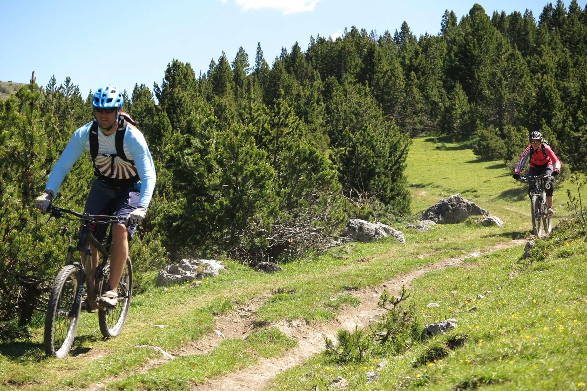
Via the Passo Val Mora you reach the Val Mora gorge, which opens up more and more and is passable all the way through. The further one goes towards Döss Radond, the more the Val Mora opens up. From Döss Radond you can either take the forest road or single trails back to St. Maria. The trails created by the local bikers lead along the hiking trail next to the forest road to the valley.
An insider tip is the trail from Palüetta (1716 m above sea level) down to Sta. Maria. At this bend, a lumberjack, which cannot be overlooked as an imposing wooden sculpture, guards the entrance to one of the most exciting single trails in this area. The medium-difficult single trail is a secret tip and very fluid to ride.
- Route
-
Alpe del Gallo (2.075 m)8,5 kmGrasso di Pra' Grata14,5 kmVal Mora21,2 kmSta. Maria Val Müstair (1.375 m)37,0 kmHotel Stelvio37,1 kmReformierte Kirche Santa Maria37,1 km
- Beste seizoen
-
janfebmrtaprmeijunjulaugsepoktnovdec
- Maximale hoogte
- 2.276 m
- Bestemming
-
PostAuto-Haltestelle Sta. Maria Val Müstair, scoula
- Hoogteprofiel
-
 © outdooractive.com
- Auteur
-
De rondleiding Passo del Gallo - Val Mora: On the tracks of two highlights of the Val Müstair wordt gebruikt door outdooractive.com op.


-
Biosfera Val Müstair
144
-
Tschierv
46