© EVAdinarica Project - EVA dinarica

- Korte beschrijving
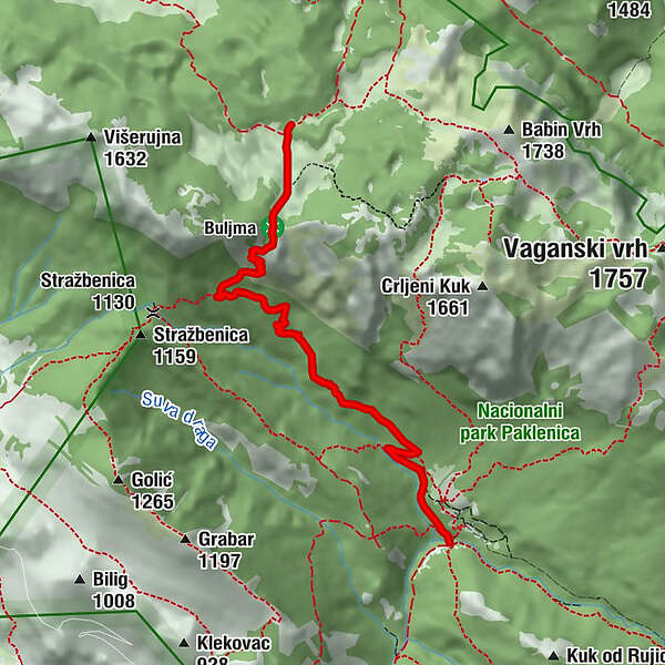
- Route
-
Planinarski dom Paklenica0,0 kmRamići0,3 kmKrajni brig3,9 kmPloče4,9 kmPlaninarsko sklonište Struge6,1 km
- Maximale hoogte
- 1.406 m
- Hoogteprofiel
-
 © outdooractive.com

-

-
AuteurDe rondleiding PD Paklenica - Struge (Via Dinarica day 51) wordt gebruikt door outdooractive.com op.