
- Korte beschrijving
-
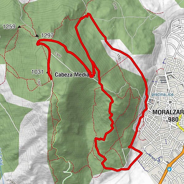
Esta ruta de dificultad media nos permite explorar el monte Matarrubia situado en la zona oeste del municipio de Moralzarzal llegando a su punto mas alto, donde se sitúa el antiguo poste de telégrafo. Recomendada para hacerse en bicicleta, se puede realizar dando un paseo incrementando así su duración.
- Moeilijkheid
-
zwaar
- Waardering
-
- Maximale hoogte
- 1.327 m
- Bestemming
-
Moralzarzal (Parking del cementerio municipal)
- Hoogteprofiel
-
 © outdooractive.com
- Auteur
-
De rondleiding Turismo Moralzarzal. Subida al Telégrafo wordt gebruikt door outdooractive.com op.