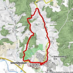
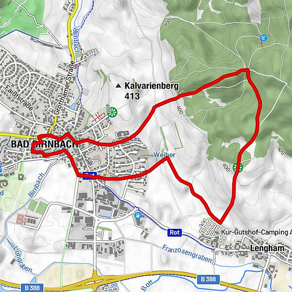
Toerdatums
5,9km
356 - 454m
Afstand
117hm
117hm
Opstijging
01:35h
 
Duur
Route
Bad Birnbach
0,1 km
Holzkapelle Hl.Bruder Konrad
2,3 km
Schöne Aussicht nach Süden
3,2 km
Maximale hoogte
454 m

Auteur
De rondleiding Bruder-Konrad-Weg wordt gebruikt door outdooractive.com op.

Algemene beoordeling

5

0

%

4

0

%

3

0

%

2

0

%

1

0

%

Fout
Er is een fout opgetreden. Probeer het opnieuw.
Bedankt voor uw beoordeling

Waardering is verwijderd

GPS Downloads
  • GPX GPS Exchange Format (XML)
  • KML Google Earth, Google Maps
QR Downloadcodes voor mobiele telefoons
Meer rondleidingen in de regio's

Populaire rondleidingen in de omgeving

Landwirtschaftlicher Informationsweg

Themapad
6,8km | 43hm | 01:42h

Klimapfad Lugenz

medium Themapad
2,36km | 73hm | 00:40h

Hubertuskapellenweg

medium Themapad
11,18km | 111hm | 02:55h

Brunnentour

Themapad
2,62km- | 00:40h