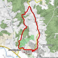
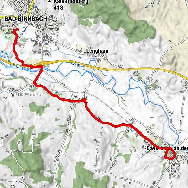
Toerdatums
14,54km
345 - 372m
Afstand
106hm
106hm
Opstijging
03:43h
 
Duur
Route
Bad Birnbach
Edmühle
2,2 km
Luderbach
3,5 km
Sankt Veit
4,5 km
Huckenham
5,4 km
Bayerbach an der Rott
7,4 km
Huckenham
9,0 km
Sankt Veit
9,9 km
Luderbach
10,9 km
Edmühle
12,1 km
Bad Birnbach
14,5 km
Maximale hoogte
372 m

Auteur
De rondleiding Kapellenweg wordt gebruikt door outdooractive.com op.

Algemene beoordeling

5

0

%

4

0

%

3

0

%

2

0

%

1

0

%

Fout
Er is een fout opgetreden. Probeer het opnieuw.
Bedankt voor uw beoordeling

Waardering is verwijderd

GPS Downloads
  • GPX GPS Exchange Format (XML)
  • KML Google Earth, Google Maps
QR Downloadcodes voor mobiele telefoons
Meer rondleidingen in de regio's

Populaire rondleidingen in de omgeving

Brunnentour

Themapad
2,62km- | 00:40h

Landwirtschaftlicher Informationsweg

Themapad
6,8km | 43hm | 01:42h

Hubertuskapellenweg

medium Themapad
11,18km | 111hm | 02:55h

Klimapfad Lugenz

medium Themapad
2,36km | 73hm | 00:40h