© TV Nationalpark Region Steyrtal

© TV Nationalpark Region Steyrtal

- Korte beschrijving
-
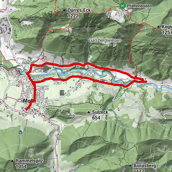
In a leisurely up and down walk to the most beautiful view of the mountains.
- Moeilijkheid
-
gemakkelijk
- Waardering
-
- Route
-
Pfarrkirche Molln0,2 kmMolln (442 m)0,3 kmristorante dal Siciliano0,3 kmLandgasthof Klausner0,9 kmGasthaus Steinbichler1,1 kmAu8,1 kmLandgasthof Klausner8,7 kmristorante dal Siciliano9,4 kmPfarrkirche Molln9,4 kmMolln (442 m)9,5 km
- Beste seizoen
-
janfebmrtaprmeijunjulaugsepoktnovdec
- Maximale hoogte
- 473 m
- Bestemming
-
Molln/center of the village
- Hoogteprofiel
-


- Auteur
-
De rondleiding Mollner sunny side round wordt gebruikt door outdooractive.com op.
GPS Downloads


Algemene info
Verfrissingsstop
Veelbelovend
Meer rondleidingen in de regio's
-
Traunviertel
1940
-
Steyr und die Nationalpark Region
1370
-
Molln
374