© Region Hohe Tatra - Monika Kromkova
- Korte beschrijving
-
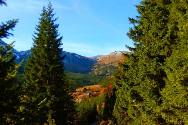
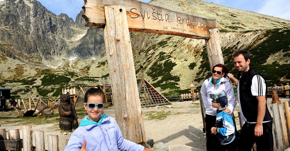
Visit the most popular tourist destination - Skalnaté pleso (tarn) at the altitude of 1,751 metres. Take a 4-seater cable car to get there from the lower station at Tatranská Lomnica. The area around the tarn is tailor-made for pleasant walks or hiking trips. Kids will love it there. They can frolic in the Marmot country – an eco-mini-park with wooden sculptures, a little marmot chalet, climbing frames and much more. There is an astronomical and meteorological observatory near Skalnaté pleso at the altitude of 1,786 metres. The observatory was established in 1943, when the first observations were made here. Relax and bag some rays at one of the highest located restaurants in the High Tatras – at the Panorama Restaurant Skalnaté pleso, which has a really fitting name. The sunny terrace offers beautiful panoramic views of surrounding rock peaks and tourist trails in the summer and the steepest ski slopes in Slovakia - Lomnické sedlo in the winter.
TIP: Take a cable car from Tatranská Lomnica to Skalnaté pleso or use a green marked tourist trail from Tatranská Lomnica, a red marked tourist trail from Zamkovský´s chalet or a red marked tourist trail from the Chalet at Zelené pleso (tarn).
TIP: Take your children to the "Tatra wilderness" and enjoy great trips with an entertaining and educational programme. Listen to gripping stories of the Tatras and discover the most beautiful and interesting places of the Tatras.
- Route
-
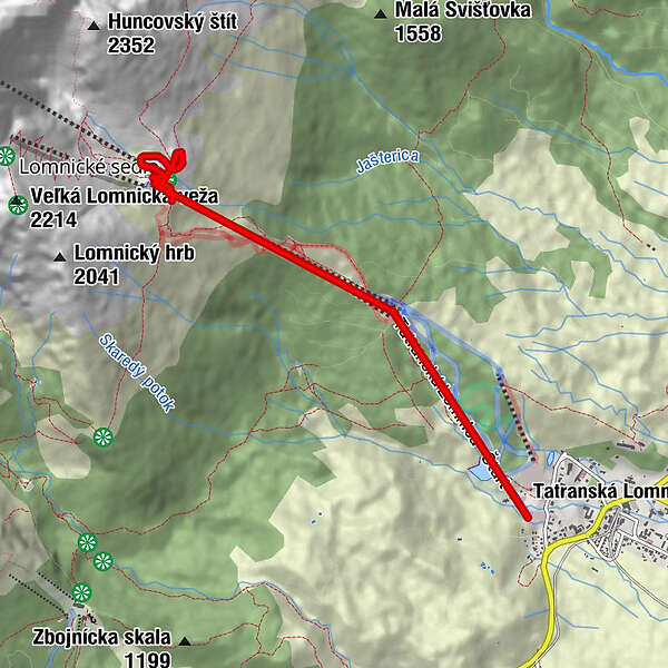
Tatralomnitz0,0 kmŠtart0,0 kmTatralomnitz0,2 kmPizza&Pasta Štart1,9 kmSkalnaté pleso2,1 kmPanorama3,2 kmSteinbachseehütte3,7 kmSkalnaté pleso5,1 km
- Maximale hoogte
- 1.770 m

- Auteur
-
De rondleiding Cable car to Skalnate tarn wordt gebruikt door outdooractive.com op.
GPS Downloads


Meer rondleidingen in de regio's
-
Poprad
97
-
Bachledka - Ždiar
30