Flachauwinkl: Mosermandl

Logo Flachauwinkl: Mosermandl
Toerdatums
8,74km
1.181 - 2.637m
Afstand
1.430hm
Opstijging
08:00h
 
Duur
Korte beschrijving

Sportliche Tour auf einen der höchsten Gipfel der Region.

Waardering
Techniek
Conditie
Landschap
Belevenis
Startpunt

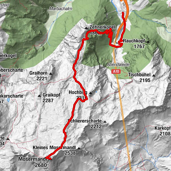
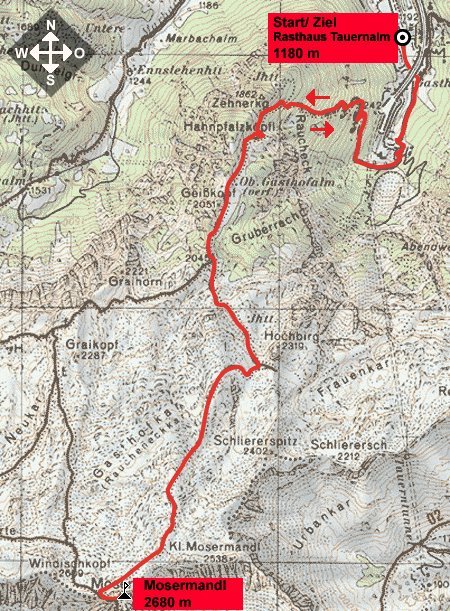
Rasthaus Tauernalm (1202 m)

Route


Maximale hoogte
2.637 m

Rust/Retraite

Keine bewirtschafteten Hütten am Berg!

Kaartmateriaal

Info telefoon

0043 (0)6457 2214

Link

5,0
Algemene beoordeling

5

100

%

4

0

%

3

0

%

2

0

%

1

0

%

GPS Downloads
  • GPX GPS Exchange Format (XML)
  • KML Google Earth, Google Maps
QR Downloadcodes voor mobiele telefoons

Condities van het pad

Asfalt
Steenslag
Weide
Bos
Rots
Moeilijk
Meer rondleidingen in de regio's

Populaire rondleidingen in de omgeving

Reiteralm -Gasselhöhe- Rippetegg

medium Wandelen
5,34km | 389hm | 03:30h

Wanderung zum Naturjuwel Reedsee

medium Wandelen
10,76km | 756hm | 04:30h

Tappenkarsee Kleinarl

medium Wandelen
9,11km | 584hm | 06:00h

Mosermandl (2680m)

zwaar Wandelen
16,34km | 1442hm | 06:45h