© Oststeiermark Tourismus - Markus Weiss

© Oststeiermark Tourismus - Markus Weiss

© Oststeiermark Tourismus - Markus Weiss

© Oststeiermark Tourismus - xSimon Sackl

© Oststeiermark Tourismus - xSimon Sackl

- Korte beschrijving
-
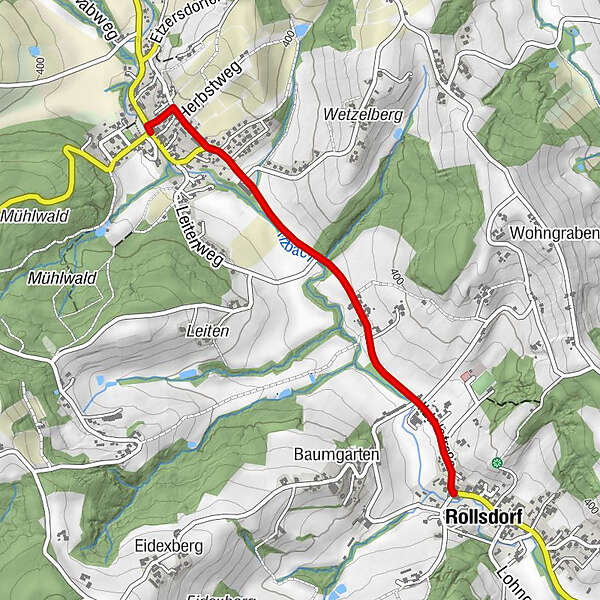
This 2.5 m wide footpath and cycle path connects the districts of Etzersdorf and Rollsdorf in the market town of St. Ruprecht an der Raab.
- Moeilijkheid
-
gemakkelijk
- Waardering
-
- Route
-
Gasthof Schneider0,0 kmEtzersdorf0,1 kmRollsdorf2,2 km
- Beste seizoen
-
janfebmrtaprmeijunjulaugsepoktnovdec
- Maximale hoogte
- 389 m
- Bestemming
-
Rollsdorf
- Hoogteprofiel
-


-

-
AuteurDe rondleiding Cycle path Etzersdorf – Rollsdorf wordt gebruikt door outdooractive.com op.
GPS Downloads


Algemene info
Verfrissingsstop
Meer rondleidingen in de regio's