Styrian Wine Country Cycling Tour - Variant East Styria

Fietsen

© Steiermark Tourismus/Tom Lamm - Tom Lamm

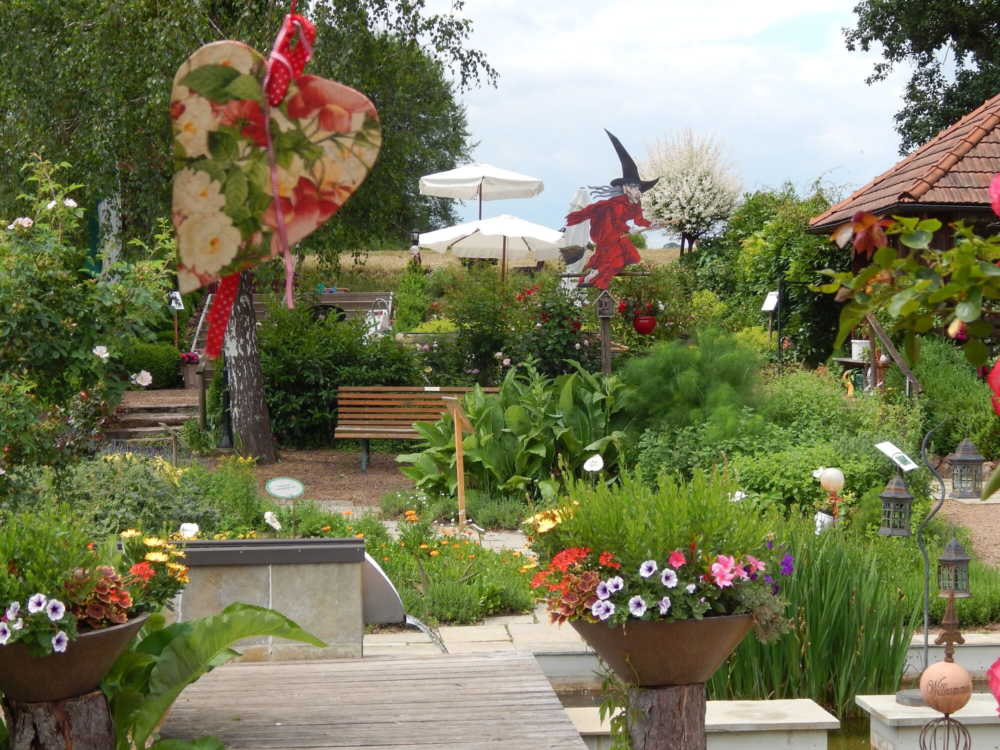
© Kräuter-, Rosen- & Hexengarten Söchau

© (c) Steiermark Tourismus/Leo Himsl - Leo Himsl

© (c) Steiermark Tourismus/Tom Lamm - Tom Lamm

© (c) Steiermark Tourismus/Tom Lamm - Tom Lamm

© Thermen- und Vulkanland Steiermark/Harald Eisenberger - Harald Eisenberger


- Korte beschrijving
-
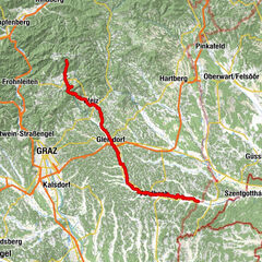
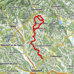
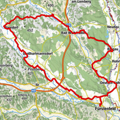
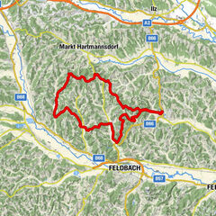
This variant of the Styrian Wine Country Cycling Tour takes us from the spa town of Loiperdorf in the Spa and Volcano Country of Styria to Gleisdorf in East Styria. This variant results in a 2-3 day round trip through East Styria with its Römerweinstraße. The route follows the Rittscheintalradweg R21, a real insider tip among cyclists.
- Moeilijkheid
-
medium
- Waardering
-
- Route
-
Dietersdorf bei Fürstenfeld0,0 kmÜbersbach4,7 kmHartl bei Fürstenfeld5,4 kmSöchau9,8 kmTautendorf bei Fürstenfeld10,7 kmRuppersdorf12,9 kmFilialkirche Heiliger Andreas17,4 kmSankt Kind17,5 kmWalkersdorf19,0 kmKapelle Walkersdorf19,0 kmSpielplatz Walkersdorf19,1 kmOttendorf an der Rittschein22,2 kmBärnbach25,0 kmGeldhof25,4 kmMarkt Hartmannsdorf27,1 kmGasthaus Gruber28,3 kmPöllau31,3 kmSommerberg (464 m)32,9 kmGasthaus Kochauf34,2 kmPatschabach34,5 kmTakern I35,9 kmZur alten Mühle36,1 kmSulz bei Gleisdorf37,9 kmWünschendorf41,6 kmGleisdorf42,8 km
- Beste seizoen
-
janfebmrtaprmeijunjulaugsepoktnovdec
- Maximale hoogte
- 458 m
- Bestemming
-
Gleisdorf
- Hoogteprofiel
-


-

-
AuteurDe rondleiding Styrian Wine Country Cycling Tour - Variant East Styria wordt gebruikt door outdooractive.com op.
GPS Downloads


Algemene info
Verfrissingsstop
Tip voor insiders
Flora
Fauna
Veelbelovend
Meer rondleidingen in de regio's
-
Oststeiermark
375
-
Feldbach
189
-
Ottendorf an der Rittschein
54