

© TV Gesäuse - Stefan Leitner

© Gesäuse - Gams

© Gesäuse - Gams

© Gesäuse - Gams

© TV Gesäuse - Stefan Leitner

© TV Gesäuse - Stefan Leitner

© TV Gesäuse - Stefan Leitner

© TV Gesäuse - Stefan Leitner

- Korte beschrijving
-
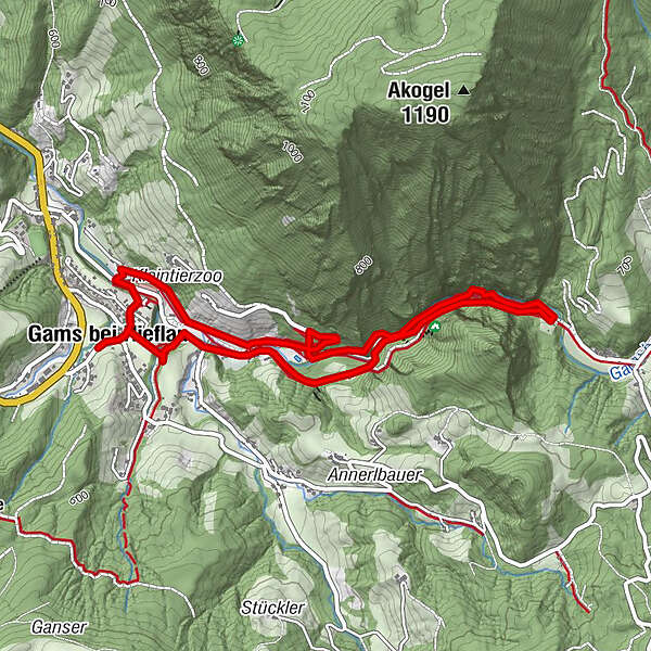
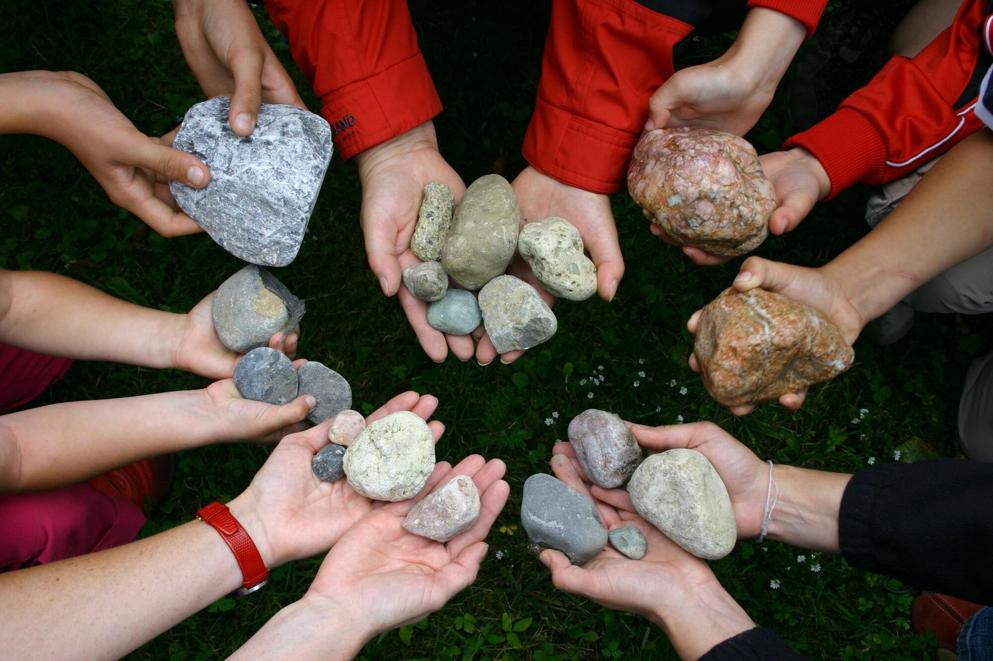
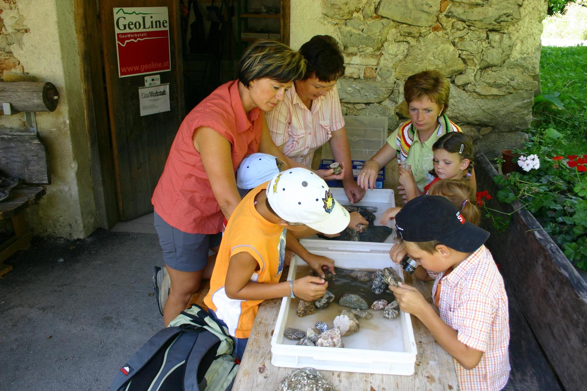
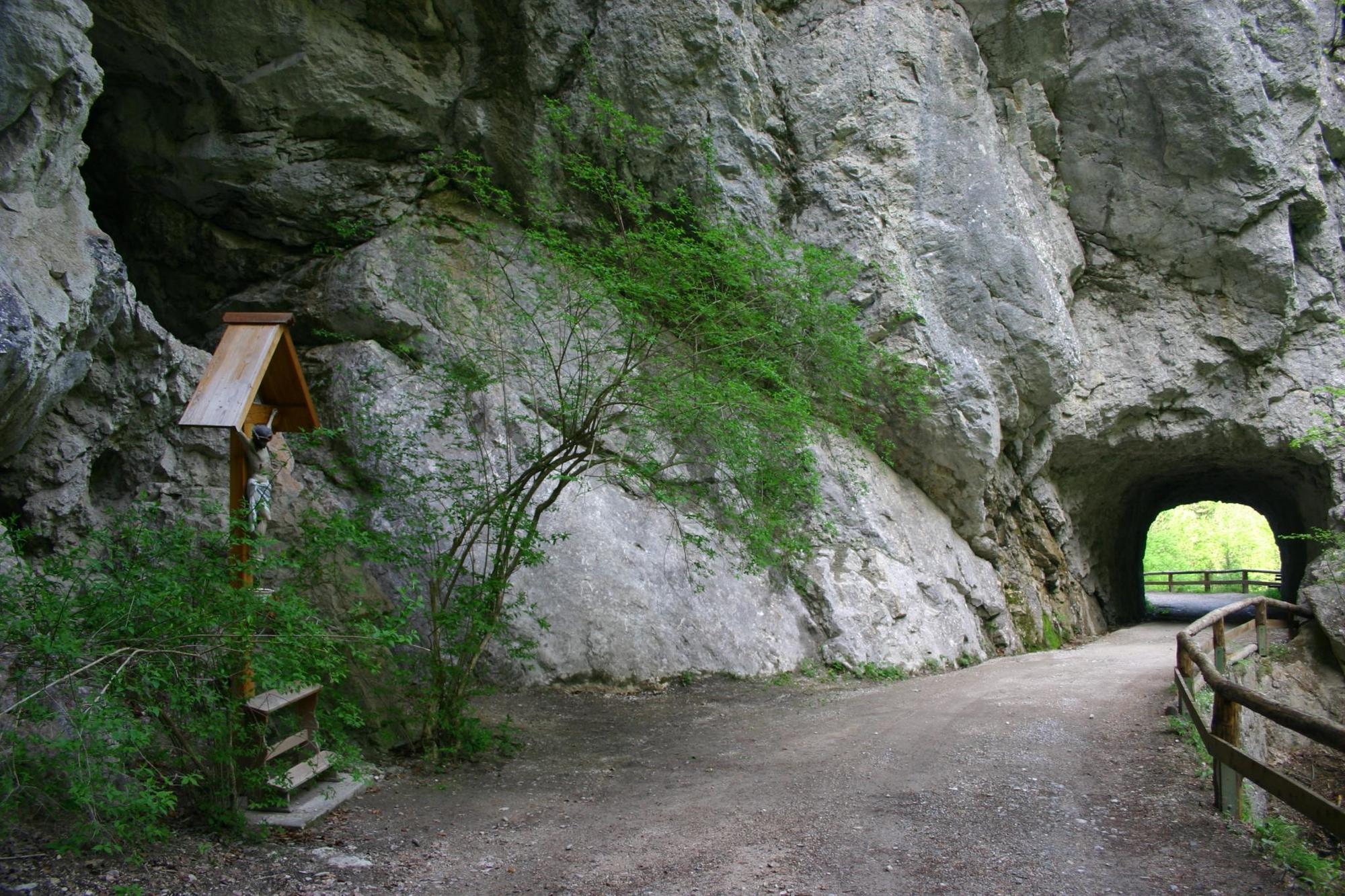
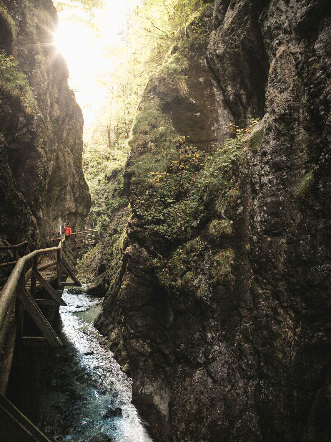
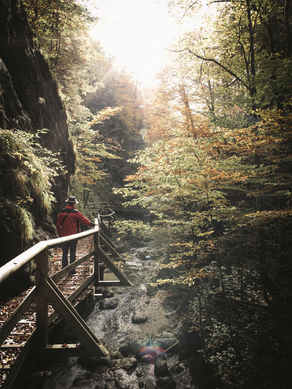
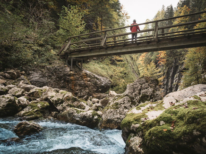
Geological circular hiking trail with 48 stations - The trail leads along the Gamsbach stream into the wildly romantic Nothklamm gorge with wooden footbridge. At the end of the Nothklamm we reach the Steinkugelmühle.
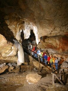
A visit to the Kraushöhle cave can also be included.
- Moeilijkheid
-
gemakkelijk
- Waardering
-
- Route
-
Pfarrkirche hl. Joseph0,0 kmGams bei Hieflau0,0 kmForstauers Brauhaus Gesäuse0,1 kmSchwefelquelle2,1 kmKraushöhle3,3 kmForstauers Brauhaus Gesäuse4,9 kmGams bei Hieflau4,9 kmPfarrkirche hl. Joseph4,9 km
- Beste seizoen
-
janfebmrtaprmeijunjulaugsepoktnovdec
- Maximale hoogte
- 635 m
- Bestemming
-
GeoZentrum beim Gemeindeamt Gams
- Hoogteprofiel
-


-

-
AuteurDe rondleiding GeoPath with nothklamm gorge and stone ball mill wordt gebruikt door outdooractive.com op.
GPS Downloads


Algemene info
Verfrissingsstop
Tip voor insiders
Meer rondleidingen in de regio's
-
Erzberg Leoben
2530
-
Hochschwab
1272
-
Landl
180


