

© TVB Oststeiermark - Steiermark Tourismus

© TVB Oststeiermark - Harald Schober

© TVB Oststeiermark - Tourismusverband Oststeiermark

© TVB Oststeiermark - Christine Pollhammer

© TVB Oststeiermark - Christine Pollhammer

© TVB Oststeiermark - Christine Pollhammer

© TVB Oststeiermark - Christine Pollhammer
- Korte beschrijving
- Moeilijkheid
-
zwaar
- Waardering
-
- Route
-
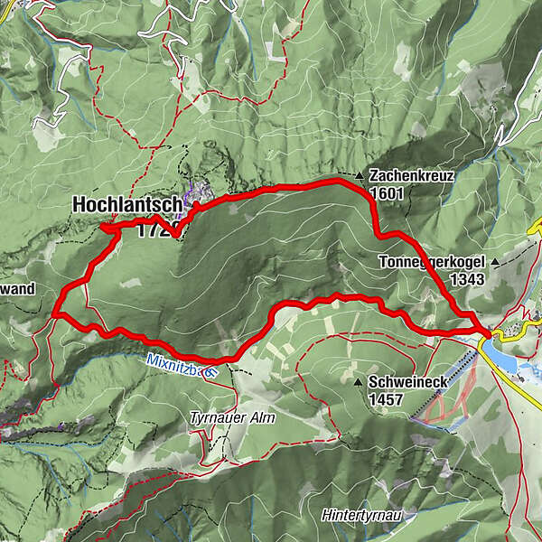
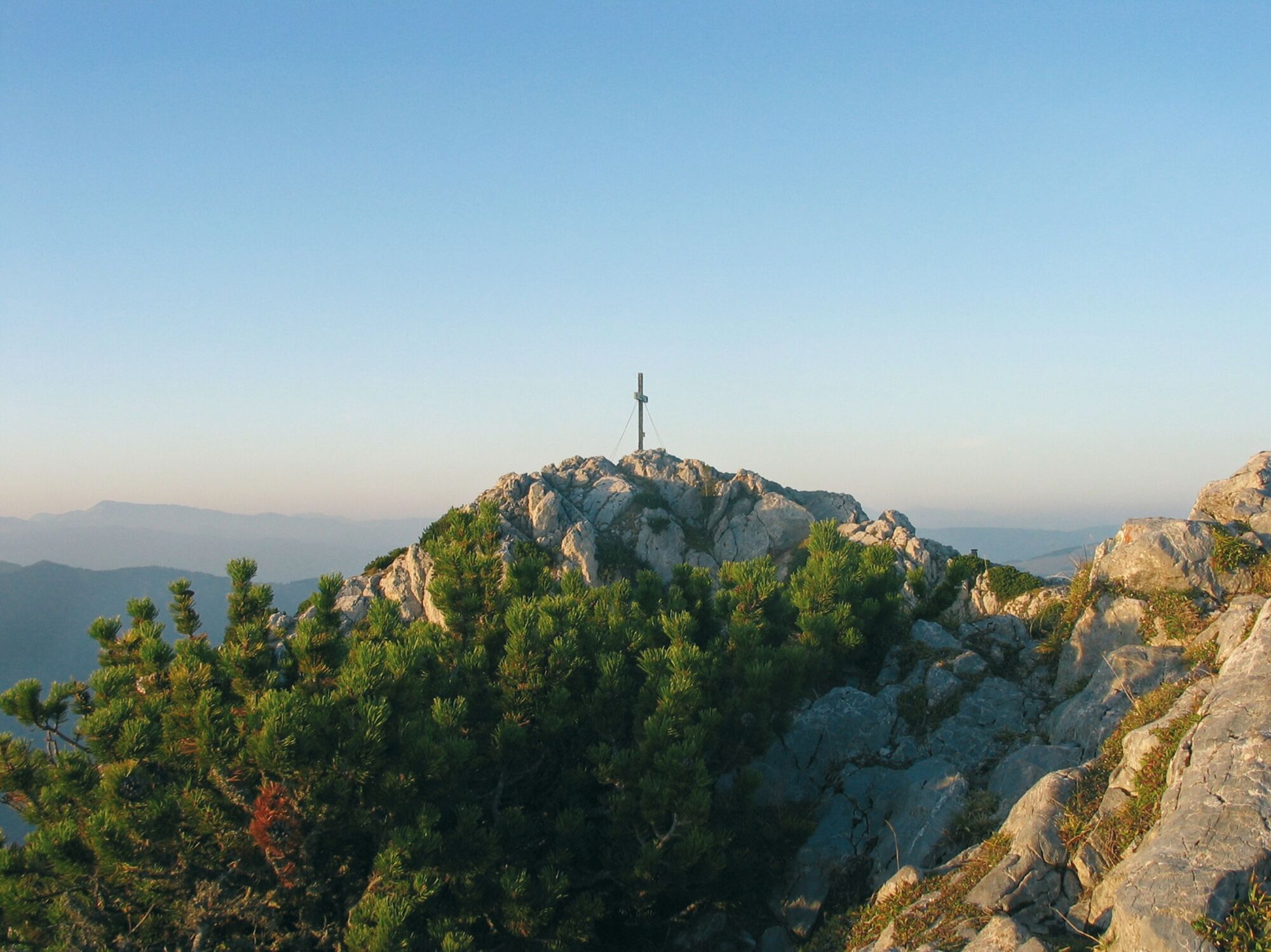
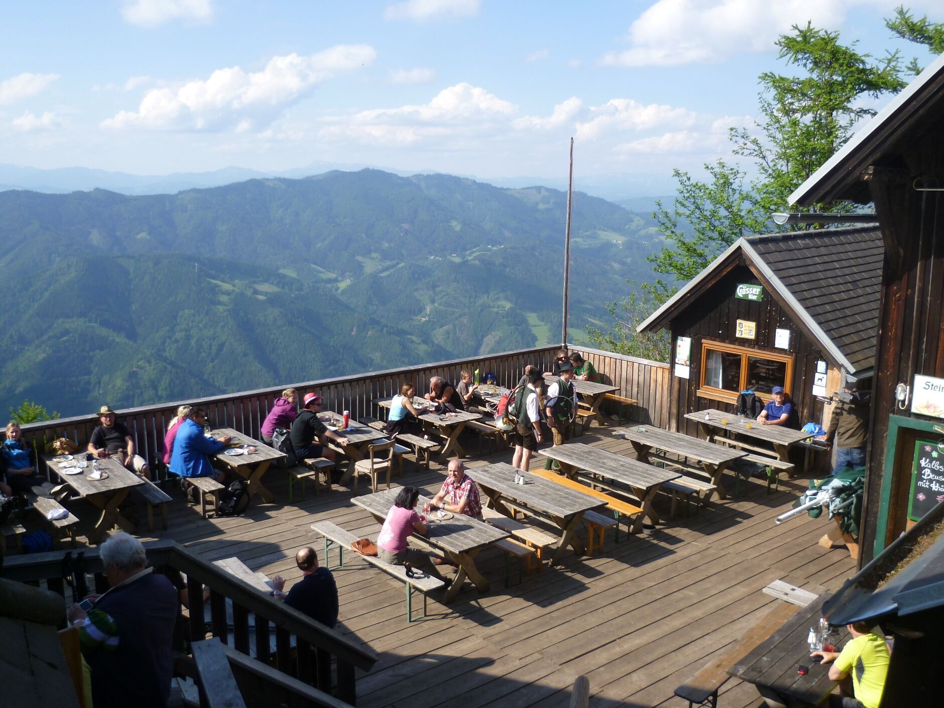
Almgasthof Teichwirt (1.200 m)0,0 kmZachenkreuz (1.601 m)2,1 kmHochlantsch (1.720 m)3,7 kmSchüsserlbrunn5,0 kmSteirischer Jokl5,1 kmZum Guten Hirten (1.206 m)6,4 kmOchsenbodenloch9,1 kmGaston-Lippitt-Hütte (1.200 m)10,9 kmAlmgasthof Teichwirt (1.200 m)11,4 km
- Beste seizoen
-
janfebmrtaprmeijunjulaugsepoktnovdec
- Maximale hoogte
- 1.709 m
- Bestemming
-
Teichalm, Hotel "Teichwirt"
- Hoogteprofiel
-


-

-
AuteurDe rondleiding Hochlantsch Hiking Tour wordt gebruikt door outdooractive.com op.
GPS Downloads


Algemene info
Verfrissingsstop
Veelbelovend
Meer rondleidingen in de regio's
-
Hochsteiermark
4066
-
Naturpark Almenland
1766
-
Breitenau am Hochlantsch
438


