Toerdatums
8,3km
2.902 - 3.725m
Afstand
396hm
875hm
Opstijging
05:00h
 
Duur
Korte beschrijving

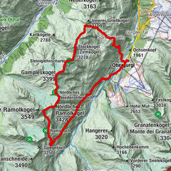
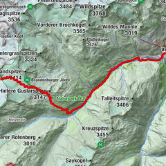
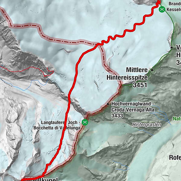
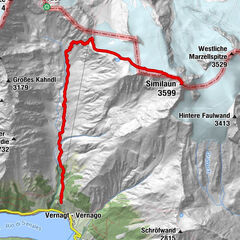
BRANDENBURGER HAUS -> WEISSKUGEL

Moeilijkheid
zwaar
Waardering
Techniek
Conditie
Landschap
Belevenis
Route
Brandenburger Haus
8,2 km

Beste seizoen
jan
feb
mrt
apr
mei
jun
jul
aug
sep
okt
nov
dec
Maximale hoogte
3.725 m
Bestemming

Weisskugel

Hoogteprofiel
© outdooractive.com

Auteur
De rondleiding Weisskugel wordt gebruikt door outdooractive.com op.

Algemene beoordeling

5

0

%

4

0

%

3

0

%

2

0

%

1

0

%

Fout
Er is een fout opgetreden. Probeer het opnieuw.
Bedankt voor uw beoordeling

Waardering is verwijderd

GPS Downloads
  • GPX GPS Exchange Format (XML)
  • KML Google Earth, Google Maps
QR Downloadcodes voor mobiele telefoons

Algemene info

Veelbelovend
Meer rondleidingen in de regio's

Populaire rondleidingen in de omgeving

Similaun - durchs Tisental

medium High rope
15km | 1792hm | 08:15h

Gratwanderung von Ramolkogel zum Zirmkogel

zwaar High rope
23,57km | 1844hm | 09:48h

Vent - Hochjoch Hospiz - Brandenburger Haus

zwaar High rope
14,89km | 1358hm | 06:00h