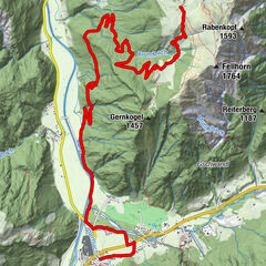
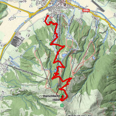
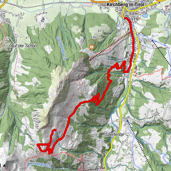
Route 257: Kobingerhütte

Logo Route 257: Kobingerhütte
Toerdatums
9,95km
837 - 1.501m
Afstand
664hm
Opstijging
02:00h
 
Duur
Korte beschrijving

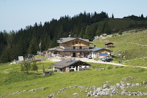
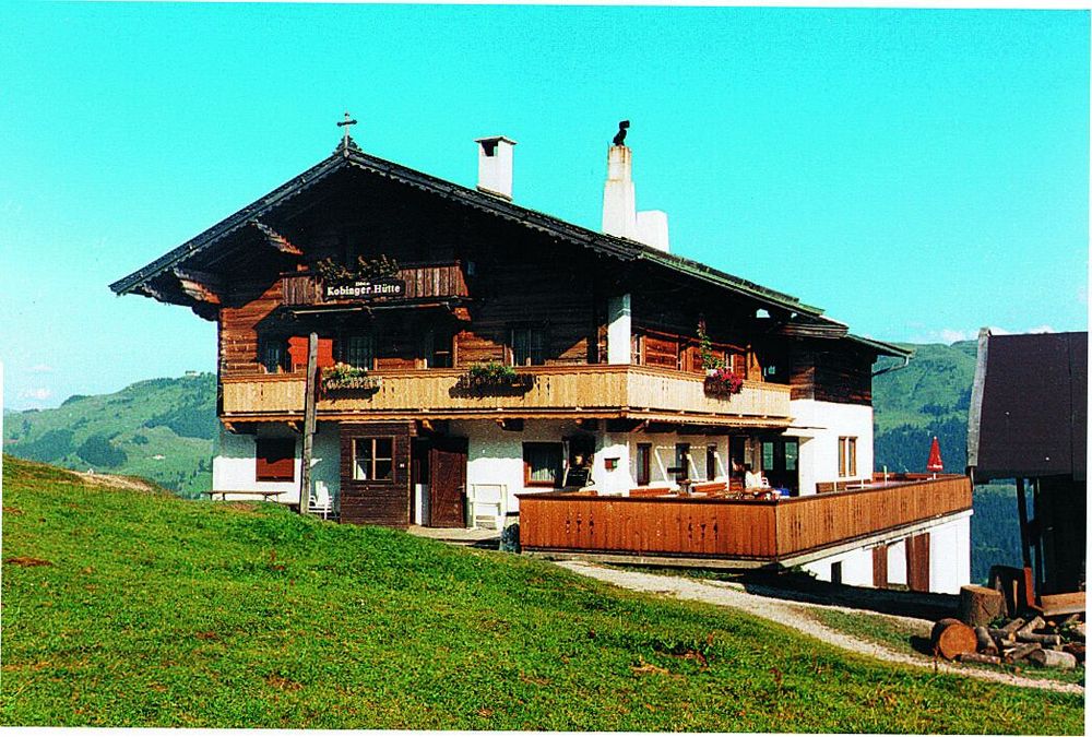
Streckenverlauf: Kirchberg - Kobingerhütte; Streckenlänge: 8 km; Höhenunterschied: 664 m

Waardering
Techniek
Conditie
Landschap
Belevenis
Startpunt

Kirchberg

Route
Kirchberg in Tirol
Wiegalm
8,9 km
Sonnleitnerhütte
9,9 km
Harlasangeralm
9,9 km
Kobingerhütte
9,9 km


Maximale hoogte
1.501 m

Kaartmateriaal

KitzalpBike Mountainbike- und Radwanderkarte
Region Kitzbühel - Brixental - St. Johann in Tirol


Algemene beoordeling

5

0

%

4

0

%

3

0

%

2

0

%

1

0

%

Fout
Er is een fout opgetreden. Probeer het opnieuw.
Bedankt voor uw beoordeling

Waardering is verwijderd

GPS Downloads
  • GPX GPS Exchange Format (XML)
  • KML Google Earth, Google Maps
QR Downloadcodes voor mobiele telefoons

Rijbanen

Asfalt
Steenslag
Bergwegen
Single trails
Trial
Verkeer
Meer rondleidingen in de regio's

Populaire rondleidingen in de omgeving

Erpfendorf: Straubinger Haus

zwaar Mountainbike
14,24km | 1010hm | 04:30h

Route 209: Brechhornhaus-Choralpe

zwaar Mountainbike
24,4km | 1015hm | 03:00h

St. Johann in Tirol: Mountainbikestrecke Harschbichl

Mountainbike
9,2km | 917hm | 02:00h