
© Region St. Johann in Tirol

© Region St. Johann in Tirol
Toerdatums
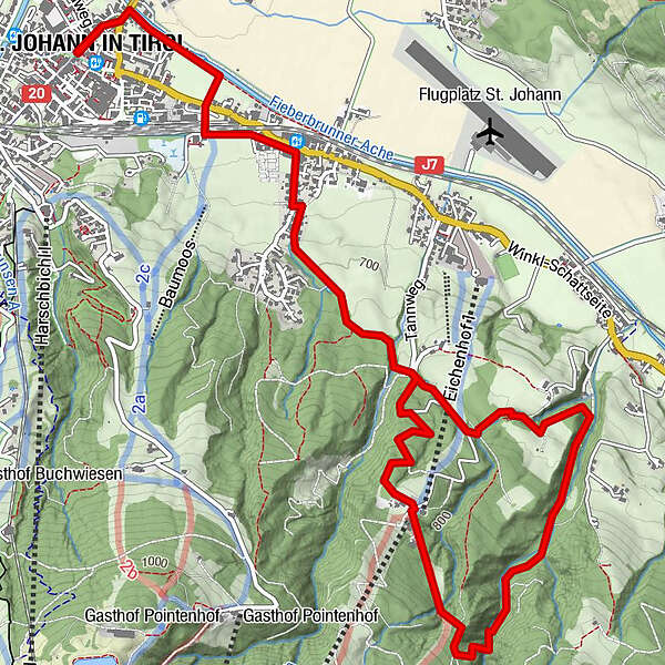
8,61km
657
- 868m
251hm
240hm
03:00h
- Korte beschrijving
-
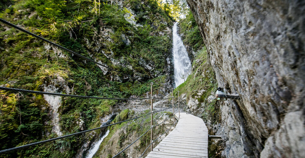
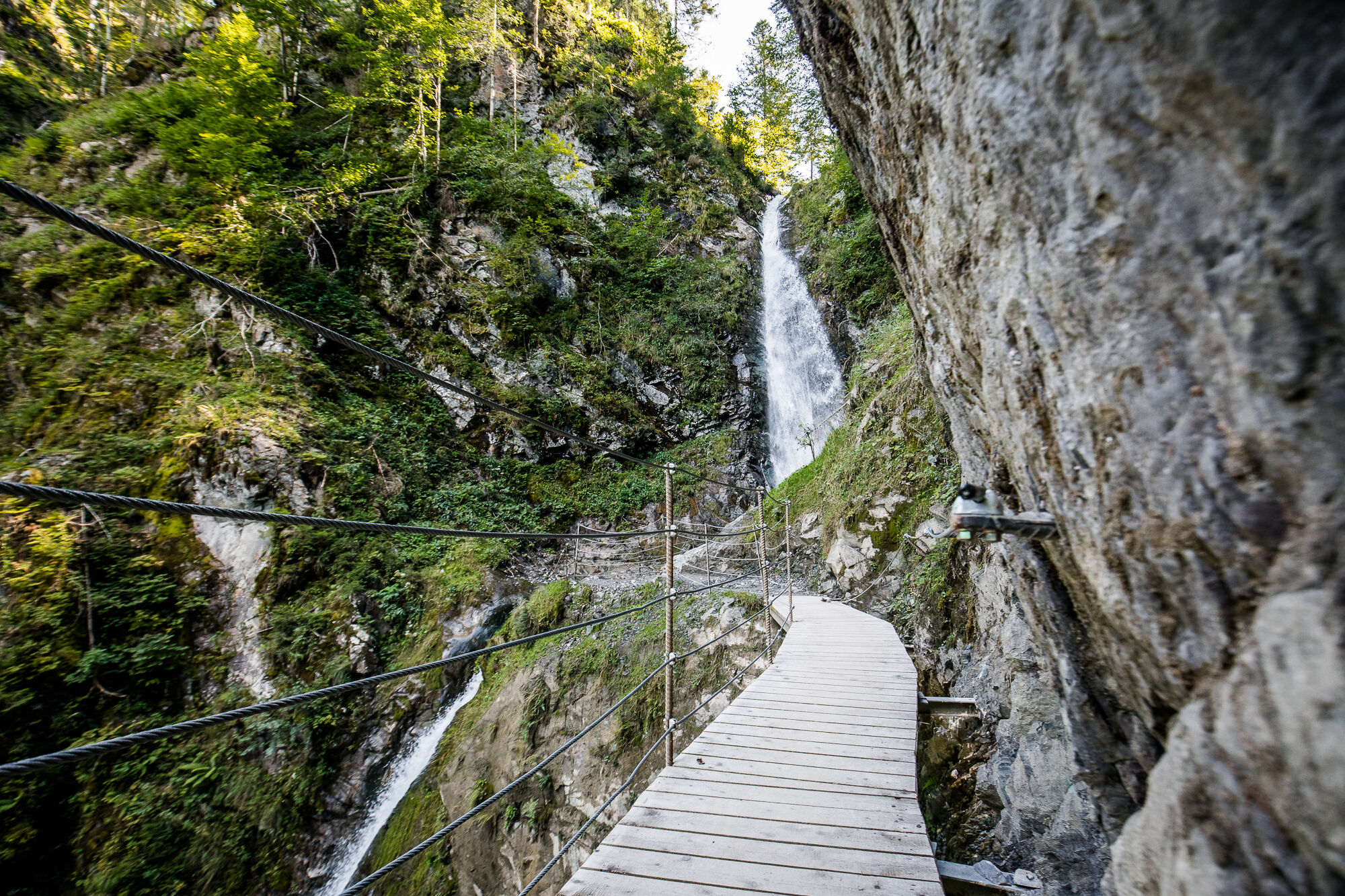
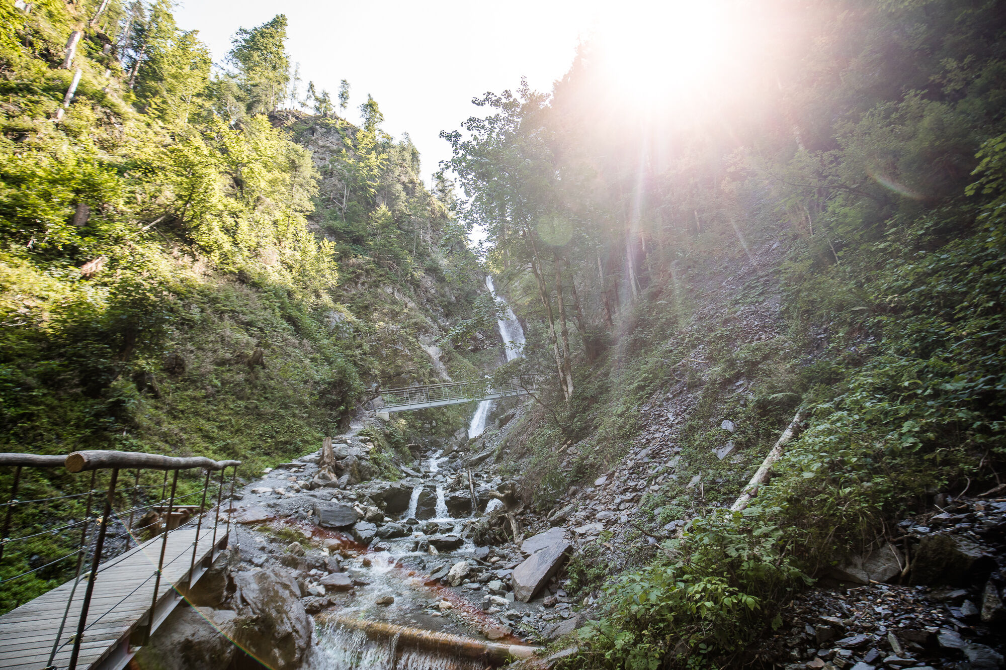
Burbling Gently and Roaring Loudly:
These are the Two Faces of the Eifersbacher Waterfall. - Moeilijkheid
-
gemakkelijk
- Waardering
-
- Startpunt
-
Parkplatz der Eichenhoflifte
- Route
-
St. Johann in Tirol0,0 kmPfarrkirche0,0 kmWeberhäusl0,1 kmSchneidern0,1 kmBruggbäck0,2 kmEibl0,2 kmSamer Talmühle3,2 kmTheresienkapelle3,3 kmSamer-Badl3,3 kmTheresienbad3,3 kmAiffersbachermühle3,3 kmHinterbichl3,3 kmEifersbacher Wasserfall4,3 kmLahnstreif4,8 kmGrander Schupf5,2 kmEibl8,0 kmBruggbäck8,0 kmWeberhäusl8,0 kmSt. Johann in Tirol8,4 kmSchneidern8,4 kmPfarrkirche8,5 km
- Beste seizoen
-
janfebmrtaprmeijunjulaugsepoktnovdec
- Maximale hoogte
- 868 m
- Rust/Retraite
-
Grander Schupf, bei der Variante: Angerer Alm, Harschbichlalm
- Kaartmateriaal
-
In allen Infobüros: St. Johann in Tirol - Oberndorf - Kirchdorf - Erpfendorf
- Info telefoon
-
Tourismusverband Kitzbüheler Alpen St. Johann in Tirol +43 (0)5352 63335-0
- Link
- https://www.kitzbueheler-alpen.com/de/st-johann
- Bron
- Tourismusverband Kitzbüheler Alpen St. Johann in Tirol
GPS Downloads


Condities van het pad
Asfalt
Steenslag
Weide
Bos
Rots
Moeilijk
Meer rondleidingen in de regio's


