
- Korte beschrijving
-
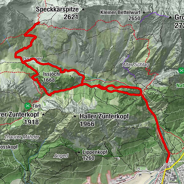
Trough the rough Halltal up to the Lafatscherjoch.
- Moeilijkheid
-
zwaar
- Waardering
-
- Route
-
Bergerkapelle0,9 kmEibental2,4 kmEibenkopf (1.275 m)2,7 kmJausenstation St. Magdalena (1.287 m)3,4 kmHirschbad4,8 kmKohlstatt (1.978 m)9,0 kmIssjöchl (1.668 m)11,2 kmRuppertikapelle12,3 kmErzherzogberg (1.424 m)12,6 kmJausenstation St. Magdalena (1.287 m)13,9 kmKohlanger14,4 kmJakobibründlquelle15,3 kmBettelwurfeck15,3 kmBergerkapelle16,4 km
- Beste seizoen
-
janfebmrtaprmeijunjulaugsepoktnovdec
- Maximale hoogte
- 2.082 m
- Bestemming
-
Halltal Parkplatz
- Hoogteprofiel
-

-

-
AuteurDe rondleiding Durch das Halltal auf das Lafatscherjoch wordt gebruikt door outdooractive.com op.
GPS Downloads


Algemene info
Verfrissingsstop
Tip voor insiders
Flora
Veelbelovend
Meer rondleidingen in de regio's
-
Ferienregion Hall - Wattens
1479
-
Absam
344


