© Garda Trentino - Archivio APT Garda Trentino

© North Lake Garda Trentino - APT Garda Trentino
© North Lake Garda Trentino - Archivio APT Garda Trentino (ph. Fabio Staropoli)

- Korte beschrijving
-
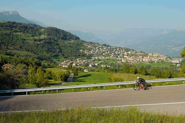
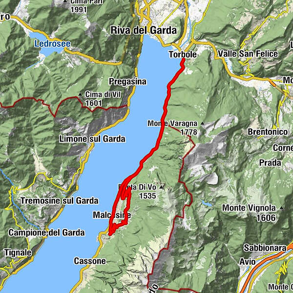
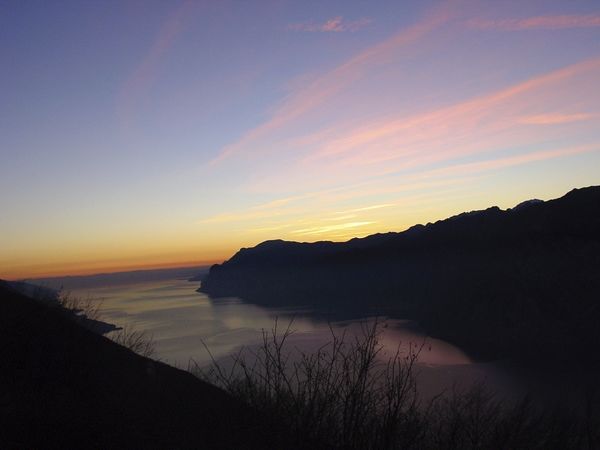
A brief tour characterised by the panoramic road in Malcesine which offers an opportunity to view Lake Garda from a different perspective. Quite a tough climb, but suitable for everyone.
- Moeilijkheid
-
medium
- Waardering
-
- Route
-
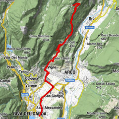
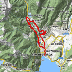
TorboleSas dei bimbi0,2 kmValmarsa2,7 kmTempesta3,5 kmTable and two chairs6,6 kmBaitone7,1 kmPizzeria Paola8,7 kmHotel Ristorante Pizzeria Oliveto8,7 kmNavene8,7 kmCampagnola10,3 kmRistorante Da Bianca10,3 kmCampagnola10,7 kmParagliding Landing Spot11,1 kmMalcesine13,4 kmSanto Stefano13,5 kmTrattoria Campiano18,5 kmLocalità Coal21,0 kmAlla Rama23,2 kmCa Vecia24,4 kmNavene25,6 kmPizzeria Paola25,7 kmHotel Ristorante Pizzeria Oliveto25,8 kmBaitone27,4 kmTable and two chairs27,6 kmTempesta30,8 kmValmarsa31,8 kmSas dei bimbi34,1 kmTorbole34,4 kmTorbole34,5 km
- Beste seizoen
-
janfebmrtaprmeijunjulaugsepoktnovdec
- Maximale hoogte
- 364 m
- Bestemming
-
Torbole - Info office
- Hoogteprofiel
-
 © outdooractive.com
-

-
AuteurDe rondleiding Via Panoramica di Malcesine wordt gebruikt door outdooractive.com op.
GPS Downloads


Algemene info
Verfrissingsstop
Tip voor insiders
Flora
Veelbelovend
Meer rondleidingen in de regio's