
- Korte beschrijving
-
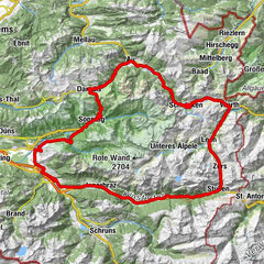
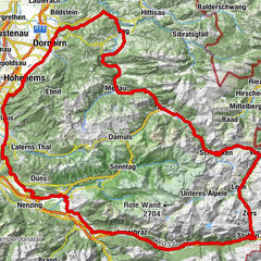
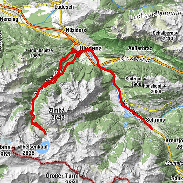
Aktivpark Montafon - Gantschier - St. Anton im Montafon - Lorüns - Brunnenfeld - Bludenz - Bürs - Alte Brandnertalstraße - Brand - Schattenlagantstraße - Talstation Lünerseebahn - Schattenlagantstraße - Brand - Bürserberg - Bürs - Bludenz - Brunnenfeld - Lorüns - St. Anton im Montafon - Gantschier - Aktivpark Montafon
- Moeilijkheid
-
medium
- Waardering
-
- Route
-
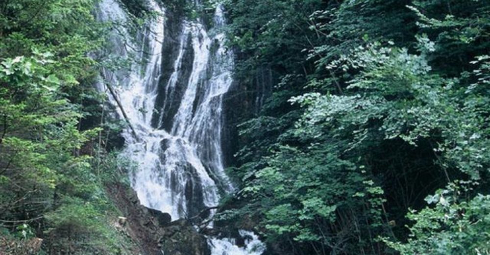
Tschagguns1,0 kmVandans4,5 kmGasthaus Postkutsche5,6 kmSt. Anton im Montafon6,0 kmSankt Anton im Montafon6,0 kmLorünser Stube8,6 kmLorüns8,8 kmBrunnenfeld10,8 kmDiamantweg Zentrum der Karma Kagyü Linie11,7 kmBludenz12,5 kmHeilig-Kreuz-Kirche12,5 kmBürs14,2 kmBrand23,7 kmRestaurant Alpen Tenne24,3 kmHerz-Jesu-Kapelle24,8 kmKesselfall26,0 kmGasthaus Schattenlagant29,5 kmLünerseebahn Talstation30,4 kmKesselfall34,2 kmHerz-Jesu-Kapelle35,2 kmRestaurant Alpen Tenne36,0 kmBrand36,5 kmKapelle zu Unserer Lieben Frau40,9 kmBürserberg42,3 kmWolfgangskapelle44,1 kmWegkapelle heilige Maria45,3 kmRestaurant Rosenegg46,6 kmGasthof Stern46,7 kmBürs46,7 kmHeilig-Kreuz-Kirche48,3 kmBludenz48,5 kmDiamantweg Zentrum der Karma Kagyü Linie49,0 kmBrunnenfeld50,1 kmLorünser Stube52,2 kmLorüns52,2 kmSankt Anton im Montafon54,8 kmSt. Anton im Montafon54,9 kmGasthaus Postkutsche55,0 kmVandans56,3 kmTschagguns59,9 km
- Beste seizoen
-
janfebmrtaprmeijunjulaugsepoktnovdec
- Maximale hoogte
- 1.563 m
- Bestemming
-
Aktivpark Montafon, Schruns-Tschagguns
- Hoogteprofiel
-

-

-
AuteurDe rondleiding Montafon - Brandnertal Tour (Lünersee Tour) wordt gebruikt door outdooractive.com op.
GPS Downloads


Algemene info
Verfrissingsstop
Veelbelovend
Meer rondleidingen in de regio's
-
Appenzellerland
12
-
Brandnertal
19
-
Bürs
5