

© Alpenregion Bludenz Tourismus GmbH - Martin Caldonazzi

© Alpenregion Bludenz Tourismus GmbH - Martin Caldonazzi

© Alpenregion Bludenz Tourismus GmbH - Martin Caldonazzi

© Alpenregion Bludenz Tourismus GmbH - Melanie Fleisch

© Alpenregion Bludenz Tourismus GmbH - Martin Caldonazzi

© Vorarlberg Tourismus GmbH
- Korte beschrijving
-
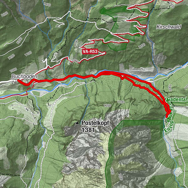
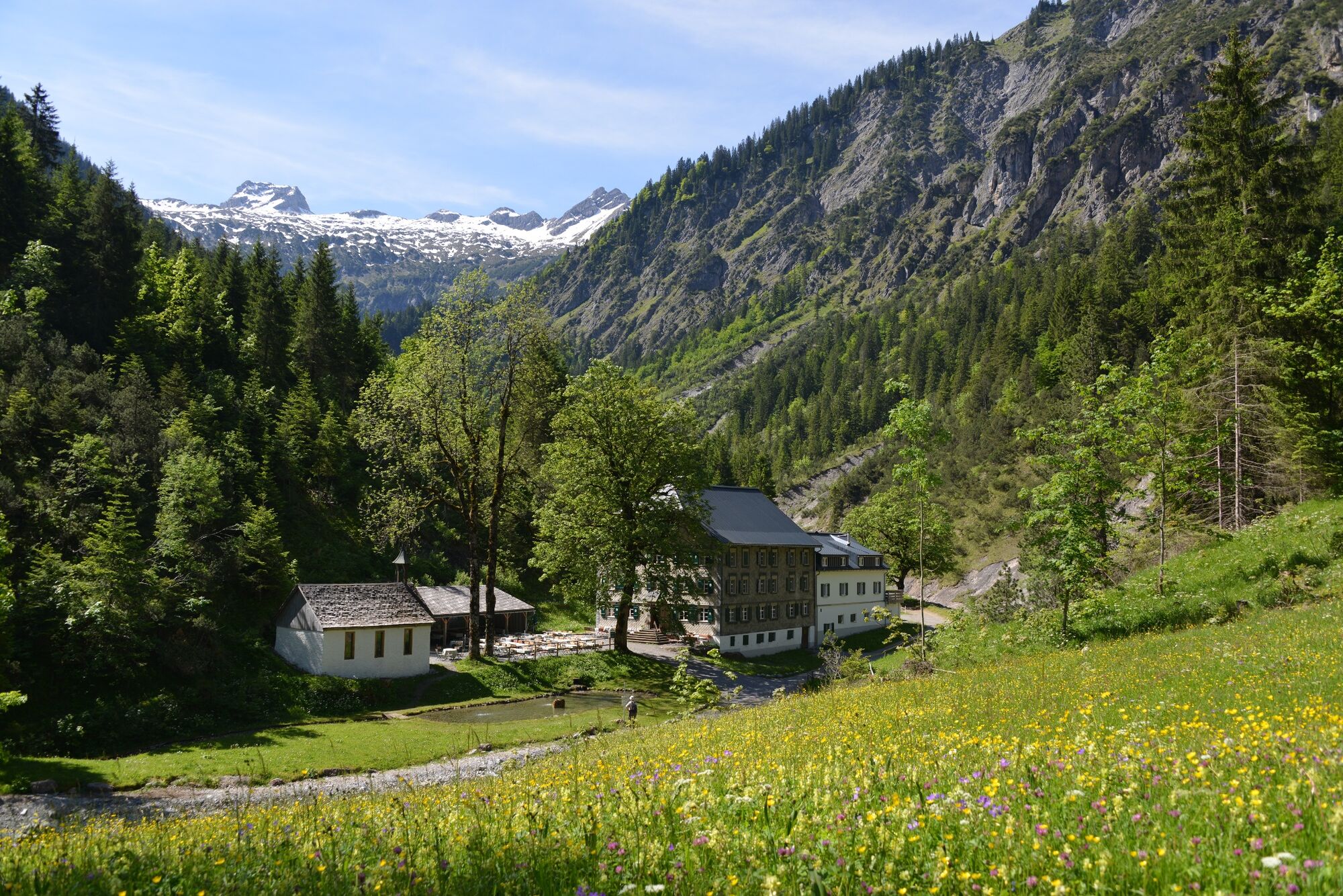
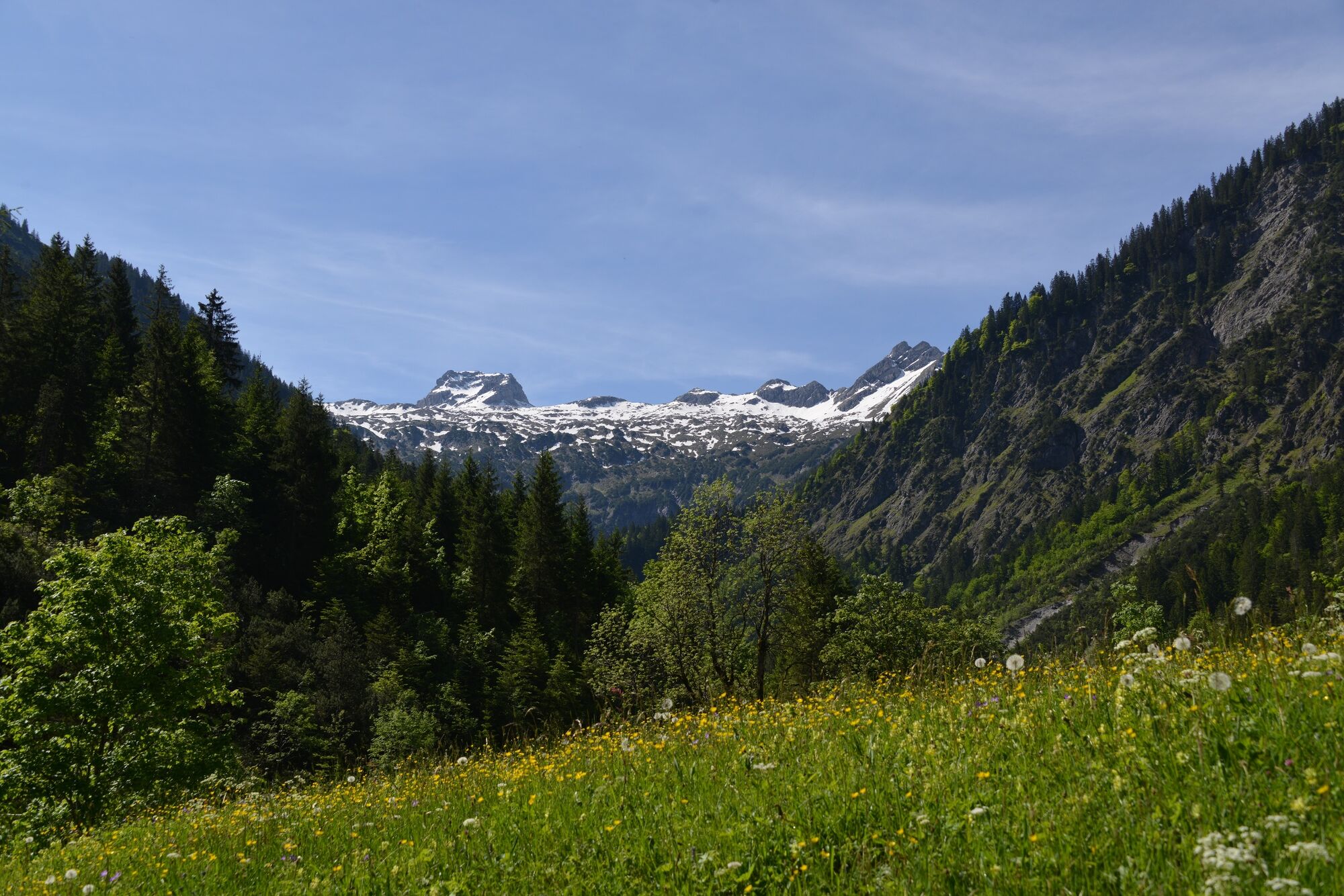
Enjoy the hike into the valley along the stream to the beautifully situated alpine inn Bad Rothenbrunnen in the Gadental valley.
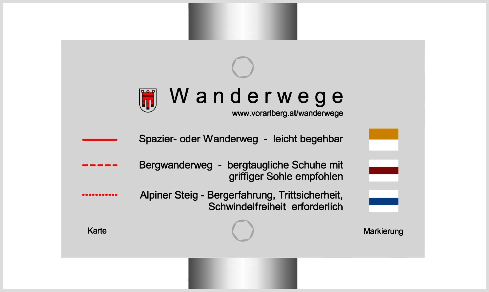
- Moeilijkheid
-
gemakkelijk
- Waardering
-
- Route
-
KreuzBuchboden0,1 kmBad Rothenbrunnen2,6 kmMarienkapelle2,6 kmBuchboden5,0 kmKreuz5,1 km
- Beste seizoen
-
janfebmrtaprmeijunjulaugsepoktnovdec
- Maximale hoogte
- 1.009 m
- Bestemming
-
Church, Sonntag-Buchboden
- Hoogteprofiel
-


- Auteur
-
De rondleiding Bad Rothenbrunnen | Sonntag-Buchboden wordt gebruikt door outdooractive.com op.
GPS Downloads


Algemene info
Verfrissingsstop
Cultureel/Historisch
Tip voor insiders
Veelbelovend
Meer rondleidingen in de regio's


