Mittelberg - Türtsch | Fontanella

Logo Mittelberg - Türtsch | Fontanella
Toerdatums
6,63km
1.105 - 1.249m
Afstand
152hm
136hm
Opstijging
02:00h
 
Duur
Korte beschrijving

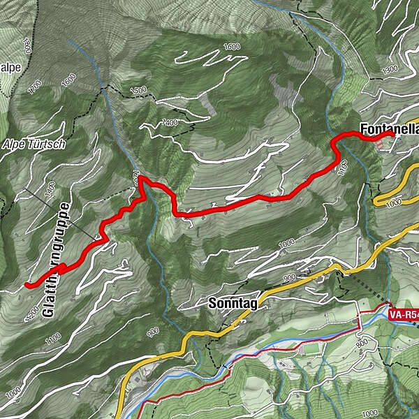
Winter hiking along the municipal road to the districts of Mittelberg and Türtsch in Fontanella.

Moeilijkheid
gemakkelijk
Waardering
Techniek
Conditie
Landschap
Belevenis
Route
Pfarrkirche Hl. Sebastian
Fontanella (1.145 m)
0,0 km
Pfarrkirche Hl. Sebastian
6,6 km
Fontanella (1.145 m)
6,6 km

Beste seizoen
aug
sep
okt
nov
dec
jan
feb
mrt
apr
mei
jun
jul
Maximale hoogte
1.249 m
Bestemming

Village centre, Fontanella

Hoogteprofiel

Auteur
De rondleiding Mittelberg - Türtsch | Fontanella wordt gebruikt door outdooractive.com op.

Algemene beoordeling

5

0

%

4

0

%

3

0

%

2

0

%

1

0

%

Fout
Er is een fout opgetreden. Probeer het opnieuw.
Bedankt voor uw beoordeling

Waardering is verwijderd

GPS Downloads
  • GPX GPS Exchange Format (XML)
  • KML Google Earth, Google Maps
QR Downloadcodes voor mobiele telefoons

Algemene info

Veelbelovend

Populaire rondleidingen in de omgeving

Schwarzenberg | Panorama hike Bödele - Schwarzenberg

gemakkelijk Winterwandelen
9,31km | 143hm | 03:00h

Schröcken | to the hotel at the lake

gemakkelijk Winterwandelen
5,34km | 147hm | 02:00h

Au-Schoppernau | Bergkristall hut

medium Winterwandelen
11,17km | 374hm | 04:00h

Damüls | Circular hike from peak to peak

gemakkelijk Winterwandelen
7,98km | 297hm | 03:00h