High altitude hiking trail | Brand

Logo High altitude hiking trail | Brand
Toerdatums
4,77km
1.022 - 1.172m
Afstand
180hm
176hm
Opstijging
02:00h
 
Duur
Korte beschrijving

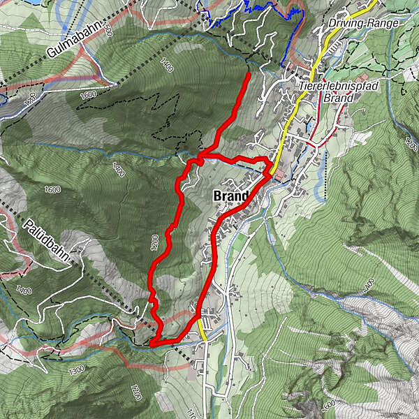
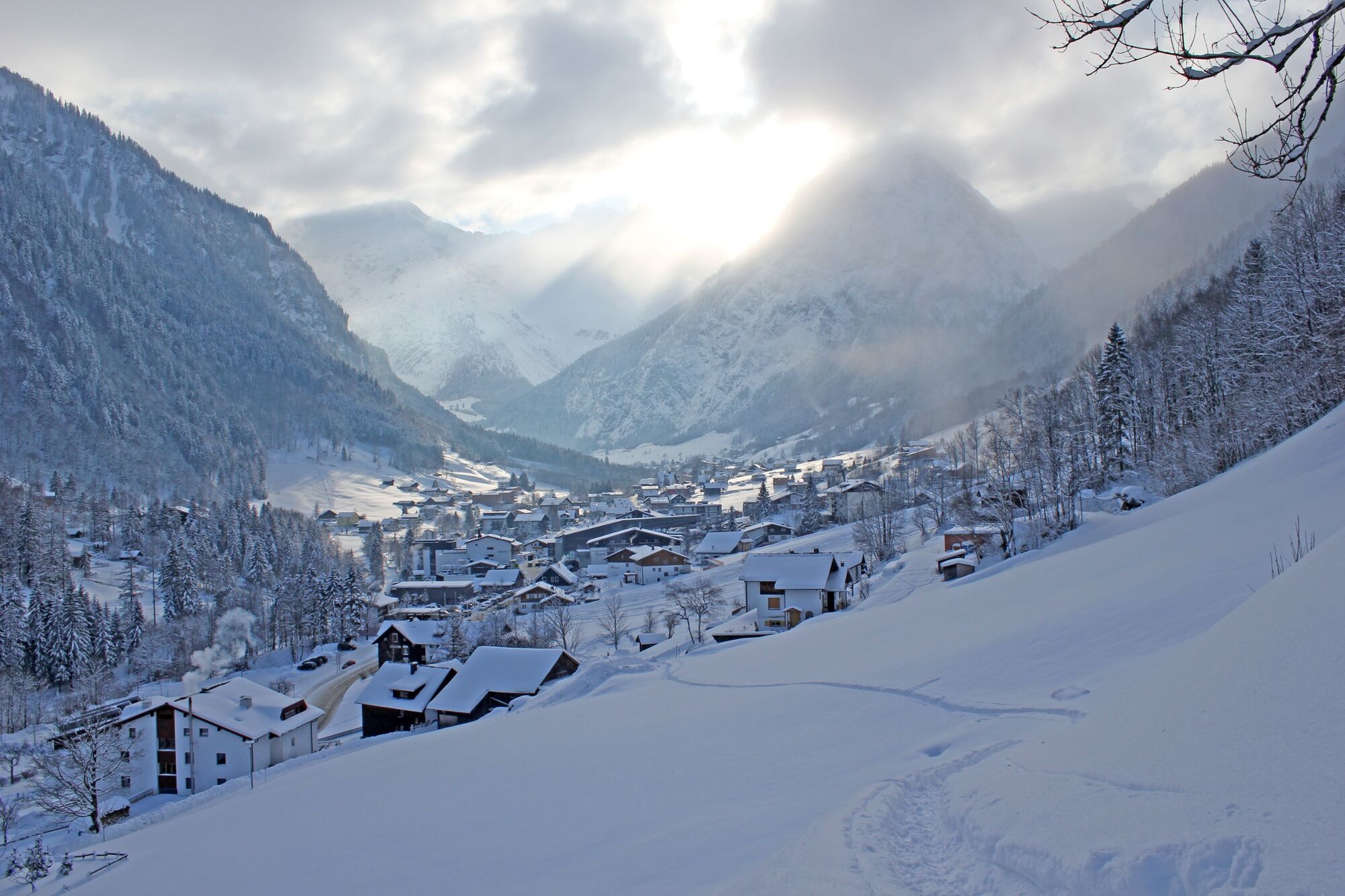
On the high hiking trail, which runs above the village, you have a beautiful view of Brand.

Moeilijkheid
medium
Waardering
Techniek
Conditie
Landschap
Belevenis
Route
Brand
4,0 km
Restaurant Alpen Tenne
4,5 km

Beste seizoen
aug
sep
okt
nov
dec
jan
feb
mrt
apr
mei
jun
jul
Maximale hoogte
1.172 m
Bestemming

Innertal, Brand

Hoogteprofiel

Auteur
De rondleiding High altitude hiking trail | Brand wordt gebruikt door outdooractive.com op.

Algemene beoordeling

5

0

%

4

0

%

3

0

%

2

0

%

1

0

%

Fout
Er is een fout opgetreden. Probeer het opnieuw.
Bedankt voor uw beoordeling

Waardering is verwijderd

GPS Downloads
  • GPX GPS Exchange Format (XML)
  • KML Google Earth, Google Maps
QR Downloadcodes voor mobiele telefoons

Algemene info

Veelbelovend
Meer rondleidingen in de regio's

Populaire rondleidingen in de omgeving

Schafbergplateau

medium Winterwandelen
1,52km | 99hm | 00:45h

Damüls | the Damüls alpine circuit

medium Winterwandelen
7,73km | 324hm | 02:30h

Sass Trail

medium Winterwandelen
4,41km | 153hm | 02:00h

Vergaldner Rundwanderweg

medium Winterwandelen
3,31km | 149hm | 01:15h