© Unbekannt - Zermatt Tourismus

© Unbekannt - Zermatt Tourismus

© © matterhorn.ultraks.com /J. Saragossa - Zermatt Tourismus
© Matterhorn Ultraks - Zermatt Tourismus
© Matterhorn Ultraks


- Korte beschrijving
-
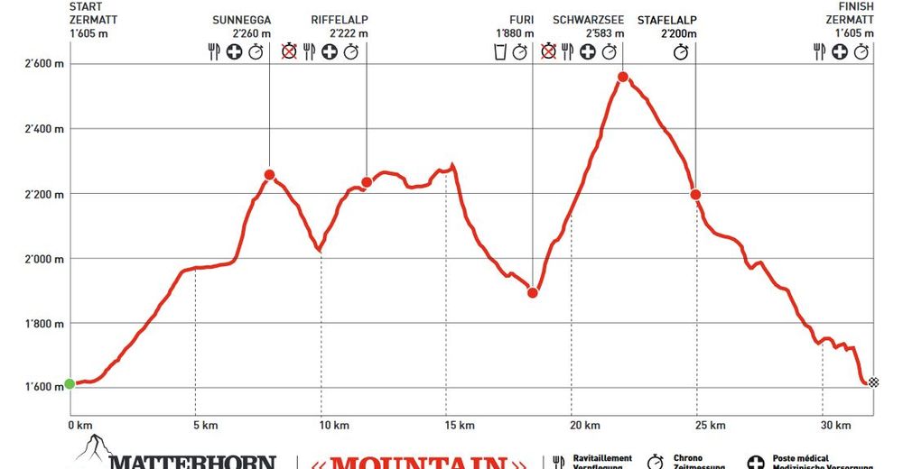
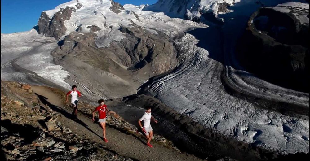
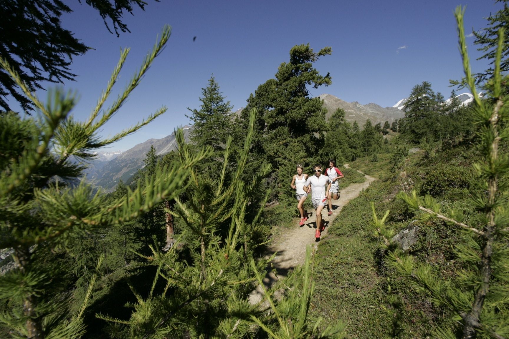
This course demands a great deal of effort, even though endurance athletes regard it as “medium” distance. Runners cover a total of 32 km, with ascents and descents of 2,000 vertical metres.
- Moeilijkheid
-
medium
- Waardering
-
- Route
-
Zermatt (1.608 m)0,0 kmKirche St. Mauritius0,4 kmOthmar’s Skihütte3,5 kmSunegga (2.277 m)7,8 kmEggen (2.177 m)8,9 kmZe Gassen (2.051 m)9,6 kmRiffelalp (2.222 m)13,3 kmFuri18,5 kmSchwarzsee paradise22,2 kmSchwarzsee (2.588 m)22,2 kmStafelalp25,0 kmStafel (2.139 m)25,3 kmBiel25,7 kmZmutt27,7 kmZermatt (1.608 m)31,9 km
- Beste seizoen
-
janfebmrtaprmeijunjulaugsepoktnovdec
- Maximale hoogte
- 2.580 m
- Bestemming
-
Zermatt (1,620 m)
- Hoogteprofiel
-
 © outdooractive.com


- Auteur
-
De rondleiding Matterhorn Ultraks Trail "Mountain" wordt gebruikt door outdooractive.com op.
GPS Downloads


Algemene info
Verfrissingsstop
Flora
Fauna
Veelbelovend
Meer rondleidingen in de regio's
-
Unterwallis
73
-
Mattertal
34
-
Zermatt
14