© Aletsch Arena – Marco Schnyder

© Aletsch Arena – Marco Schnyder

© Aletsch Arena – Marco Schnyder


- Korte beschrijving
-
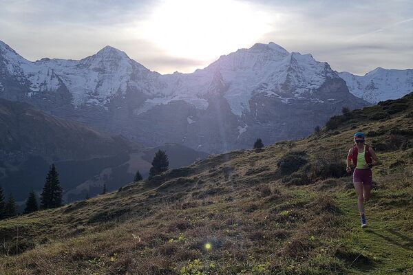
Running along the Great Aletsch Glacier, this is a smooth trail that keeps you moving, except when you can’t resist stopping to admire the view.
- Moeilijkheid
-
medium
- Waardering
-
- Route
-
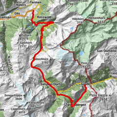
Bettmeralp (1.948 m)0,0 kmGopplerlücke1,5 kmRiederalp (1.925 m)3,1 kmRiederfurka4,5 kmMoosfluh (2.394 m)7,7 kmGletscherstube Märjelen15,3 kmMärjela15,3 kmBettmeralp (1.959 m)26,7 kmBettmeralp (1.948 m)27,0 km
- Beste seizoen
-
janfebmrtaprmeijunjulaugsepoktnovdec
- Maximale hoogte
- 2.390 m
- Bestemming
-
Bettmeralp
- Hoogteprofiel
-
 © outdooractive.com


- Auteur
-
De rondleiding Along the Aletsch Glacier, Bettmeralp wordt gebruikt door outdooractive.com op.
GPS Downloads


Algemene info
Verfrissingsstop
Cultureel/Historisch
Flora
Fauna
Veelbelovend
Meer rondleidingen in de regio's
-
Aletsch Arena
72
-
Brig Simplon
15