- Korte beschrijving
-
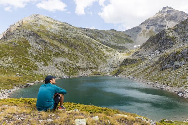
High altitude hikers will get their money's worth on this mountain hike. A breathtaking view of the Valais mountains awaits you at the summit, the likes of which you rarely get to see.
- Moeilijkheid
-
medium
- Waardering
-
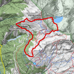
- Route
-
DorbiaKapälli1,8 kmAugstbordhorn (2.972 m)5,4 kmDorbia10,7 km
- Beste seizoen
-
janfebmrtaprmeijunjulaugsepoktnovdec
- Maximale hoogte
- 2.950 m
- Bestemming
-
Moosalp
- Hoogteprofiel
-
 © outdooractive.com
- Auteur
-
De rondleiding Moosalp - Augstbordhorn - Moosalp wordt gebruikt door outdooractive.com op.
GPS Downloads


Algemene info
Verfrissingsstop
Flora
Fauna
Veelbelovend
Meer rondleidingen in de regio's
-
Oberwallis
1881
-
Moosalpregion
942
-
Bürchen
140