

© Région Dents du Midi - Litescapemedia

- Korte beschrijving
-
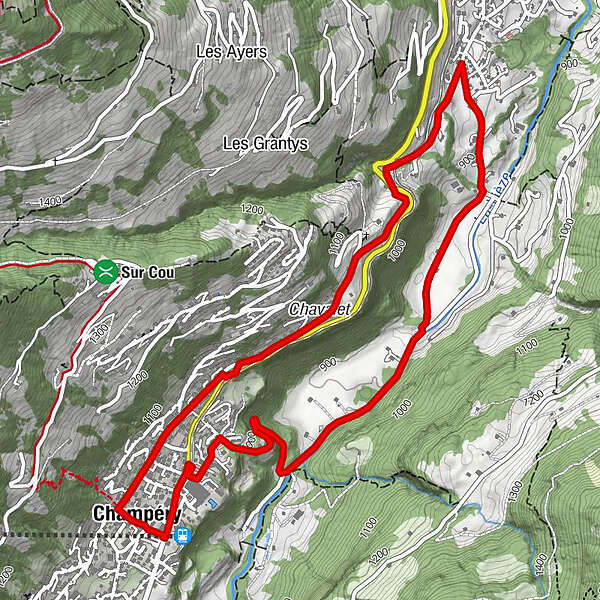
Explore the quiet backroads and paths that join the neighbouring alpine villages of Champéry and Val-d'Illiez, then return along the banks of the rushing River Vièze at the bottom of the Illiez Valley.
- Moeilijkheid
-
gemakkelijk
- Waardering
-
- Route
-
Champéry (1.050 m)0,2 kmEglise catholique de Champéry0,5 kmTemple de Champéry0,9 kmChampéry (1.050 m)6,6 km
- Beste seizoen
-
augsepoktnovdecjanfebmrtaprmeijunjul
- Maximale hoogte
- 1.060 m
- Hoogteprofiel
-
 © outdooractive.com
- Auteur
-
De rondleiding Champéry - La Cour wordt gebruikt door outdooractive.com op.
GPS Downloads


Algemene info
Verfrissingsstop
Meer rondleidingen in de regio's