


6th section Werra-Burgen-Steig Hessen


Certified long-distance hiking trail from Hann. Münden to Tannenburg near Nentershausen. The route runs 133 km through the Geo-Nature Park Frau-Holle-Land.


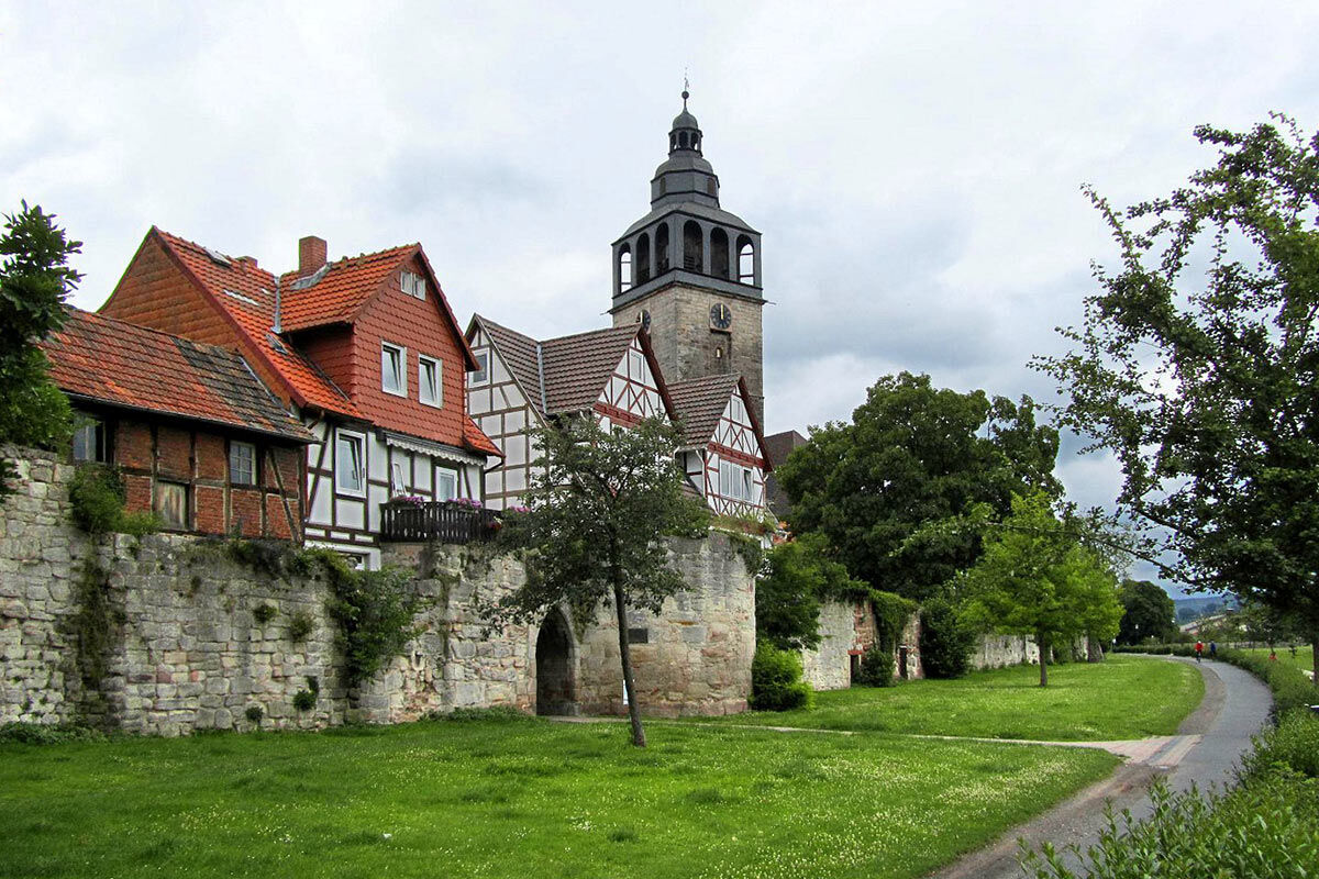
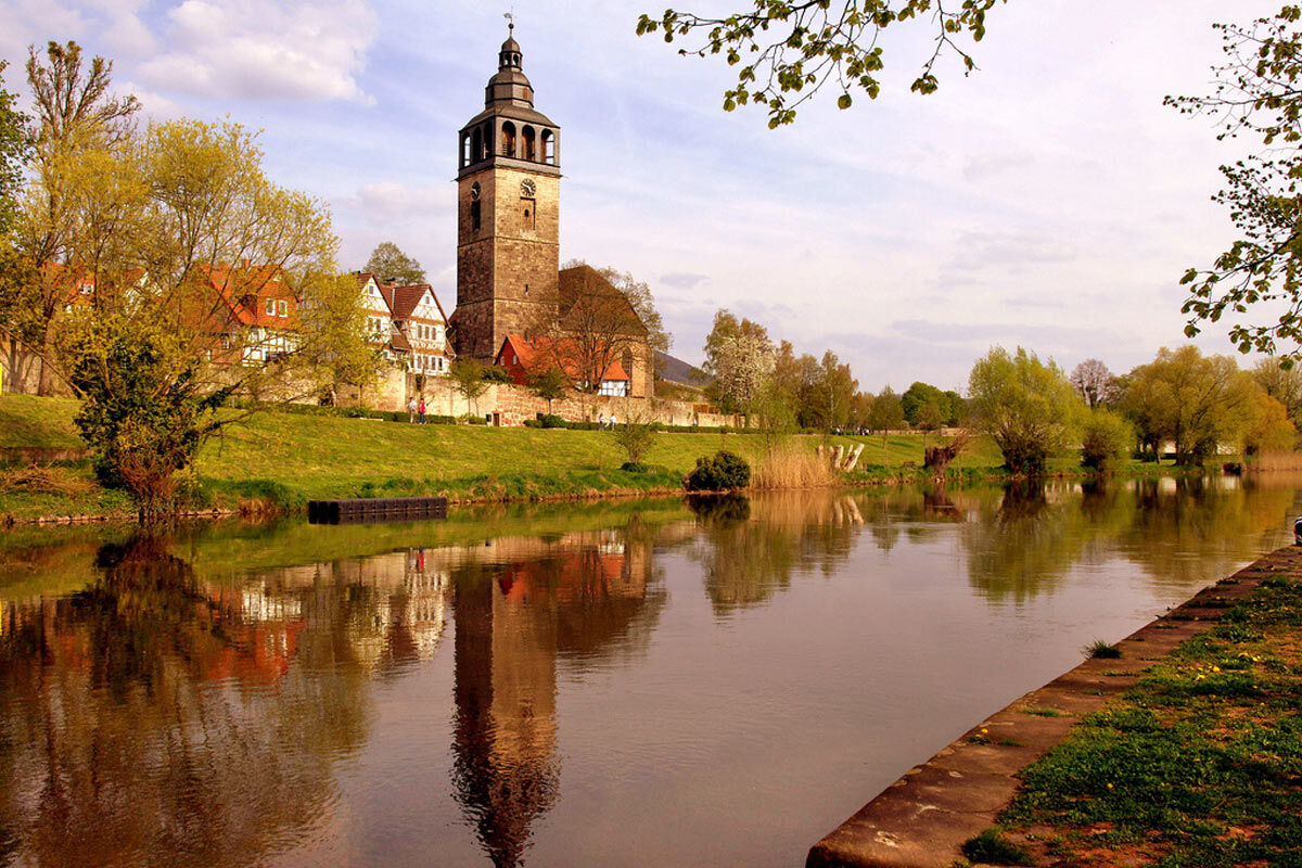
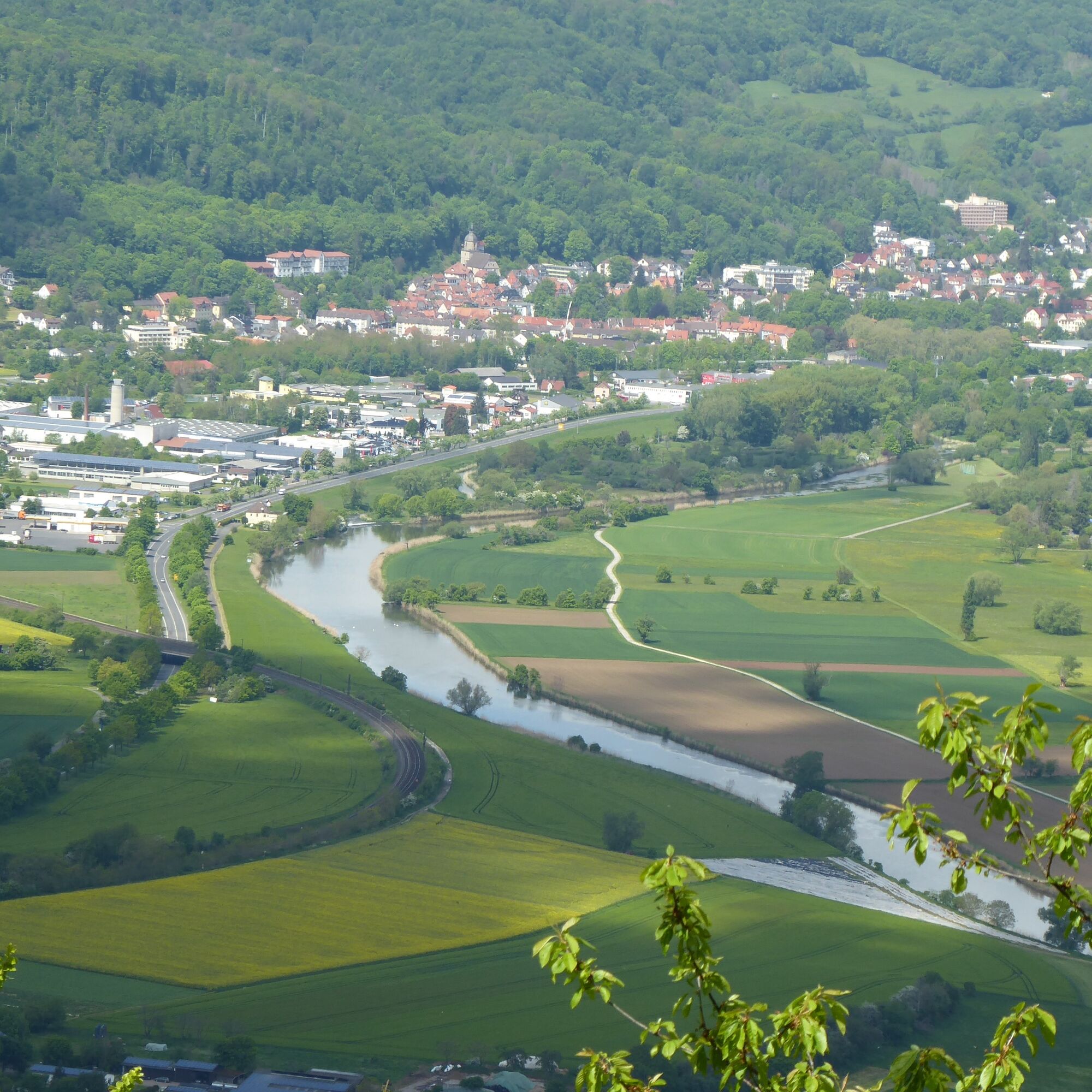
After crossing the Werra, a footpath branches off to the right along the town wall, shortly after you pass on the left side the church and Bible garden St. Crucis with the Cafe Himmelspforte. After about 250 m, you turn right at the height of the church and the cemetery to the sports field and walk along the meadow path immediately next to the Werra.
This section is impassable during floods. As an alternative, follow the trail marking 5 straight ahead from the cemetery/sports field. After about 2.5 km, the alternative route meets the regular route again just before the beginning of the climb to Rothestein Castle.
The path surface changes from grass cover to gravel; after a 90° turn, you turn right onto another meadow path. Follow this path until you reach an asphalt path; first turn right onto it, but then immediately leave it to the left via a small path.
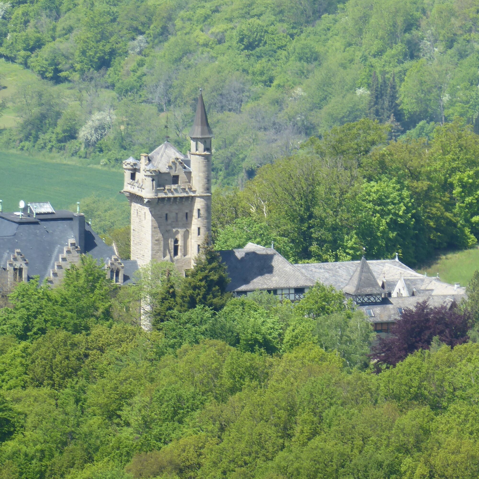
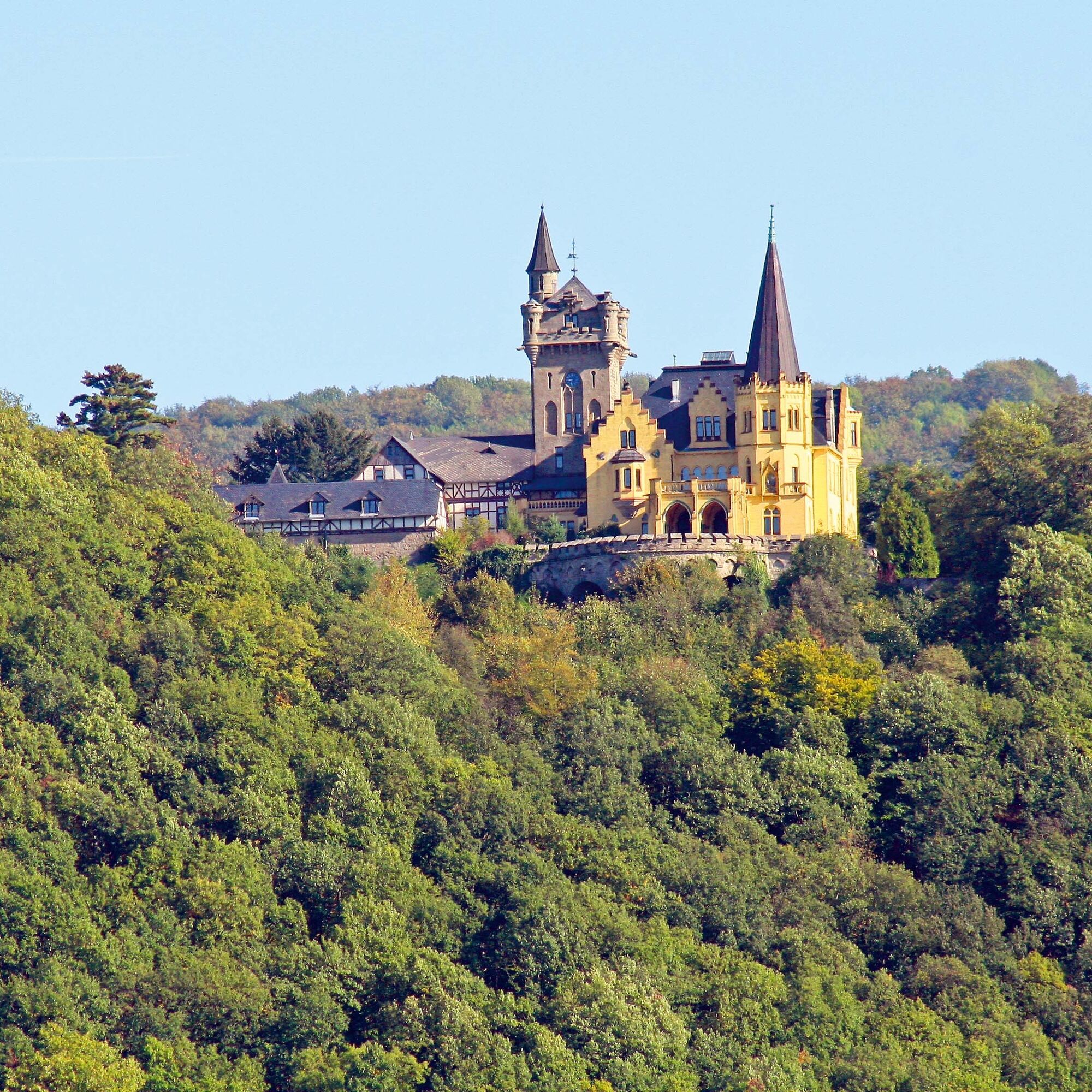
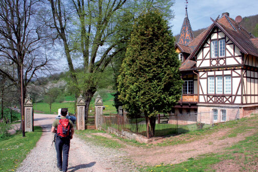
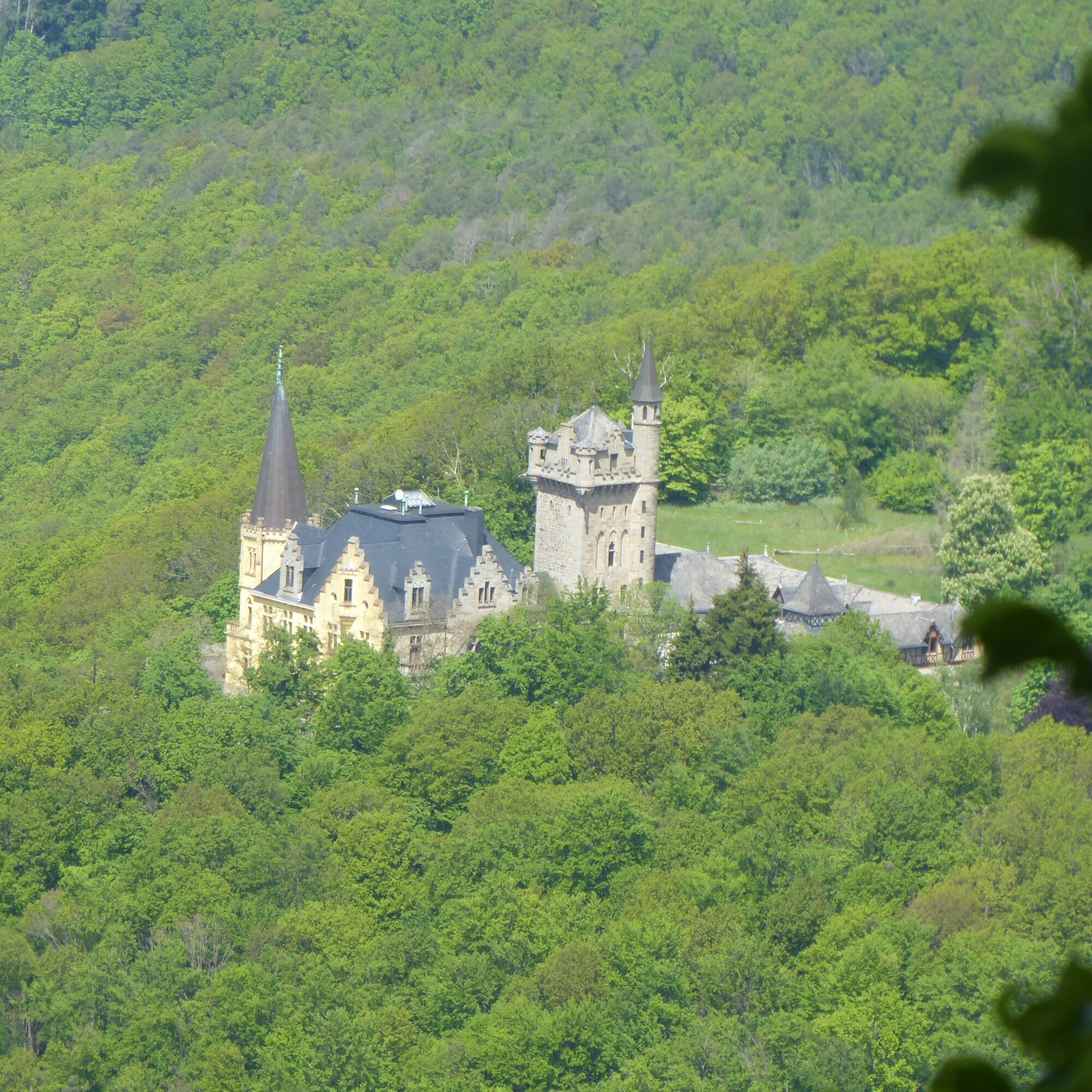
You arrive at a paved path with a strikingly beautiful house, the former greenhouse of Rothestein Castle. Past this magnificent building, the ascent to Rothestein Castle begins. Following the driveway, it is about 2 km; following the X5 H marking, about 900 m must be managed on steep, natural paths.
At the end of the steep ascent, you reach the driveway to the castle. Keep left; after about 150 m you have reached the large castle gate.
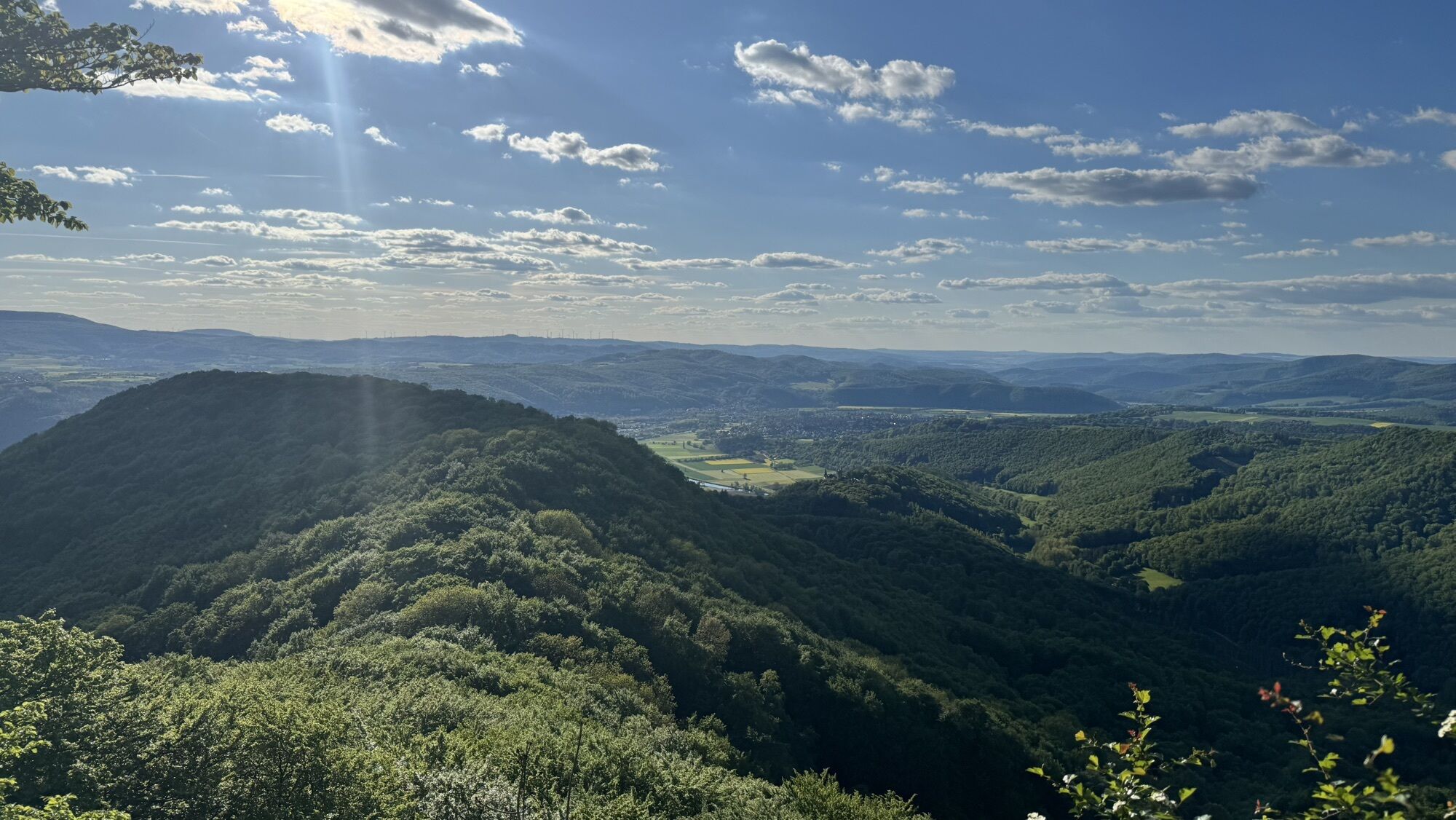
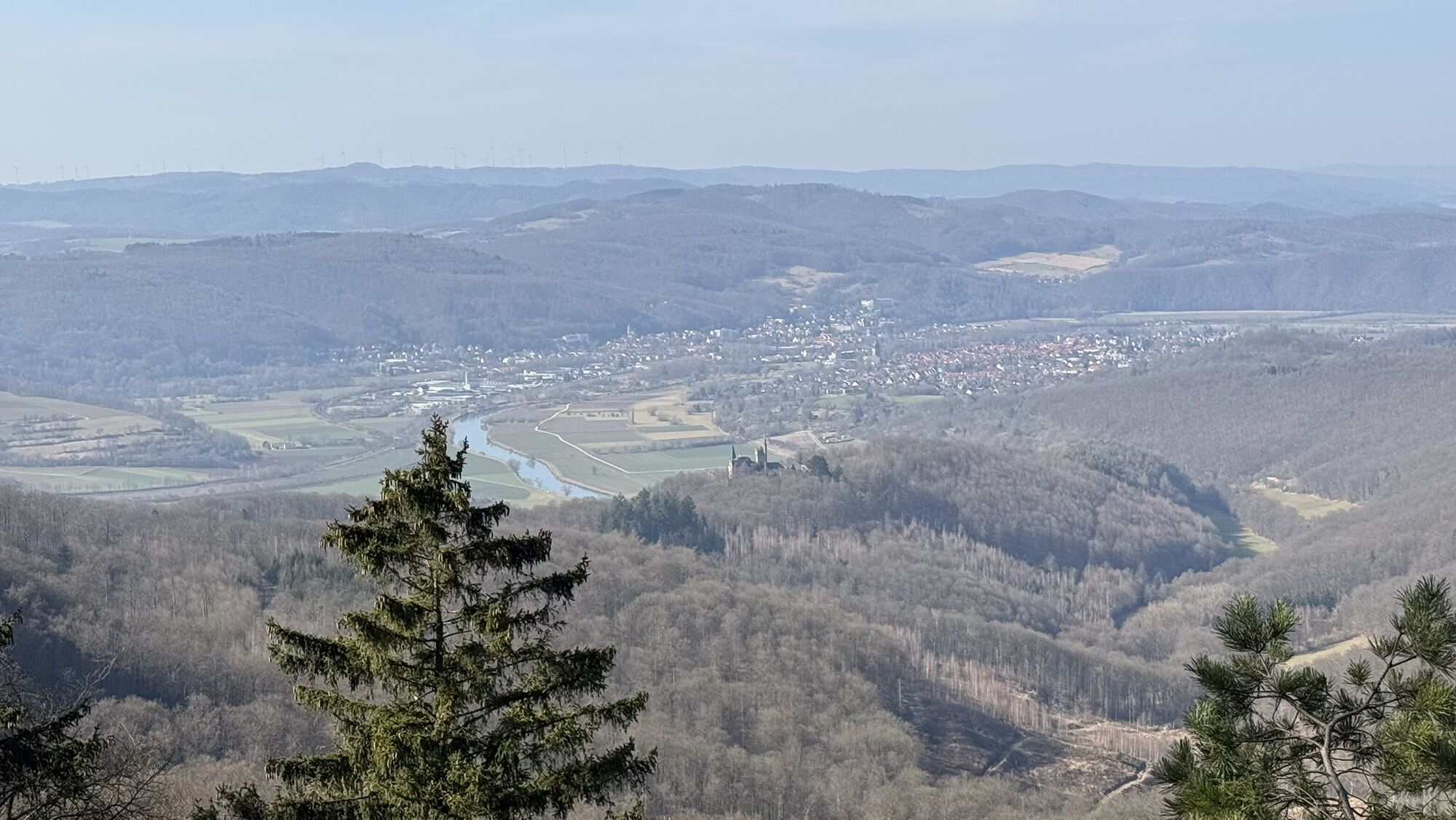
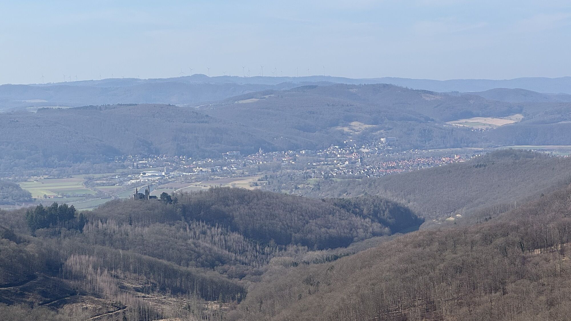
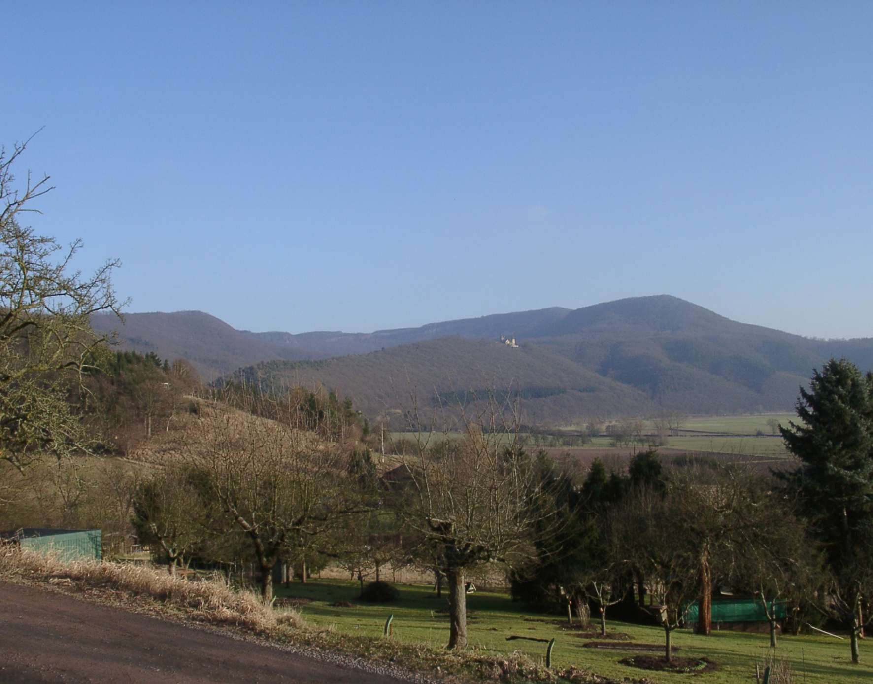
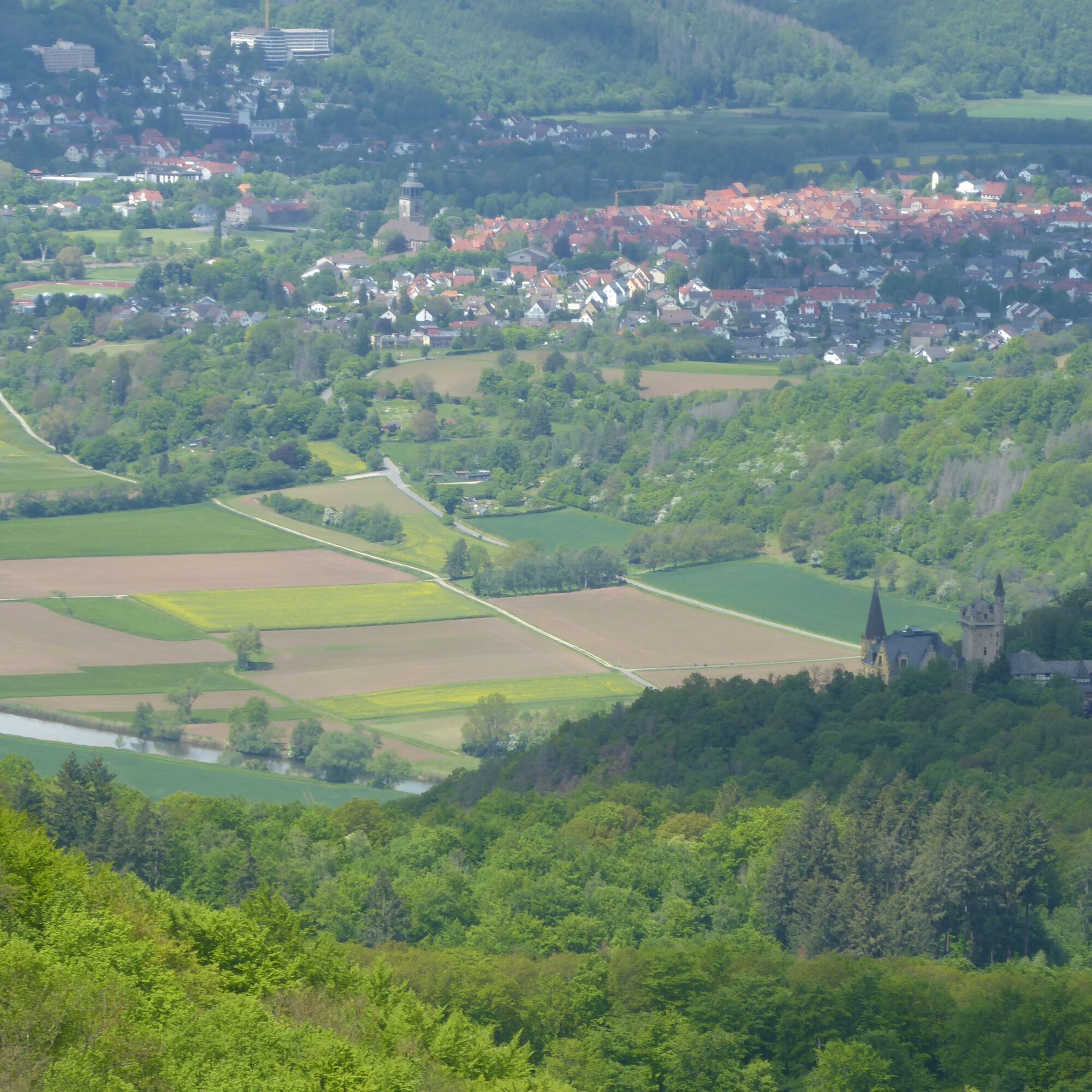
The Werra-Burgen-Steig Hessen leads from the castle gate down the forest path to the left. After about 1 km, turn right onto the ascending path. At the next fork, keep right on the ascending path, then a downhill section follows, at the end of which you follow the crossing path a few meters to the left. Now climb left on the strongly uphill path to the Hörne viewpoint (with shelter) in the Hessian Switzerland nature reserve. The view from this 523 m high rock spur into the Werra valley with the deciduous forest slopes rising on both sides of the river is overwhelming! From the Hörne, a nature trail leads a short way downhill and soon another great view opens up. The path now runs mostly flat and partly close to a steep rock edge—caution is advised when wet!
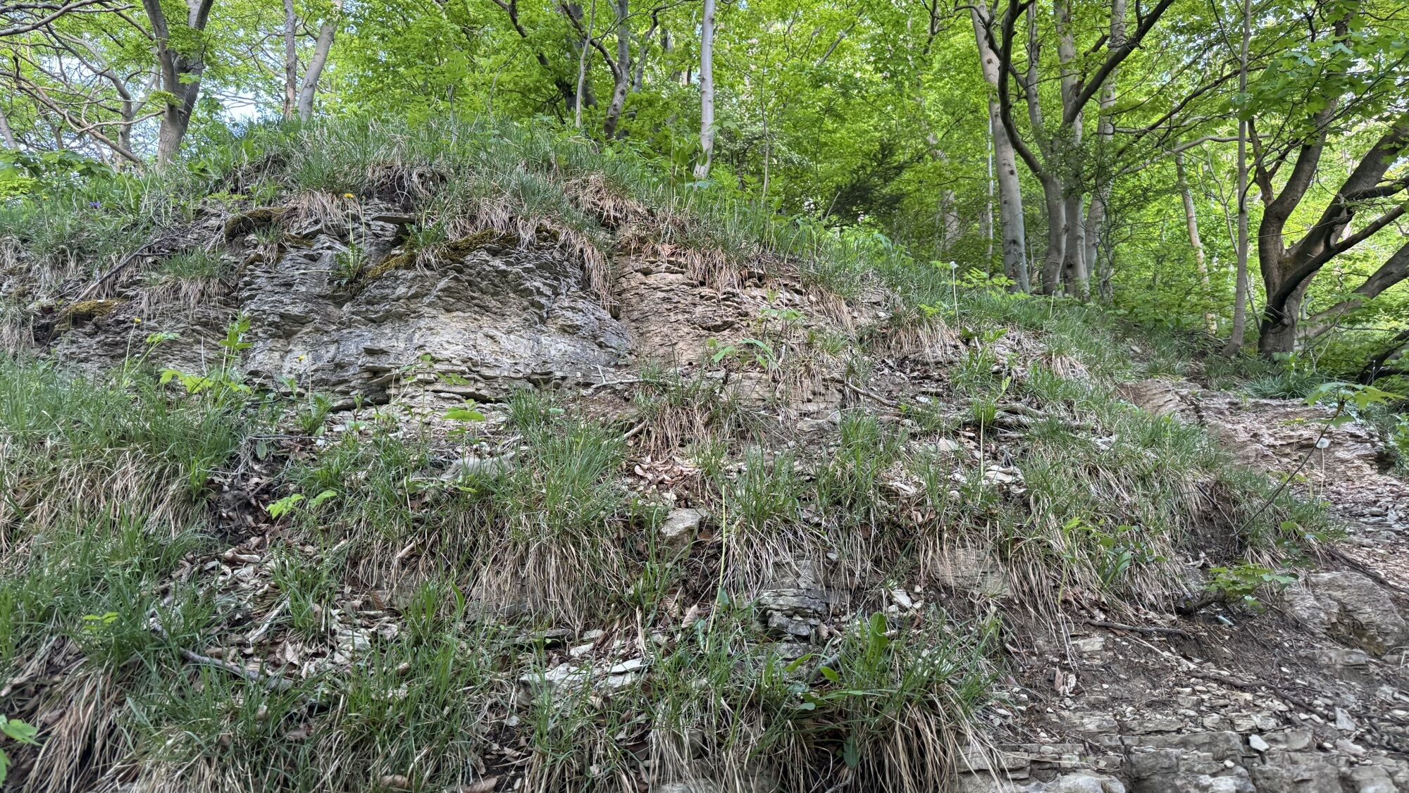
The path sometimes runs directly over rocks and repeatedly goes slightly downhill. At the end of a small hollow, a steep rock spur rises before you, which the path passes on the right. The rock spur marks the beginning of a mighty Muschelkalk limestone rock massif that stretches along the path through the beautiful deciduous forest interspersed with yews. Over some steps and after another slight ascent, a bench is reached at the height, from where it continues towards Schön Aussicht (beautiful view). After a few minutes' walk, you find yourself in a clearing with a border stone; follow the path to the right around the meadow.
Immediately after passing the forest meadow, take the path turning left, walk past a shelter, and reach another viewpoint at Schön Aussicht. Soon the forest opens again, and it seems you have reached another clearing. Here you have reached the Hessian-Thuringian border, and the supposed clearing is a corridor that already belongs to the Green Belt.
Before the corridor, the X5 H marking points right. Straight ahead, a sign points to the variant via the former patrol path. You should definitely follow the second variant; it is much more interesting and not longer.
Follow the former patrol path down slightly to the right to a shelter and a rest area, near which a part of the former border fence has been preserved. On the metal fence, a panel provides information about the history and dissolution of the border at this point in 1989. The rest area ("Sägewerk") also recalls the local border opening on 28.12.1989.
From the rest area, it is only a few steps before the patrol path variant meets the main route of the Werra-Burgen-Steig Hessen in the forest again, which now continues left in immediate proximity to the Green Belt. The path straight ahead leads to Hitzelrode, approx. 1.7 km away (end of the 6th section).
Ja
For more information visit https://www.werra-burgen-steig-hessen.de/
Populaire rondleidingen in de buurt
-
4,0
Premium route P1 Hoher Meißner
zwaarWandelen 13,8 km -
5,0
Premiumweg P16 Asbach Sickenberg
zwaarWandelen 13,6 km -
Premium route P4 Hessische Schweiz - Walkable Green Belt
zwaarWandelen 19,3 km -
5,0
Premium route P2 Frankershäuser Karst
zwaarWandelen 10,2 km -
Premium route P19 Datterode, Goose Lads' Route
mediumWandelen 9,55 km -
Premium route P7 Söder Wald
zwaarWandelen 15,0 km -
5th section Werra-Burgen-Steig Hessen
zwaarWandelen 17,5 km -
4th section of the Werra-Burgen-Steig Hessen
Wandelen 9,62 km -
1,0
Premium path P8 Heiligenberg Bühlchen
lichtWandelen 7,58 km -
Anger-Radtour
mediumFietsen 26,3 km
Wandelen en spoorzoeken


Mis geen aanbiedingen en inspiratie voor je volgende vakantie
Uw e-mailadres is toegevoegd aan de mailinglijst.