


Lourdes Aubisque via Spandelles


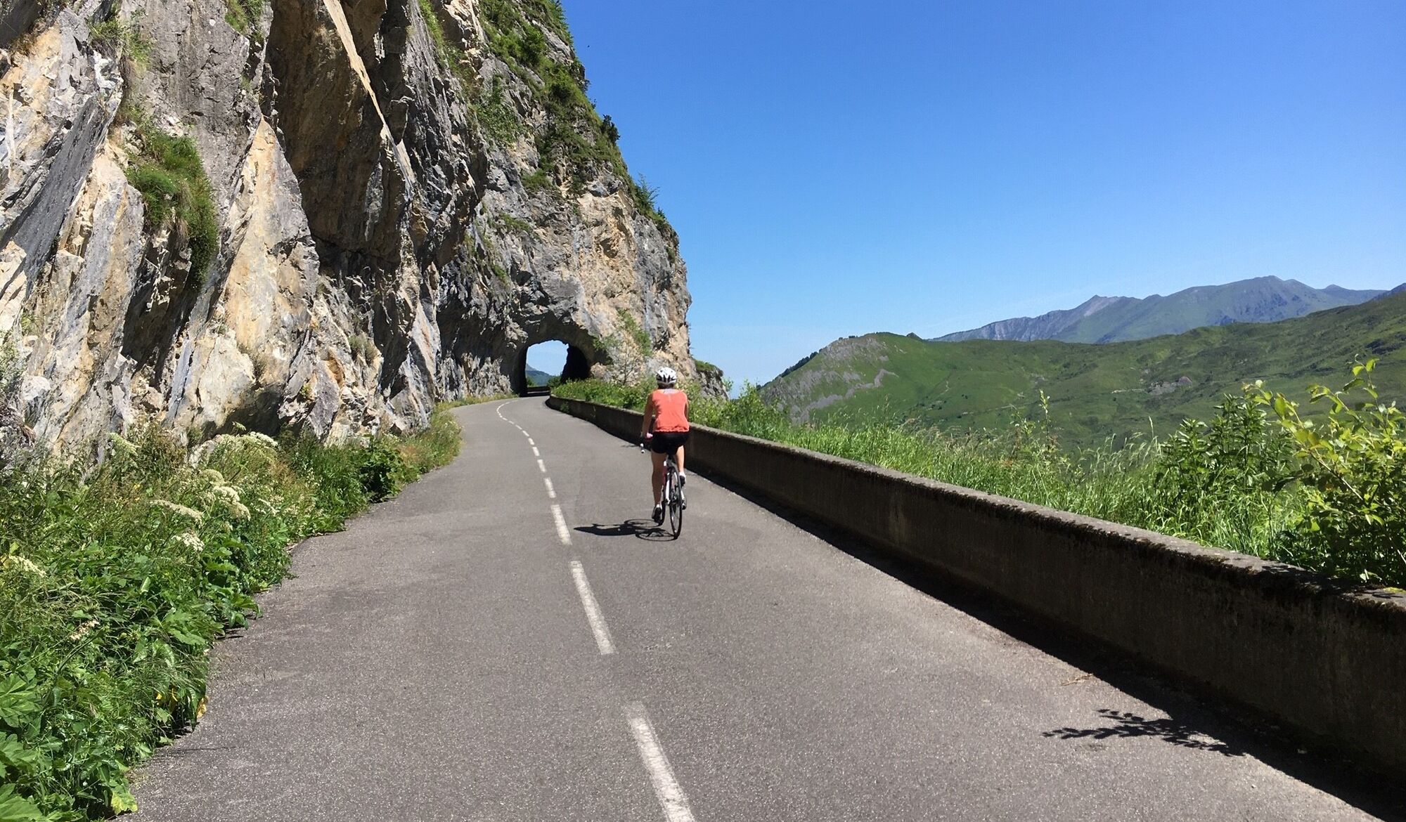
This cycling trip from Lourdes to the legendary Col d'Aubisque via the Col de Spandelles (1378m) and Col du Soulor (1474m) promises an exciting adventure through the Pyrenees.
You'll embark on an itinerary...
This cycling trip from Lourdes to the legendary Col d'Aubisque via the Col de Spandelles (1378m) and Col du Soulor (1474m) promises an exciting adventure through the Pyrenees.
You'll embark on an itinerary that takes in spectacular scenery and wild mountain roads. The demanding climbs of the Col de Spandelles and Col du Soulor will challenge you, with a total vertical drop of 2527m, but the breathtaking panoramas (including the Cirque du Litor) and the achievement of reaching the summit of the Col d'Aubisque (1709m) will make this a memorable outing.

Ja
Before setting off :
Make sure your bike is in perfect mechanical condition, including tires and brakes. Make sure your bike is properly adjusted to your body type. Wearing a helmet is highly recommended Take along a repair kit Remember that the Highway Code applies to cyclists in all circumstances. Never ride with more than two people abreast, and keep to a single lane when traffic conditions dictate. Respect other road users as you would like them to respect you. Choose a route suited to your physical abilities Inform those around you of your itinerary Be aware of weather conditions A first-aid kit is not essential, but can be very useful. Know and keep emergency numbers. Respect the environment by not throwing food packaging on the side of the road. If you have to return home after dark, make sure you can see and be seen.
In case of emergency, dial 112
Think about carpooling
Parking close to departure point
To find out more about our destination, visit our website
A unique opportunity to push your limits while soaking up the natural beauty of the Pyrenees.
Populaire rondleidingen in de buurt
M 13. Etappe Aucun-Bielle, Okzitanien/Frankreich
zwaarFietsen48,2 kmLA VOIE VERTE DES GAVES A VELO
lichtFietsen18,8 kmLourdes Hautacam
zwaarRacefiets55,4 kmLourdes Vélosud (V81) along the river gave
lichtFietsen33,0 kmLac d'Anglas von Gurette
mediumWandelen8,07 kmLourdes Lac d'Estaing
mediumFietsen63,2 kmSoulor - Aubisque par le col des Spandelles
zwaarRacefiets84,0 kmCol des Spandelles via Asson
zwaarFietsen78,6 kmLourdes Luz Ardiden Hautacam
zwaarRacefiets119,1 kmTHE COL D'AUBISQUE VIA THE VALLÉE D'OSSAU
zwaarFietsen94,5 km
Wandelen en spoorzoeken


Mis geen aanbiedingen en inspiratie voor je volgende vakantie
Uw e-mailadres is toegevoegd aan de mailinglijst.