Chläggi-Route
zwaar
Fietsen
Navigeer naar
Navigeer naar
Ontvang deze tour op je mobiele telefoon
Kaart
Chläggi-Route
zwaar
Fietsen
58,06 km
Scan de QR-code en start de navigatie in de bergfex app.
QR Code
Wandelen en spoorzoeken

Chläggi-Route

Afstand
58,06 km
Duur
04:30 h
Opstijging
691 hm
Zeespiegel
360 - 622 m

Moeilijkheidsgraad: 3

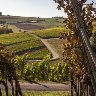
Cycle through the rural Klettgau, through endless vineyards, past breathtaking viewpoints, through lush meadows and rustling forests. Let yourself be enchanted by the charm of the wine-growing villages...


Beschrijving van de

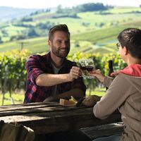
Cycle through the rural Klettgau, through endless vineyards, past breathtaking viewpoints, through lush meadows and rustling forests. Let yourself be enchanted by the charm of the wine-growing villages and treat yourself to a good drop in one of the numerous cozy wine cellars.

The Chläggi-Route offers you a varied experience with culinary, cultural and scenic highlights. Discover a part of the Regional Nature Park Schaffhausen on two wheels.
Route
Schaffhausen
(403 m)
Stad
0,3 km
Neuhausen
(410 m)
Stad
3,4 km
Reformierte Kirche
(467 m)
Gebedshuis
8,3 km
Reformierte Dorfkirche St. Moritz
(432 m)
Gebedshuis
18,8 km
Freie Evangelische Gemeinde
(425 m)
Gebedshuis
34,0 km
Reformierte Kirche St. Jakob
(446 m)
Gebedshuis
36,8 km
Reformierte Kirche
(413 m)
Gebedshuis
54,7 km
Route
Kaart
Chläggi-Route
zwaar
Fietsen
58,06 km
Schaffhausen
(404 m)
Station
0,1 km
Schaffhausen
(403 m)
Stad
0,3 km
Gemeinde für Christus
(405 m)
Gebedshuis
0,4 km
Neuapostolische Kirche
(387 m)
Gebedshuis
1,6 km
Flurlingen
(413 m)
Dorp
2,1 km
Neuhausen
(397 m)
Station
2,4 km
Neuhausen
(410 m)
Stad
3,4 km
Wirtschaft zum Bahnhof
(447 m)
Restaurant
7,3 km
Beringen
(449 m)
Dorp
8,0 km
Restaurant Gemeindehaus
(455 m)
Restaurant
8,2 km
Restaurant Ochsen
(455 m)
Restaurant
8,2 km
Reformierte Kirche
(467 m)
Gebedshuis
8,3 km
Löhningen
(479 m)
Dorp
9,8 km
Restaurant Weinstube Klettgauerhof
(428 m)
Restaurant
14,8 km
Neunkirch
(429 m)
Dorp
14,8 km
Gmaandhuus8213
(427 m)
Restaurant
14,9 km
Städtlikirche
(427 m)
Gebedshuis
14,9 km
Neunkirch
(427 m)
Station
15,2 km
Reformierte Dorfkirche St. Moritz
(432 m)
Gebedshuis
18,8 km
Trattoria La Calabrisella
(433 m)
Restaurant
18,8 km
Rathauskeller
(427 m)
Restaurant
18,9 km
Hallau
(421 m)
Dorp
19,1 km
Oberi Egg
(565 m)
Corridor/terrein
26,2 km
Berghaus
(567 m)
Corridor/terrein
28,8 km
Trasadingen
(403 m)
Dorp
31,1 km
Freie Evangelische Gemeinde
(425 m)
Gebedshuis
34,0 km
Wilchingen
(419 m)
Dorp
34,5 km
Rest. Trauben
(424 m)
Restaurant
34,5 km
Gwelb
(423 m)
Schikking
34,5 km
Rest. Gemeindehaus
(427 m)
Restaurant
34,6 km
Bergtrotte Osterfingen
(457 m)
Restaurant
36,2 km
Osterfingen
(438 m)
Dorp
36,4 km
Reformierte Kirche St. Jakob
(446 m)
Gebedshuis
36,8 km
Rossberg
(625 m)
Restaurant
41,7 km
Neuapostolische Kirche
(448 m)
Gebedshuis
46,7 km
Jestetten
(429 m)
Dorp
47,3 km
Altenburg
(397 m)
Dorp
50,1 km
Taverne Nohlbuck
(413 m)
Restaurant
52,3 km
Nohlbuck
(406 m)
Corridor/terrein
52,5 km
Nohl
(382 m)
Dorp
52,7 km
Laufen-Uhwiesen
(409 m)
Dorp
53,3 km
Rhine Falls
(370 m)
Waterval
54,2 km
Reformierte Kirche
(413 m)
Gebedshuis
54,7 km
Neuhausen
(410 m)
Stad
54,8 km
Neuhausen
(397 m)
Station
55,3 km
Flurlingen
(413 m)
Dorp
55,8 km
Neuapostolische Kirche
(387 m)
Gebedshuis
56,2 km
Gemeinde für Christus
(405 m)
Gebedshuis
57,5 km
Schaffhausen
(403 m)
Stad
57,6 km
Schaffhausen
(404 m)
Station
57,9 km
Beschrijving van de

A sporty and relaxing bike ride through the expanses of the cross-border Klettgau awaits you. Discover the various villages and their surroundings. 

Technologie
3 / 6
Voorwaarde
5 / 6
Landschap
4 / 6
Ervaring
3 / 6
Beste tijd van het jaar
Jan
Feb
Maa
Apr
Mei
Jun
Jul
Aug
Sep
Okt
Nov
Dec
Auteur
De Chläggi-Route rondleiding wordt verzorgd door outdooractive.com.
Logo
Deel tour
Kaart
Chläggi-Route
zwaar
Fietsen
58,06 km
Fout
Er is een fout opgetreden. Probeer het opnieuw.
Route-informatie
Route

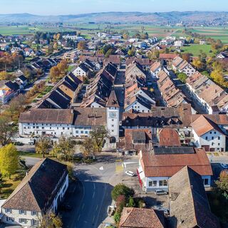
You start in Schaffhausen at the train station and follow the signs along the cycle path towards Beringen. In the middle of the village of Beringen, take a right turn to the natural swimming pool «Gwaagge Badi» – perfect for a short cooling off in summer. Then continue to the next village, Löhningen. Before entering the village, take the left turn to the Schmerlat airfield. From there, you proceed to the small town of Neunkirch. Distinctive and well-preserved buildings, a picturesque old town with charming alleys and romantic backyards give the town an incomparable charm.

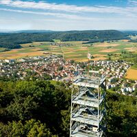
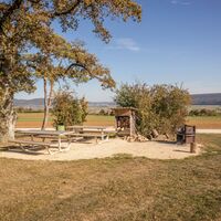
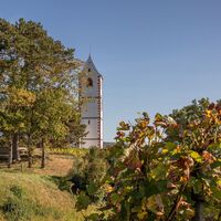
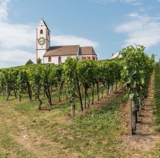
The cycle path continues to Hallau, the largest wine-growing village in the Klettgau. Now the route goes uphill, but the climb is worth it. On the way up Hallauerberg, you pass the romantically situated mountain church St. Moritz, the landmark of Hallau, and numerous vineyards. Once at the top, you can enjoy a wonderful view over the Klettgau and on clear days all the way to the majestic Alps.

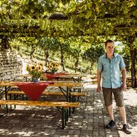
Follow the signs to Trasadingen and then to Wilchingen. Explore the picturesque small villages before continuing in the direction of Osterfingen. The wine-growing village Osterfingen lies between the Wannenberg and the Rossberg. Its history is shaped by the long tradition of viticulture. A prominent witness to this is the well-known Bergtrotte, which perches above the village in the vineyard. The venue invites you to a cosy celebration and enjoyment. Here you will discover regional delicacies and the abundance of Schaffhausen wines.

Now you cycle over the Rossberg towards Jestetten (DE). On the south slope of the Rossberg, not directly on the route but worth a detour, stands the Radegg castle ruins on a rugged promontory. When you stand on the ruins, you can see as far as Säntis and the Churfirsten. And with some luck, you may encounter the «Kätterli vo Radegg» or find his blue rose bush. The view is certainly fabulous.

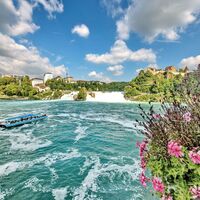
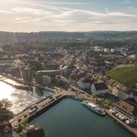
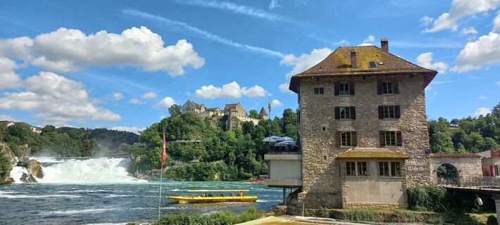
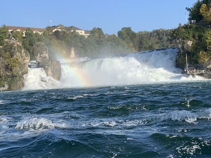
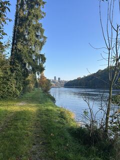
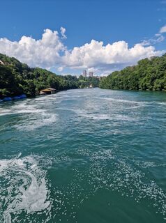
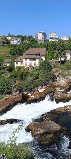
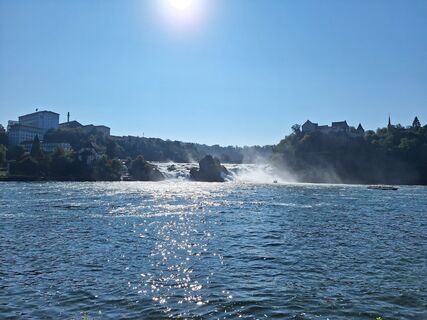
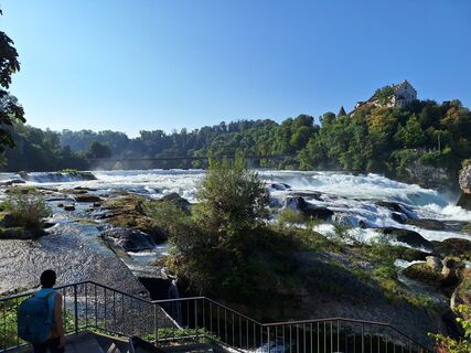
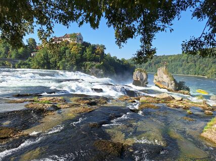
On the way from Jestetten to Neuhausen am Rheinfall, you cycle past the Celtic rampart in Altenburg from the 2nd century BC. It testifies to the Celtic history of the area. In Neuhausen you pass by the Rhine Falls – you might even feel the spray on your skin. Then continue along the Rhine back to Schaffhausen. Enjoy the northernmost city of Switzerland with its 171 bay windows and if you like, climb the impressive Munot.

Geologische hoogtepunten

Ja

Uitrusting

Roadworthy bicycle, bike helmet, drinks and snacks for in between.

Veiligheidsinstructies

You ride on cycle paths, gravel roads and streets – a bike helmet is therefore recommended.

Aankomst informatie
Aankomst

Starting point: Schaffhausen train station

Route planner

Openbaar vervoer

Starting point: Schaffhausen train station

Stop: Schaffhausen train station

sbb.ch

Parkeren

Near Schaffhausen train station there are several parking garages.

Aanvullende informatie & tips
Moeilijkheidsgraad

3

Aanvullende informatie

Order the route map or download it directly at: https://www.natourpark.ch/tour/chlaeggi-route/ 

schaffhauserland.ch 

Tips

Taste the wines from the Schaffhauser Blauburgunderland.

Download route map at: https://www.natourpark.ch/tour/chlaeggi-route/  

Nog geen beoordelingen
Schrijf een review

Beoordelingen helpen andere gebruikers bij het kiezen van hun volgende avontuur. Beoordeel alleen de tour, niet het weer of je tussendoortje.

Selecteer een van de sterren om de tour te beoordelen
Slechte tour
Zwakke tour
Middelmatige tour
Goede rondleiding
Uitstekende rondleiding
bergfex logo Inzicht krijgen Altijd live op locatie met meer dan 9.500 webcams. bergfex Als Pro-gebruiker kun je nu de bijbehorende webcams voor veel tours zien in de tours-app van. Zo kun je de actuele omstandigheden direct bekijken.
Wandelen en spoorzoeken

Wandelen en spoorzoeken

Wandelen en spoorzoeken
Meer dan 550.000 suggesties voor tochten, gedetailleerde kaarten en een intuïtieve routeplanner maken de app een must-have voor alle natuurliefhebbers.
Wandelen en spoorzoeken