


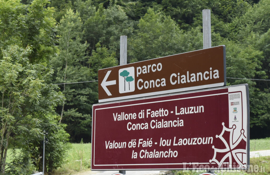
PERRERO The Lakes of Conca Cialancia


From the valley floor (Perrero) you enter the Faetto Valley to face a long climb of about 20 km, with a slope that is always steady but never prohibitive. Once you reach Lake Lauson (2,030 m) you can catch...
From the valley floor (Perrero) you enter the Faetto Valley to face a long climb of about 20 km, with a slope that is always steady but never prohibitive. Once you reach Lake Lauson (2,030 m) you can catch your breath, admiring the magnificent panorama of the surrounding Alps.
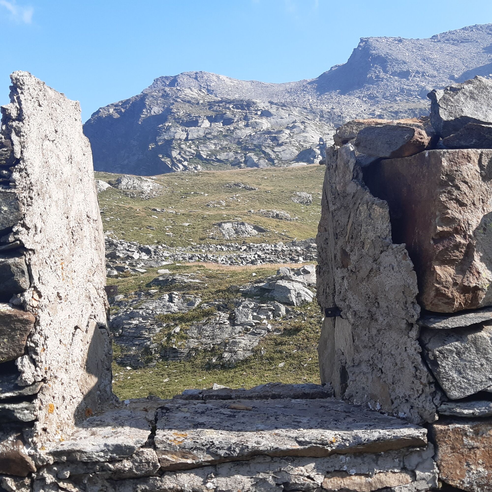
The route now runs inside the Provincial Natural Park of Conca Cialancia: describing a very long traverse you reach the end of the road (closed to cars), in Conca Cialancia (2,451 m) surrounded by two beautiful small lakes, where there are also some ruins of old military shelters dating back to the early 20th century.
For better trained and “daredevil” cyclists, it is possible to take a variant that allows you to make a loop: from the lakes climb the challenging trail that reaches Passo della Cialancia (2,683 m). From here you go to the Prali side: after descending to Lake Ramella, continue to Bric Rond. Now follow a long traverse on false flat culminating at Colle della Balma (2,315 m). Via a trail descend to Alpe della Balma and then, on a forest road, return to Lake Lauson.

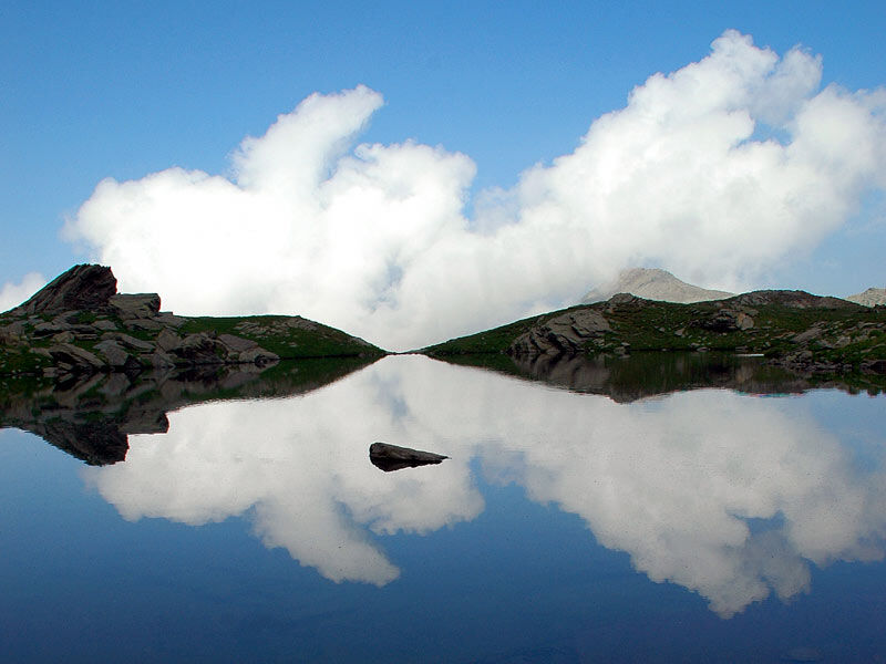
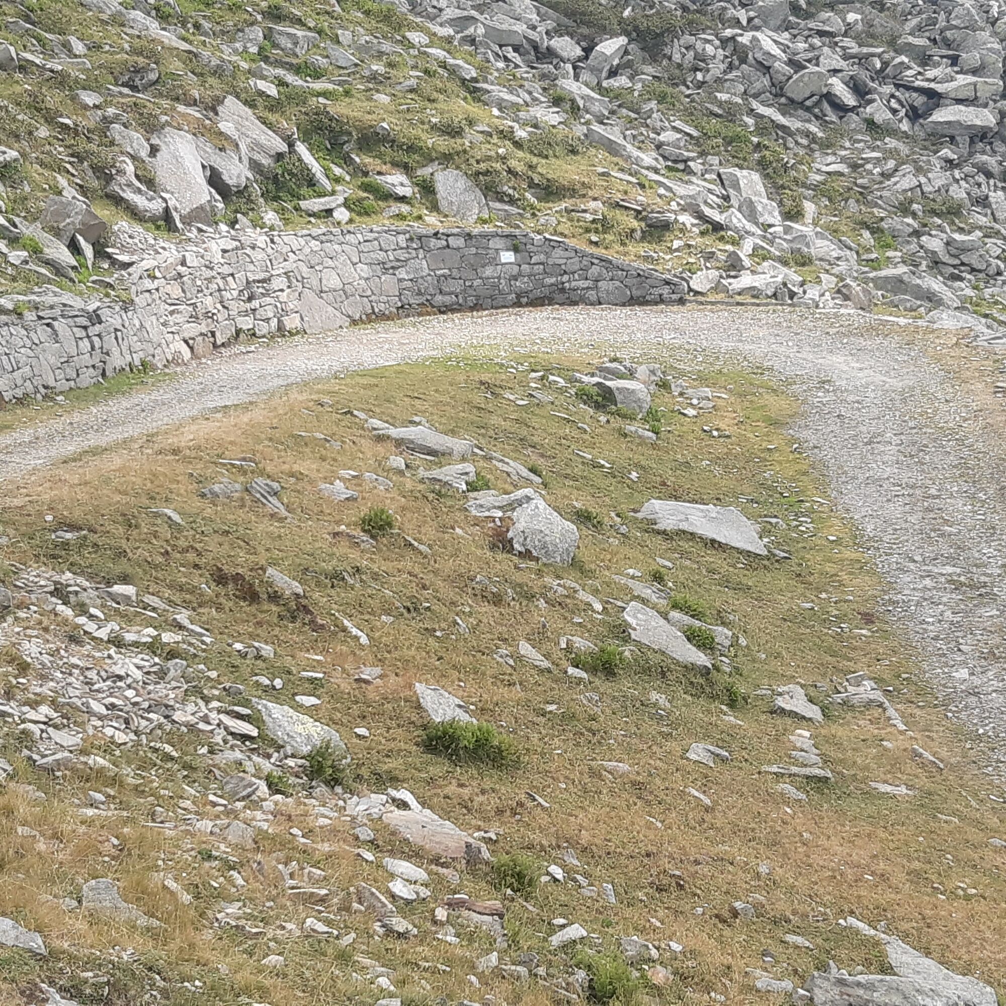
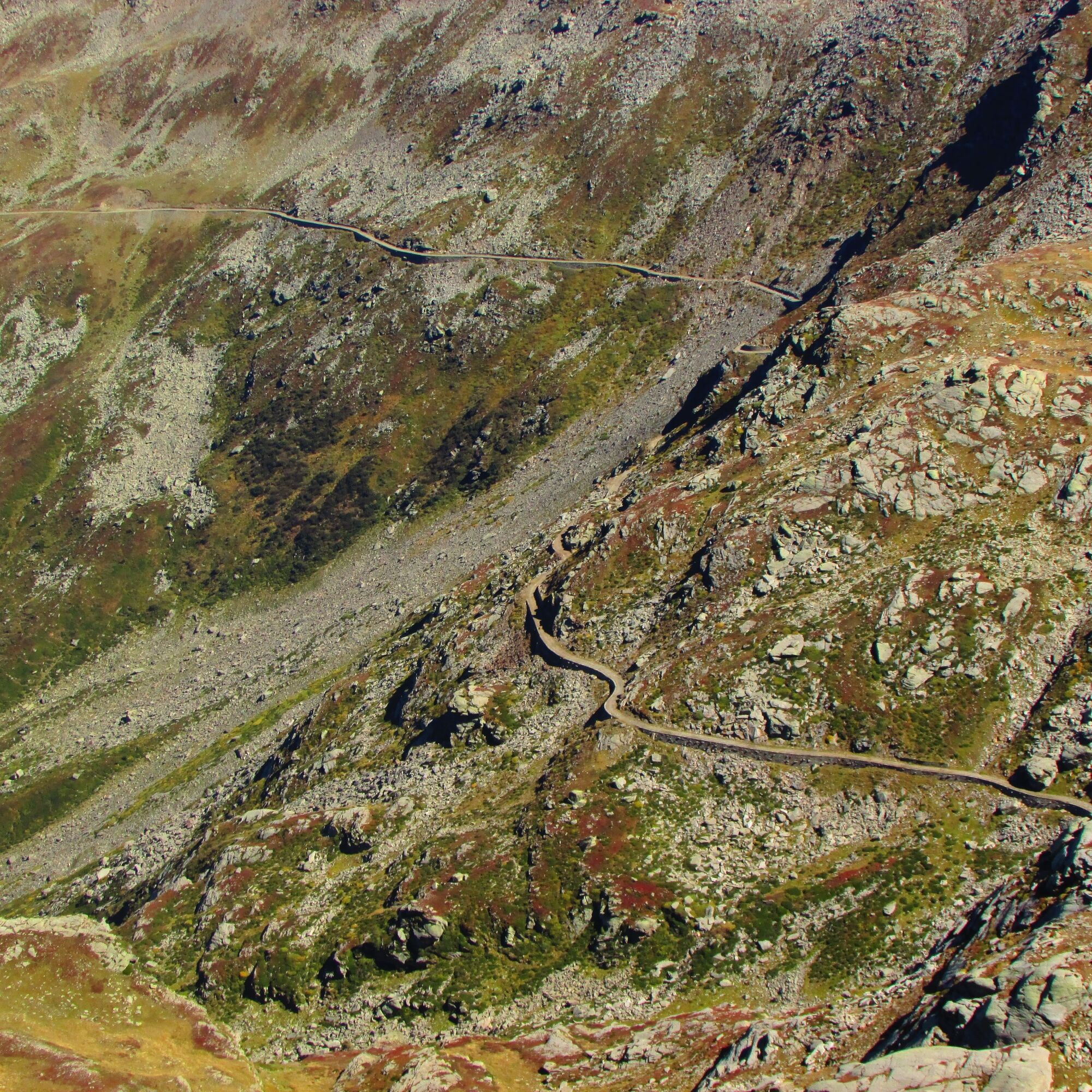
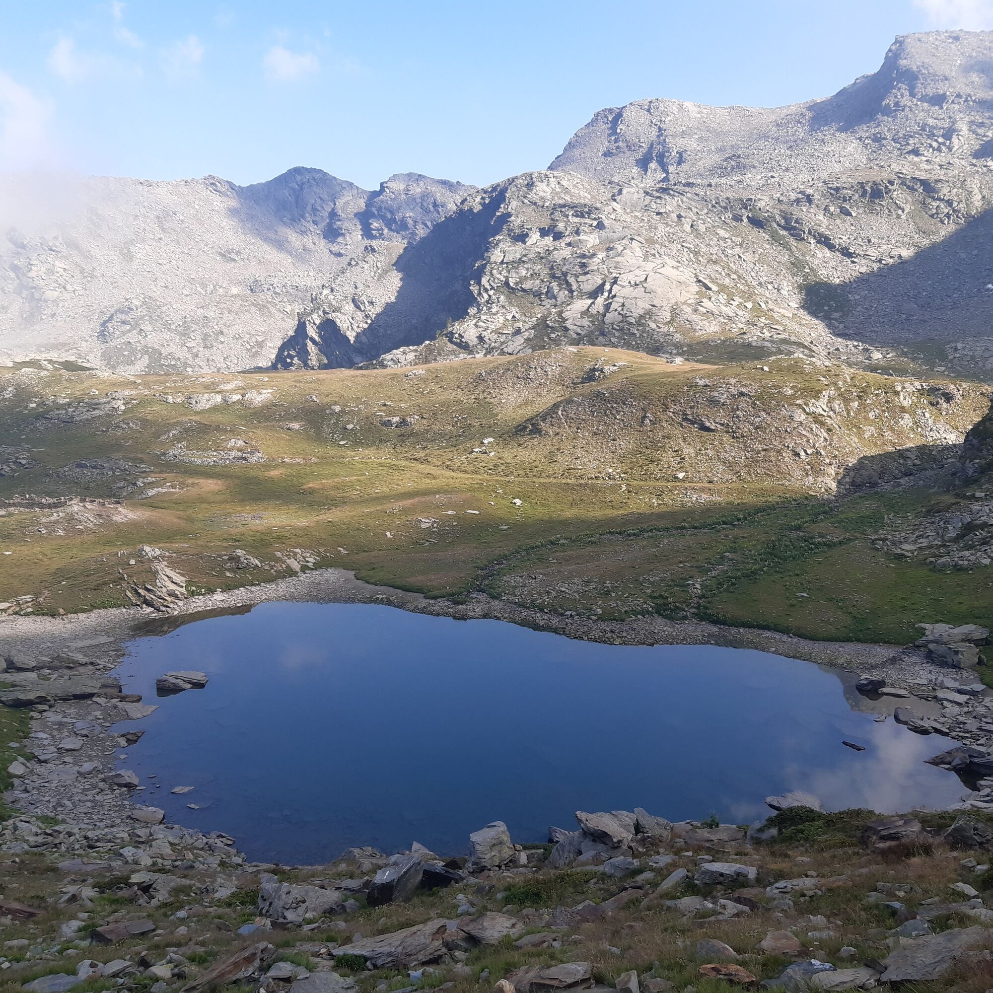
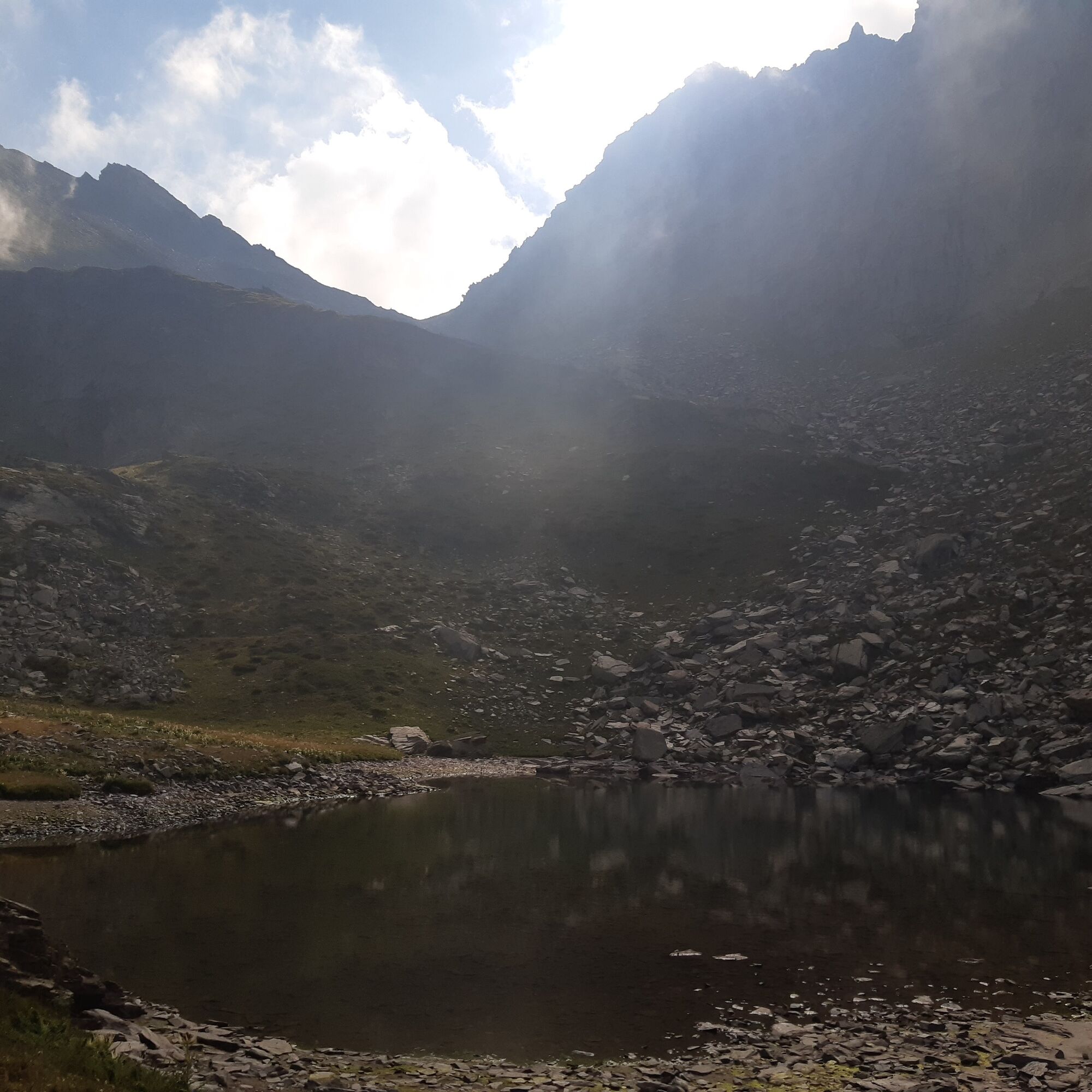
From the center of Perrero, we descend along the provincial road and turn right onto the Faetto Valley. We face a very long climb of about 20 km, with a slope that is always steady but never prohibitive; it is an old military road built during the fascist period. The first 4 km are paved, preceding the remaining part, which is completely unpaved. Once we reach Lake Lauson (2,030 m), you can catch your breath while admiring a magnificent view of the surrounding Alps. The route, which now runs inside the Provincial Natural Park of Conca Cialancia, describes wide diagonals in a wild environment over 2000 m altitude. The ground conditions are slightly worse than in the first part, but the unpaved road is still rideable, albeit with more effort. Describing a final very long traverse, you reach the end of the road in Conca Cialancia (2,451 m), surrounded by two beautiful small lakes.
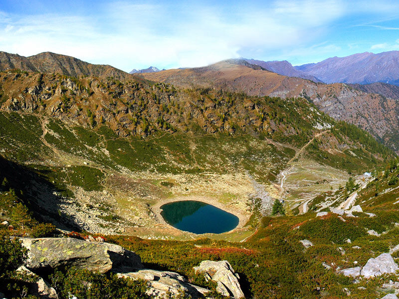
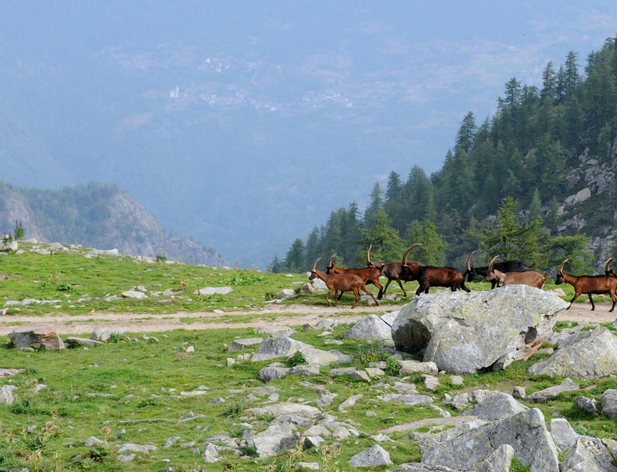
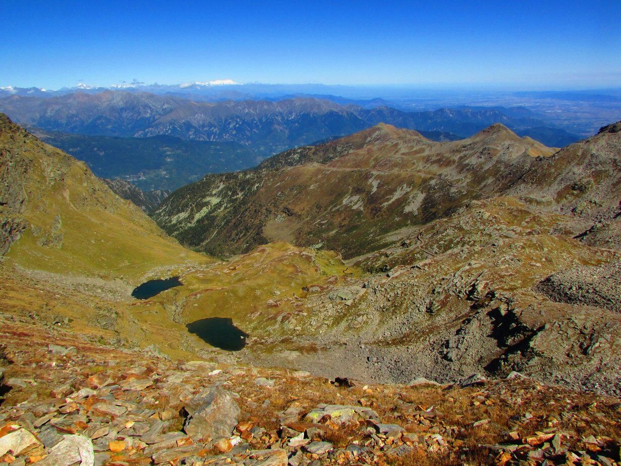
Now, thanks to recent work carried out by the Unione Montana Valli Chisone e Germanasca, we tackle a challenging stretch of trail that climbs to the evident notch of Passo di Cialancia (2,683 m). From here you go to the opposite side, in the Conca dei Tredici Laghi; after descending to Lake Ramella (also called Lake dei Cannoni), you continue on a stony mule track until Bric Rond, the arrival point of the Tredici Laghi chairlift on the Prali side. Now we face one of the panoramic high-altitude routes worth all the effort we made to get here: we follow a beautiful mule track, almost completely rideable, with some initial exposed and winding sections, which leads first to the foot of Lake Envie and then on a long false-flat traverse at 2300 m that culminates at Colle della Balma (2,315 m), near the ruins of a barracks located on the slopes of Rocca Bianca.
At this point, you cross the ridge again, returning to the Faetto Valley: via a trail you descend to the lower Alpe della Balma (1,985 m) and then on a forest road you reach Lake Lauson, from where you resume the road that returns to the valley floor.
Ja
Appropriate clothing and equipment are recommended.
Before undertaking any excursion, it is advisable to check weather reports or ask for information at local Tourist Offices.
It is good practice not to go on an excursion alone, always inform someone of your destination.
Do not throw waste into the environment but carry it with you, collecting any left by others.
The indicated travel times are approximate and may vary depending on weather conditions, your abilities, and the type of bike used.
From Turin take the highway to Pinerolo, then continue towards Val Chisone. Upon reaching the village of Perosa Argentina, turn left following provincial road no. 169 until Perrero.
In the center of the village there are several free parking lots. You can also leave the car in the parking lot just above the bridge for the Faetto Valley.
Along the route it is possible to see the remains of numerous fortifications from different eras; for more information visit the following pages of the Fortified Works Atlas website: The Thirteen Lakes and Conca Cialancia
It is possible to reduce the overall elevation gain of the route by driving up to the Roccia-Linsard junction (1,150 m), where the paved road ends.
Populaire rondleidingen in de buurt
-
5,0
BOBBIO PELLICE Upslowtour - Ring 2 of the refuges
zwaarFietsen 37,6 km -
The Fort Roads - stage 11 from Massello to Prali
zwaarPelgrimspad 13,7 km -
PRALI Rocca Bianca Loop
zwaarMountainbike 17,9 km -
TORRE PELLICE Hike to Bars d'la tajola (and Monte Castlus)
mediumWandelen 4,40 km -
VILLAR PELLICE Inverso path
lichtWandelen 5,62 km -
PRAROSTINO From Piani to Sonagliette and back - SLOWLY TOGETHER
lichtWandelen 6,60 km -
Le Strade dei Forti - stage 6 from Perosa Argentina to Fenestrelle
mediumPelgrimspad 19,4 km -
PINEROLO Trail "Ecomuseum of the Charcoal Piles"
lichtWandelen 7,46 km -
PINASCA Grandubbione Ring
mediumFietsen 28,8 km -
PRALI Thirteen Lakes - Colle Giulian - Villanova
mediumMountainbike 19,0 km
Wandelen en spoorzoeken


Mis geen aanbiedingen en inspiratie voor je volgende vakantie
Uw e-mailadres is toegevoegd aan de mailinglijst.