


Lou Viage: Tappa 8 Rifugio della Gardetta - Villaggio Primavera


The eighth stage of Lou Viage starts from the Rifugio della Gardetta towards Villaggio Primavera along the military road that crosses the Passo della Gardetta. From here, the road is abandoned to follow...
The eighth stage of Lou Viage starts from the Rifugio della Gardetta towards Villaggio Primavera along the military road that crosses the Passo della Gardetta. From here, the road is abandoned to follow the GTA route, which coincides with the Occitan Routes of the Valle Maira, towards the northwest. After passing the Valle di Unerzio and the bunkers of Prato Ciorliero, continue on a path that leads to the Passo dell’Escalon and the Colle della Scaletta, until reaching the splendid lakes of Roburent. Crossing Rio Roburent and heading towards a mountain hut, you reach the excellent viewpoint of Tinetta. and descends to Argentera. From here, descend to Argentera to Bersezio, crossing the Stura river and reaching the ski facilities up to the view of the Hotel Roburent, which represents the final stage of the route at 1,624 meters above sea level.

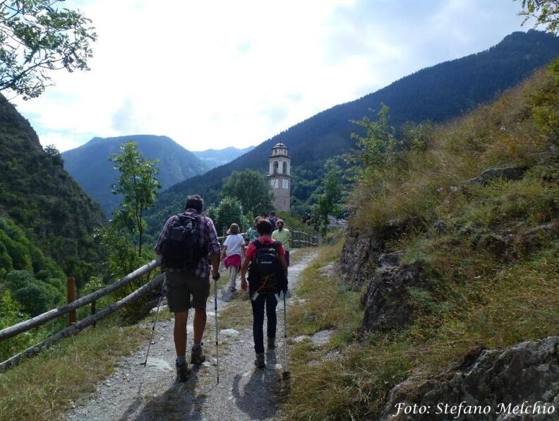
From Rifugio della Gardetta, proceed on the military road towards the West and shortly reach Passo della Gardetta. Here, the military road is abandoned to turn right and follow the GTA route, which in this stretch coincides with the Occitan Routes of Valle Maira, towards the Northwest. You pass the lateral valley of Unerzio and reach the bunkers of Prato Ciorliero (1,955 m). Here you encounter a dirt road on the right. Shortly, you reach a fork where you leave the GTA to continue left. After a stretch, the path turns towards the West and ascends towards Passo dell’Escalon. You proceed for a fairly long stretch towards the Northwest and then ascend south towards Colle della Scaletta (2,641 m). A few meters before the shore of the lake, you encounter the P41 trail, which must be followed to the left. You proceed southeast, parallel to the Eastern shore of the upper lake of Roburent (2,462 m), leaving the lake behind and soon reaching the other two lakes of Roburent (2,360 m and 2,330 m). You pass near the Western shore of the lakes and shortly after the trail turns west. You cross Rio Roburent and, heading towards a mountain hut (P41), begin to climb towards the panoramic point of Tinetta. From here, in a steep descent, you reach Argentera (1,684 m). From Argentera, descend for about 300 meters on SS 21 until you encounter a small road on the right, which, after crossing the Stura river, turns sharply to the left and, continuing parallel to the watercourse, reaches the ski facilities of Bersezio. You cross the river again and, after a short stretch of SS 21, enter Bersezio. Here, at the level of the mill, turn right and, crossing the Stura on a wooden bridge, continue almost flat until entering a forest through which a trail leads to the upper houses of Villaggio Primavera and from there on asphalt to the Hotel Roburent, the stopover point (1,624 m).
Ja
Populaire rondleidingen in de buurt
-
5,0
eVélo MNCA stage 2: St-Dalmas-Le-Selvage - St-Etienne-de-Tinée
mediumMountainbike 43,2 km -
5,0
Chiappera- Spaziergang
lichtWandelen 8,39 km -
Gardetta Bike Emotions
mediumMountainbike 13,5 km -
Les lacs de vens
mediumWandelen 18,9 km -
Acceglio, bric boscasso
mediumToerskitocht 12,1 km -
Anello Intersile lago tempesta punta piovosa
mediumWandelen 17,9 km -
4,5
Col de Larche - Lac du Lauzanier, France
lichtWandelen 13,7 km -
FFC cycling route No. 34: the Bonette via the Moutière
zwaarRacefiets 51,0 km -
5,0
Goldtoni - Alpenbogen A109 Sambuco-Ruata Valle (Stroppo)
mediumlangeafstandswandelpad 36,8 km -
5,0
Goldtoni - Alpenbogen A108 Strepeis-Sambuco
mediumlangeafstandswandelpad 16,1 km
Wandelen en spoorzoeken


Mis geen aanbiedingen en inspiratie voor je volgende vakantie
Uw e-mailadres is toegevoegd aan de mailinglijst.