


San Giacomo di Entracque - Valdieri / Pagarine Route (stage 8)


The wool trade has always been important in Entracque. In the middle of the 19th century, the village had fifty factories which employed 300 workers and produced some 3,000 curtains and fabrics per year.
...The wool trade has always been important in Entracque. In the middle of the 19th century, the village had fifty factories which employed 300 workers and produced some 3,000 curtains and fabrics per year.
Not to be missed on this stage:
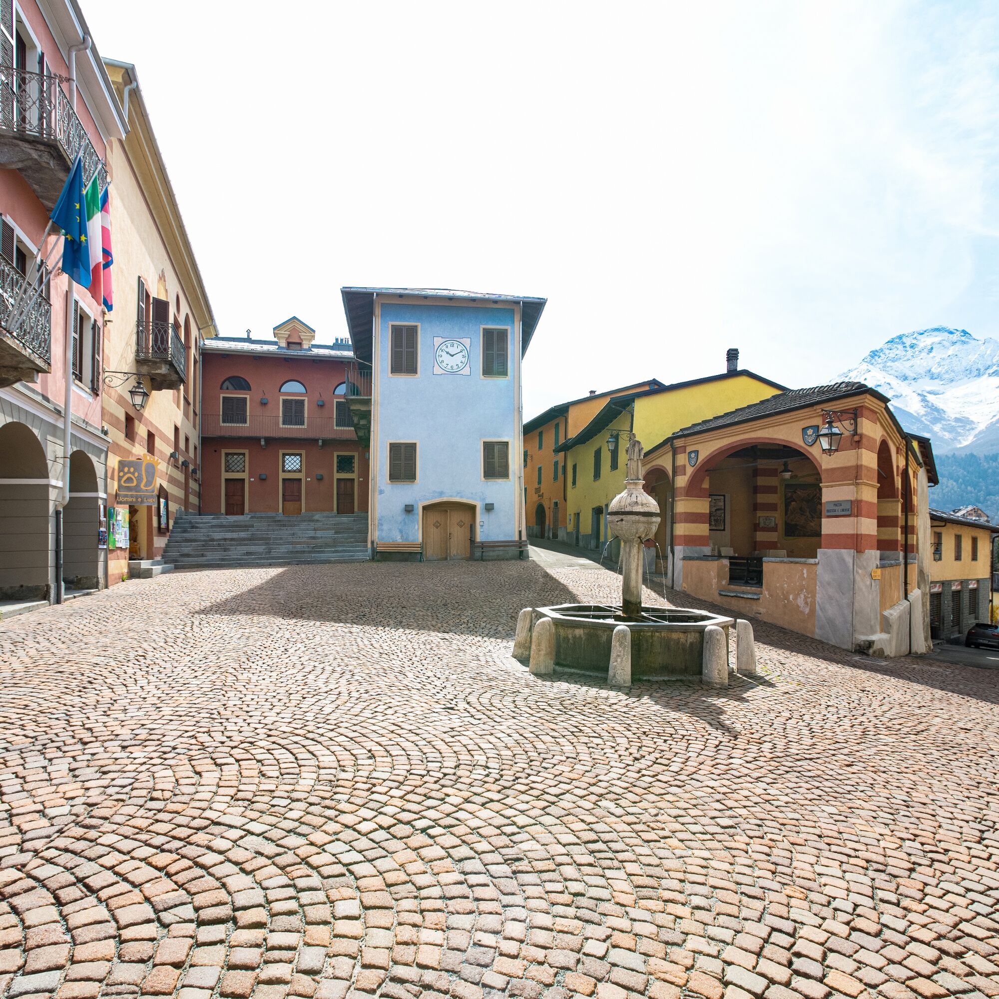
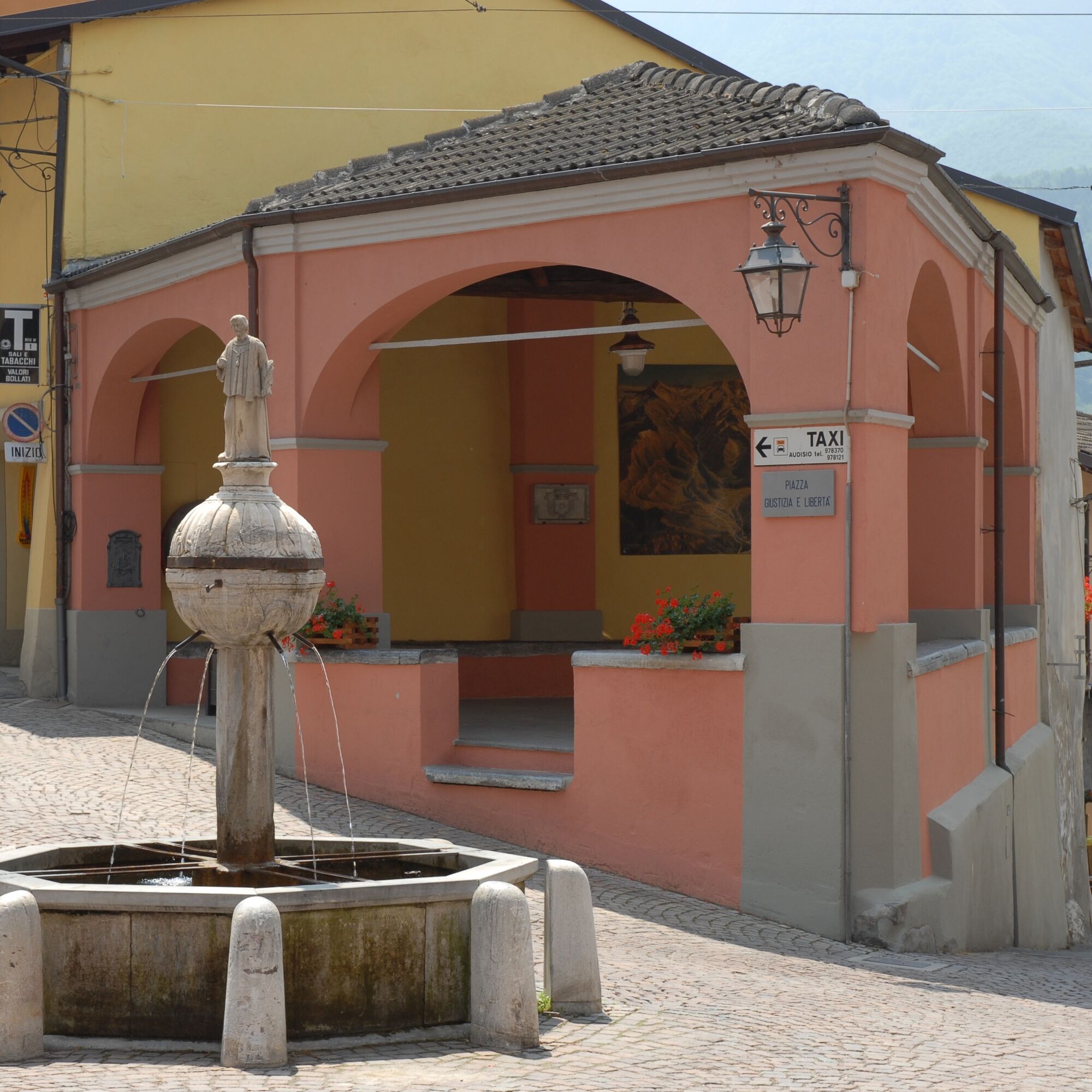
The fountains of Entracque Centre uomini e lupi Exhibition on climate change
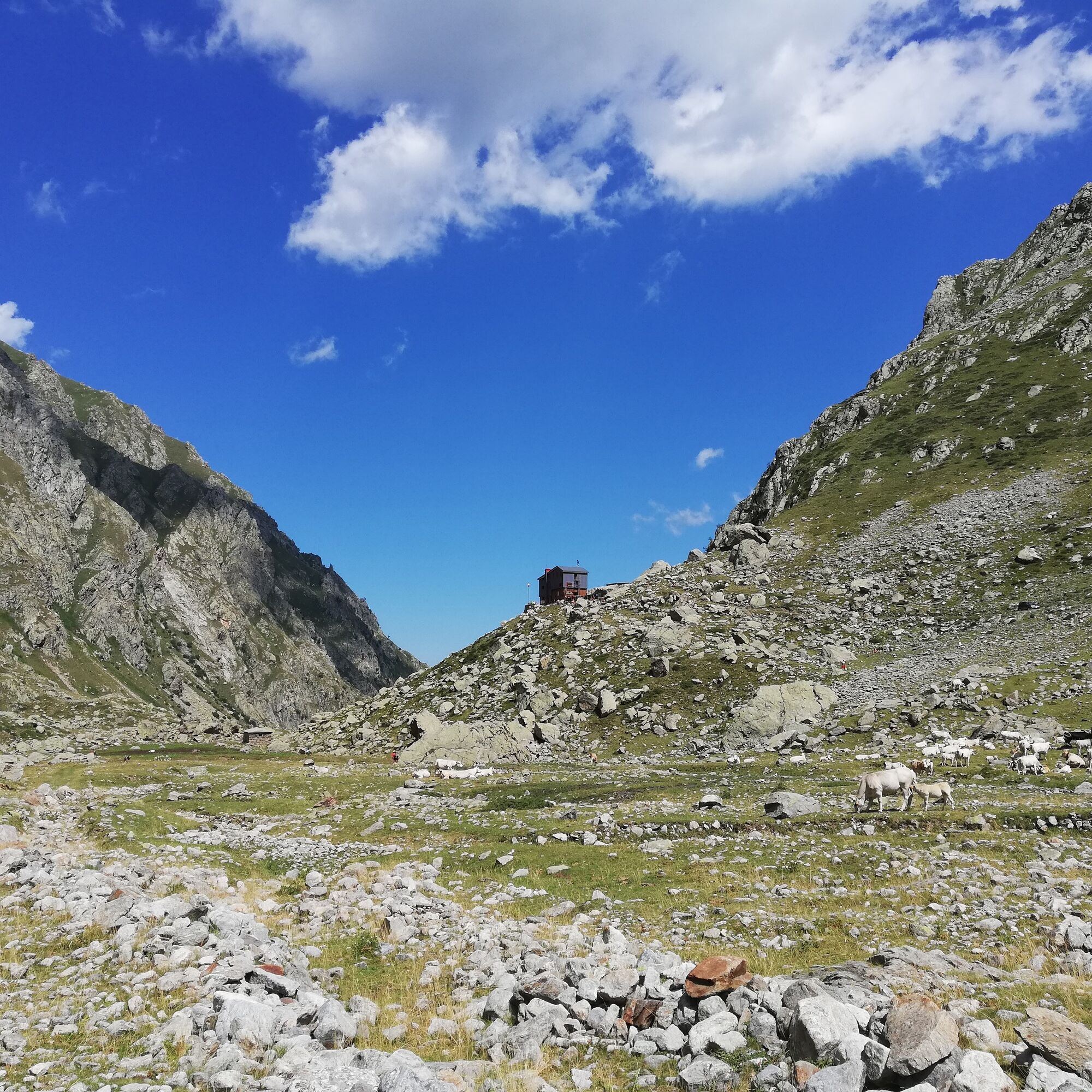
Alpi Marittime Natural Park
Archaeological park
Eco-museum of rye
Parlate d’Entracque
Follow the signs on the posts with the pink "Route du sel" logo.
Ja
Ja
Suitable walking shoes are strongly recommended
Bring water, a cap, provisions and warm, waterproof clothing.
Flashlight or headlamp if you're going through a tunnel, or to avoid being caught out by nightfall
A first-aid kit
Before you go:
Check the local weather before you go
Inform a loved one of your purpose of walk and your departure time
Check that the length, elevation of the route and travel time correspond to your level of practice before committing yourself and do not overestimate your abilities
During your hike :
Take the marked paths and respect the direction of the routes
The trails are shared: mountain bikers, riders and hunters can take your route
You may encounter herds of grazing sheep. Guard dogs are there to protect them from any aggression. The golden rule: stop and keep your distance from the herd. Take the time to walk around it calmly.
Pay extra attention during the hunting season and find out about the ongoing hunts.
Have an eco-citizen behavior: take away your waste, be discreet so as not to frighten wild animals and do not pick flowers or wild plants, a photo is a sufficient souvenir
Respect private property, crop areas and natural spaces and close the barriers after your visit
In summer the days are hot, and the vegetation is very sensitive to the risk of fire, do not light fires, you jeopardize your safety and that of others
To alert the emergency services, dial 112
Accessible by car
Think about carpooling!
Accessible by train and bus: Train: Regionale Veloce - Regionale Veloce (RV) - https://rail.cc/fr/type-de-train/regionale-veloce/168, change à Borgo S. Dalmazzo Then bus: Autolinee Nuova Benese - https://www.benese.it/linee_urbane.php, from Borgo S. Dalmazzo à Valdieri Possibility to use the paying shuttle service offered by the Parco Alpi Marittime from mid-June to mid-September under televisual reservation (0171 74298 from 7am to 1pm and from 2pm to 6.30pm). Allows you to reach the main railway stations and other transport. More information at https://www.parcoalpimarittime.it/visita/info-pratiche/la-navetta-del-parco For a departure from Nice, you need to take the TER to Ventimiglia and then the train and bus, more information on: https://www.sncf-connect.com/
Suitable walking shoes are highly recommended
Please bring water, a cap, provisions, waterproof and warm clothing
A flashlight or headlamp in case of a tunnel or to avoid being caught out by nightfall
A first-aid kit.
Volume 1, by Nice à Cuneo follows the footsteps of our fictional hero, Artémio, on the old Pagarin Road.
Have fun discovering the heritage linked to the salt routes in Nice by downloading the "Explore Games" application and choose the "Intrigue" puzzle game.
Populaire rondleidingen in de buurt
- 5,0
Goldtoni - Alpenbogen A105 Refuge de la Modena de Fenestre-Refugio Morelli Buzzi
mediumlangeafstandswandelpad24,8 km La Madone di Fenestre - San Giacomo di Entracque / Pagarine Route (stage 7)
mediumWandelen13,3 km- 5,0
Goldtoni - Alpenbogen A106 Refugio Morelli Buzzi-Refugio Malinvern
mediumlangeafstandswandelpad25,0 km - 5,0
AVU Alta Via dei Lupi | Stage 7 San Giacomo di Entracque - Ellena-Soria refuge
mediumWandelen6,15 km - 5,0
AVU Alta Via dei Lupi | Stage 8A Lake Brocan - Terme di Valdieri
mediumWandelen14,3 km Great Crossing of the Alps - South Piedmont
zwaarlangeafstandswandelpad249,2 kmHistoric Mountain Streets | Madonna delle Finestre Road
mediumMountainbike10,6 km- 5,0
AVU Alta Via dei Lupi | Stage 10 Franco Remondino refuge - Valdieri thermal baths
mediumWandelen9,47 km Piemonte without cars | Vernante-Limone Piemonte
zwaarlangeafstandswandelpad29,6 km- 5,0
Historic Mountain Routes | Strada del Pagari
zwaarWandelen11,3 km
Wandelen en spoorzoeken


Mis geen aanbiedingen en inspiratie voor je volgende vakantie
Uw e-mailadres is toegevoegd aan de mailinglijst.