


Puch: Rosenkranzweg from Puch to St. Jakob (No. 10/10a - TVB Puch))


The hiking trail leads from the centre of Puch to the picturesque village of St. Jakob am Thurn. There, the short circular route around the lake is recommended. Part of this route is the signposted Rosenkranzweg...
The hiking trail leads from the centre of Puch to the picturesque village of St. Jakob am Thurn. There, the short circular route around the lake is recommended. Part of this route is the signposted Rosenkranzweg (Rosary Path) with five stations. The Rosary Way shows the "Mysteries of the Joyful Rosary" on five granite stations and thematises the birth and childhood of Jesus. The motifs painted on sheet metal were created by Elisabeth Traxl from Grünbach bei Freistadt in the Mühlviertel region. By chance, they were consecrated in the Lourdes grotto on 11 February 2006. This is a special date, because it was also on 11.2.1885 that Mary first appeared to Bernadette of Lourdes.
The first station is at the beginning of the Sillergut path shortly after the turn-off from the Vollererhof road.


From the town center of Puch past Puch Parish Church (view the old Roman milestone embedded in the cemetery wall next to the main road) heading north as far as the petrol station. There, turn right into Vollererhofstraße. Along this road, underneath the autobahn bridge, then keep left. After ca. 200 Meter left, taking the lane which leads to the Sillergut. This is the start of the Rosenkranzweg.
After the first station, the path leads into a patch of forest, across a half-open bridge to the second station, where there is also a bench to rest on. From there, continue on a path through forest and fields until you see the sign for the "Rosenkranzweg", with the path now leading through the forest and across a bridge once more. Here, you will again come to the paved road running to the Sillergut and to the third station. Stay on this road, uphill to the right and past the Sillergut, now entering a forest. This stage is more steeply uphill and, after a short, straight stretch, we come to the second and final steep section of the Rosenkranzweg.
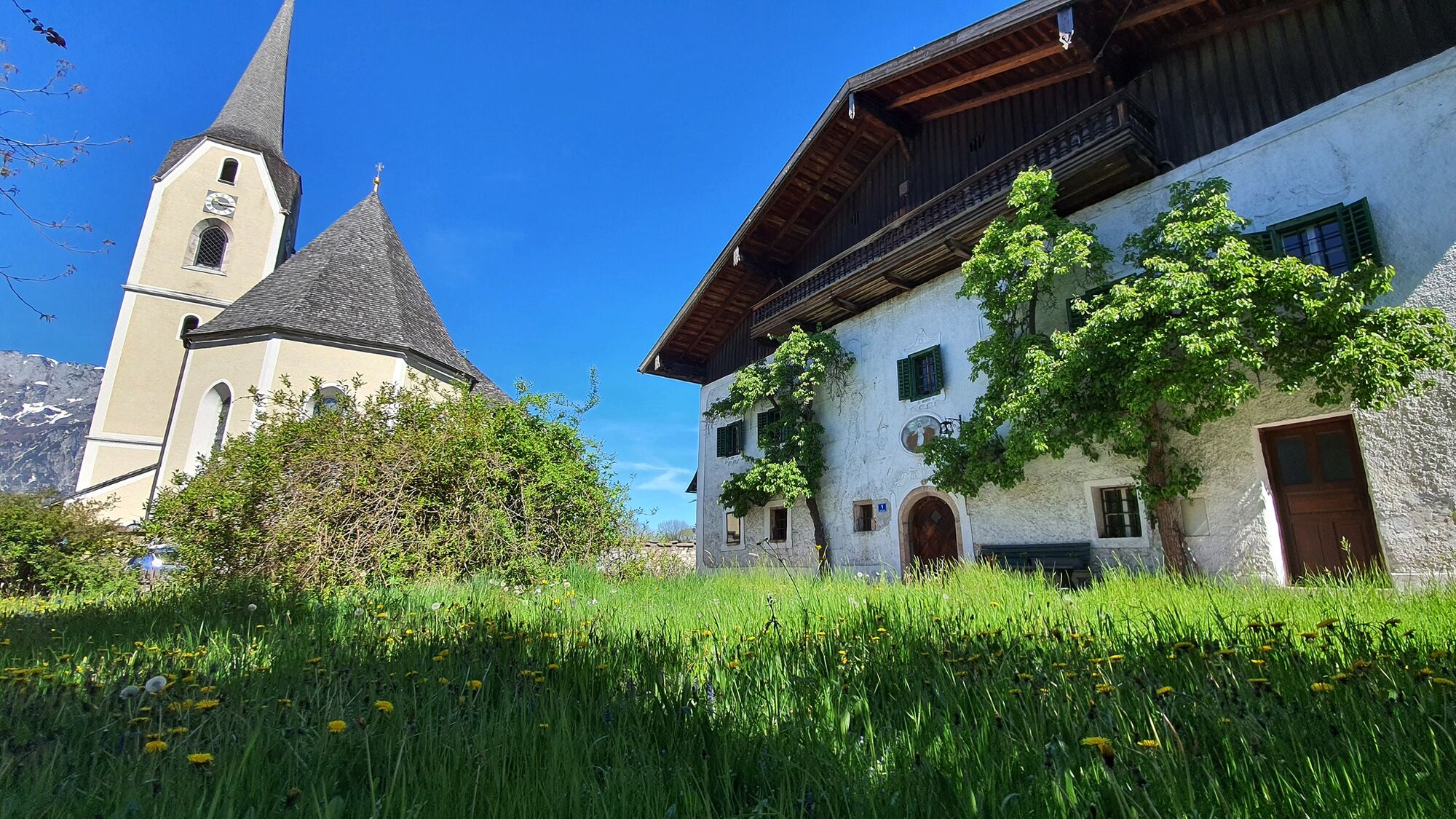
Before reaching the Risolstraße, we find the fourth station on our right next to a bench. There you will also find the stamping station for the Tennengau Hiking Pass (4 points). Immediately after this, we come to the paved road. From there, our hike is all downhill and straight ahead. After several meters, we come to the fifth and last station of the Rosenkranzweg on the right-hand side. After another 800 meters on the paved road, our destination is reached - the pilgrimage church of St. James the Greater along with the Loreto Chapel.
Here, you will be rewarded by a stroll around the small lake (No. 10a). Return to Puch along the same route or walk down the road to Haslach, where you can catch the bus.
Ja
Ja
No special equipment required!
Recommended:
Normal hiking equipment with sturdy shoes. Clothing suitable for the weather Drinking water and food if necessary
This hiking path is indicated by yellow hiking signs as week as a simple red-white-red symbol in between.
r from Vienna on the A1 autobahn or from Munich on the A9, shortly before reaching the Tennengau (Hallein) you will come to a big interchange where you will merge onto the A10 (Tauern Autobahn), continuing south. Puch/Urstein (Exit 11) is the northernmost autobahn exit in Tennengau. If you are driving in from the south on the A10 from Villach/Kärnten, also leave the Tauern Autobahn in Puch Urstein, taking Exit 11. From this exit. drive either south into Puch itself or north following signs for Salzburg City as far as St. Jakob am Thurn.
: The No. 160 coming from Salzburg City stops right outside Puch village hall. Coming from Hallein, get off either at the stop in front of Bäckerei Pföss (across from the fire station) or, after the village hall, opposite the parish church.
By train: Puch has 2 stops on the suburban railway (S-Bahn). One is close to the town center and one is at the Salzburg University of Applied Sciences in Puch Urstein. Both offer free parking.
Public parking in the center of Puch (next to the village hall) or at the sports field in St. Jakob am Thurn.
Several places to stop in Puch and St. Jakob am Thurn: see www.puch-salzburg.com
The Seerundweg in St. Jakob is highly recommended.
In May there is always a parish procession followed by May devotions in the Loretto Chapel.
Populaire rondleidingen in de buurt
- 4,2
Idyllische Hintersee-Runde
lichtWandelen5,10 km - 4,4
Von Koppl auf die Gaisbergspitze
mediumWandelen4,93 km - 4,7
Reitsteig - Dopplersteig Runde_Untersberg
mediumHigh rope9,89 km - 3,7
Durch die Almbachklamm nach Ettenberg
Wandelen7,54 km - 4,2
Hike to the Kleiner Barmstein via the Thürndl ruin
mediumWandelen4,20 km - 4,8
Schlenken and Schmittenstein hike
zwaarWandelen10,9 km - 5,0
Untersberg (Salzburger Hochthron)
mediumWandelen11,8 km - 4,0
From Latschenwirt over Tannenwinkel to Wolfschwang
lichtWandelen5,55 km - 4,6
Untersberg Bahn - Salzburger Hochthron - Berchstendgadener Hochthron
mediumWandelen11,2 km - 3,8
From Kaltenhausen to the Großer Barmstein (10 points)
mediumWandelen4,26 km
Wandelen en spoorzoeken


Mis geen aanbiedingen en inspiratie voor je volgende vakantie
Uw e-mailadres is toegevoegd aan de mailinglijst.