


Climbing area Höhenburg


Foto's van onze gebruikers
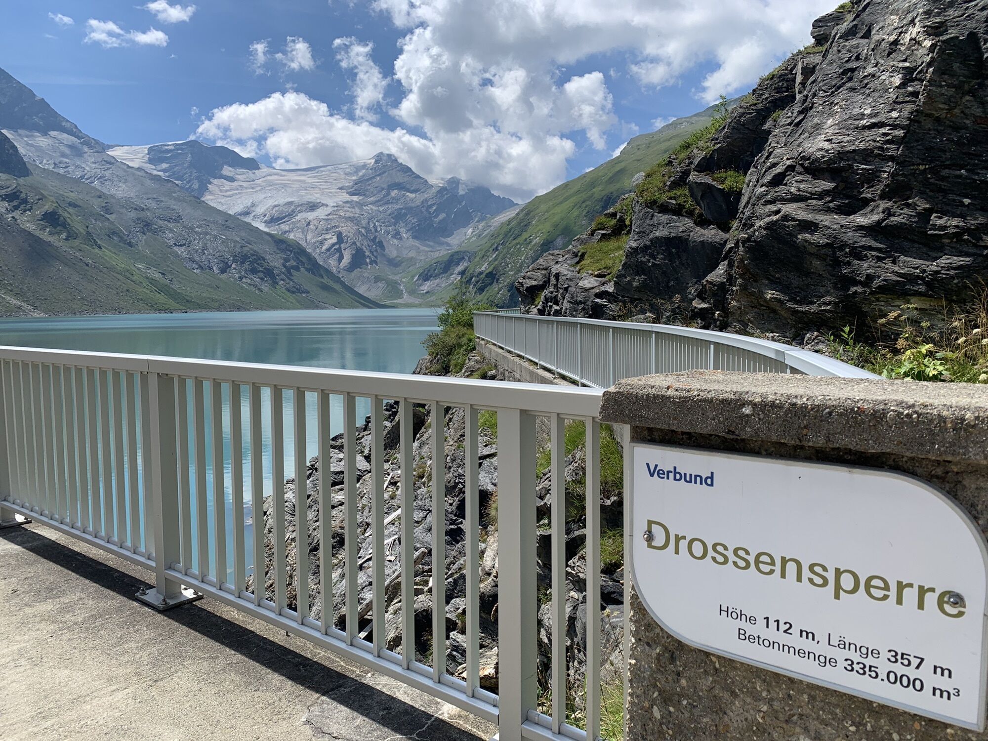
With the ‘Mooser-Mandl’, the ‘Drossen-Hex’ and the ‘Limberg-Zwerg’, three varied via ferrata routes await you at the Höhenburg, between Drossen and Moosersperre. The ‘Limberg-Zwerg’ in particular incorporates...
With the ‘Mooser-Mandl’, the ‘Drossen-Hex’ and the ‘Limberg-Zwerg’, three varied via ferrata routes await you at the Höhenburg, between Drossen and Moosersperre. The ‘Limberg-Zwerg’ in particular incorporates the historic iron ladder of the former high mountain school and offers an exciting C-level key section with the ‘Zwergenleiter’ (dwarf ladder). All routes end at the summit of the Höhenburg – the descent is relaxed via the Höhenburg hiking trail.
Mooser Mandl: Climb length: 110 metres · Duration: 30 minutes · Difficulty: C
Drossen Hex: Climb length: 100 metres · Duration: 30 minutes · Difficulty: E
Limberg Zwerg: Climb length: 50 metres · Duration: 15 minutes · Difficulty: B/C
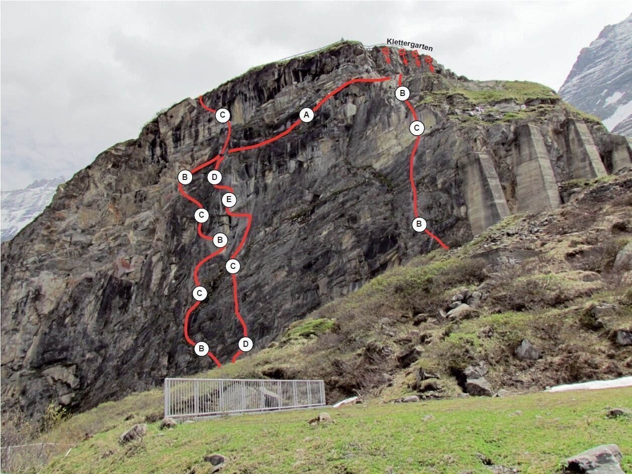
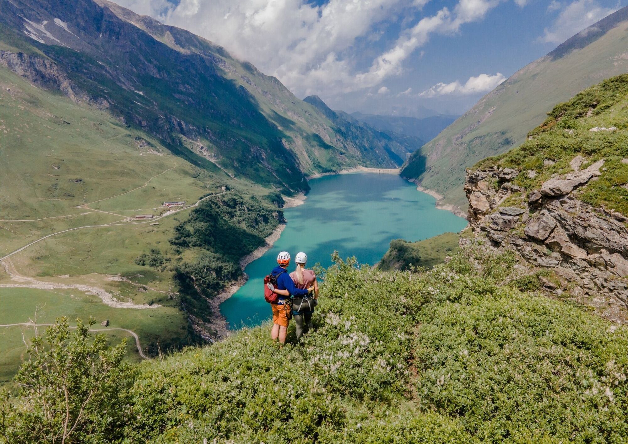
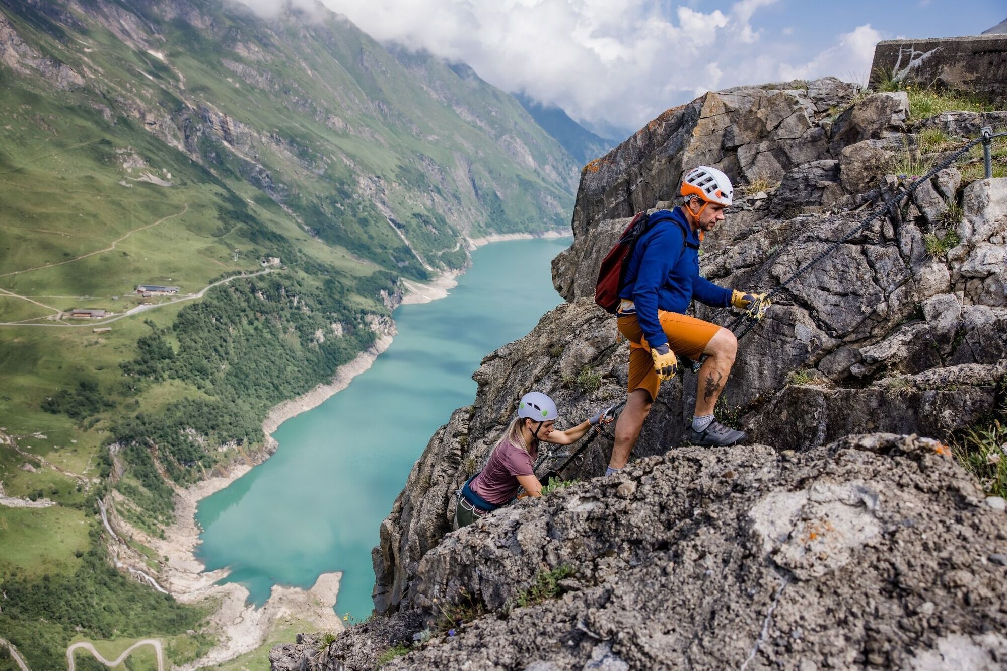
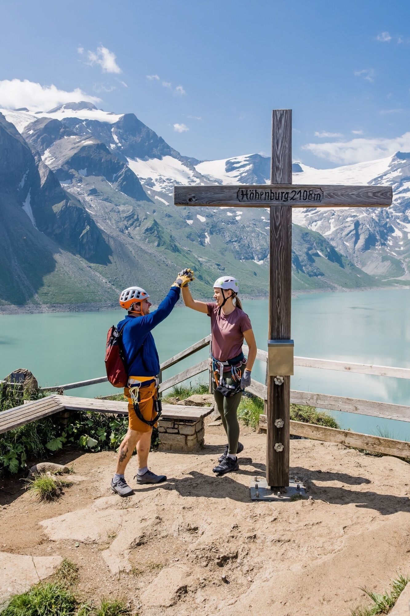
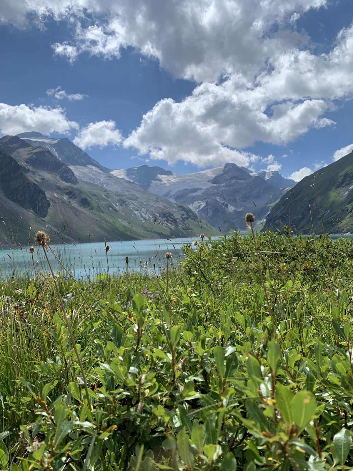
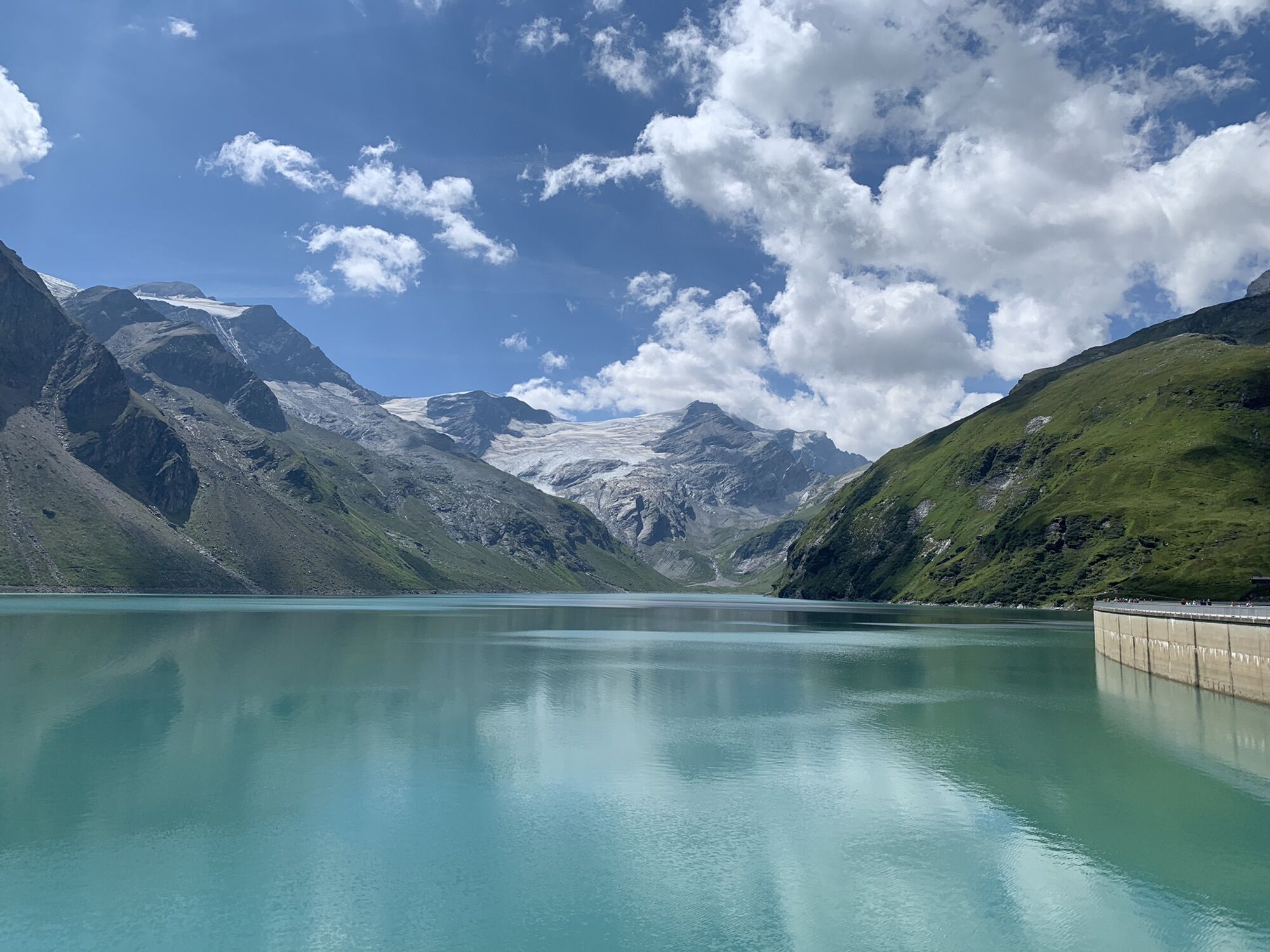
All three routes end at the summit of the Höhenburg, which towers up between the Drossen and Mooser dams.
Via ferrata equipment can be rented there daily during opening hours on the Besecamp MOBO107.
to Kaprun - Kesselfall
Special transfer buses take you in comfort from the Kesselfall ticket office to the Mooserboden reservoir at an elevation of 2,040 metres above sea level.
Free parking house Kesselfall
Please keep an eye on the weather: in the high mountains, the weather can change very quickly.
Populaire rondleidingen in de buurt
- 3,9
Glacier Route to the Pasterze with Gamsgrubenweg (up to Tunnel 6)
mediumWandelen8,05 km - 4,7
Geotrail Tauernfenster
lichtWandelen5,90 km - 5,0
Kaiser-Franz-Josefs-Höhe zur Oberwalderhütte
zwaarWandelen5,52 km - 4,5
Sigmund Thun Klamm
lichtWandelen3,10 km - 4,9
Glockner
mediumHigh rope19 km - 4,8
Glockner Alpincenter - Salmhütte - Hohenwartkees
mediumWandelen8,64 km - 4,5
1 Großglockner Normalweg von der Stüdlhütte (Tirol & Kärnten)
zwaarHigh rope8,17 km - 4,7
Fusch: Gleiwitzer Hütte
zwaarWandelen8,26 km - 4,6
3 Oktober Fusch Walcher Grung und Hohalm
mediumWandelen8,57 km - 4,8
Sigmund Thun Klamm, Klammsee, Bürgkogel
lichtWandelen4,56 km
Wandelen en spoorzoeken


Mis geen aanbiedingen en inspiratie voor je volgende vakantie
Uw e-mailadres is toegevoegd aan de mailinglijst.