


Ötztal Trek Stage 10
Moeilijkheidsgraad: T4


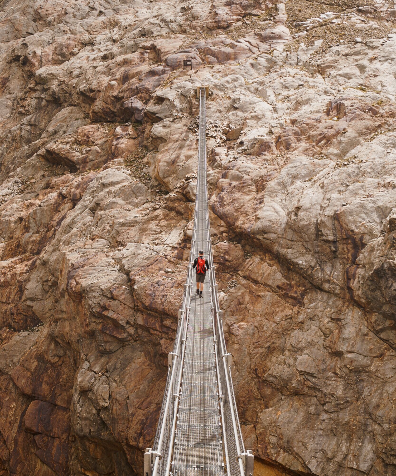
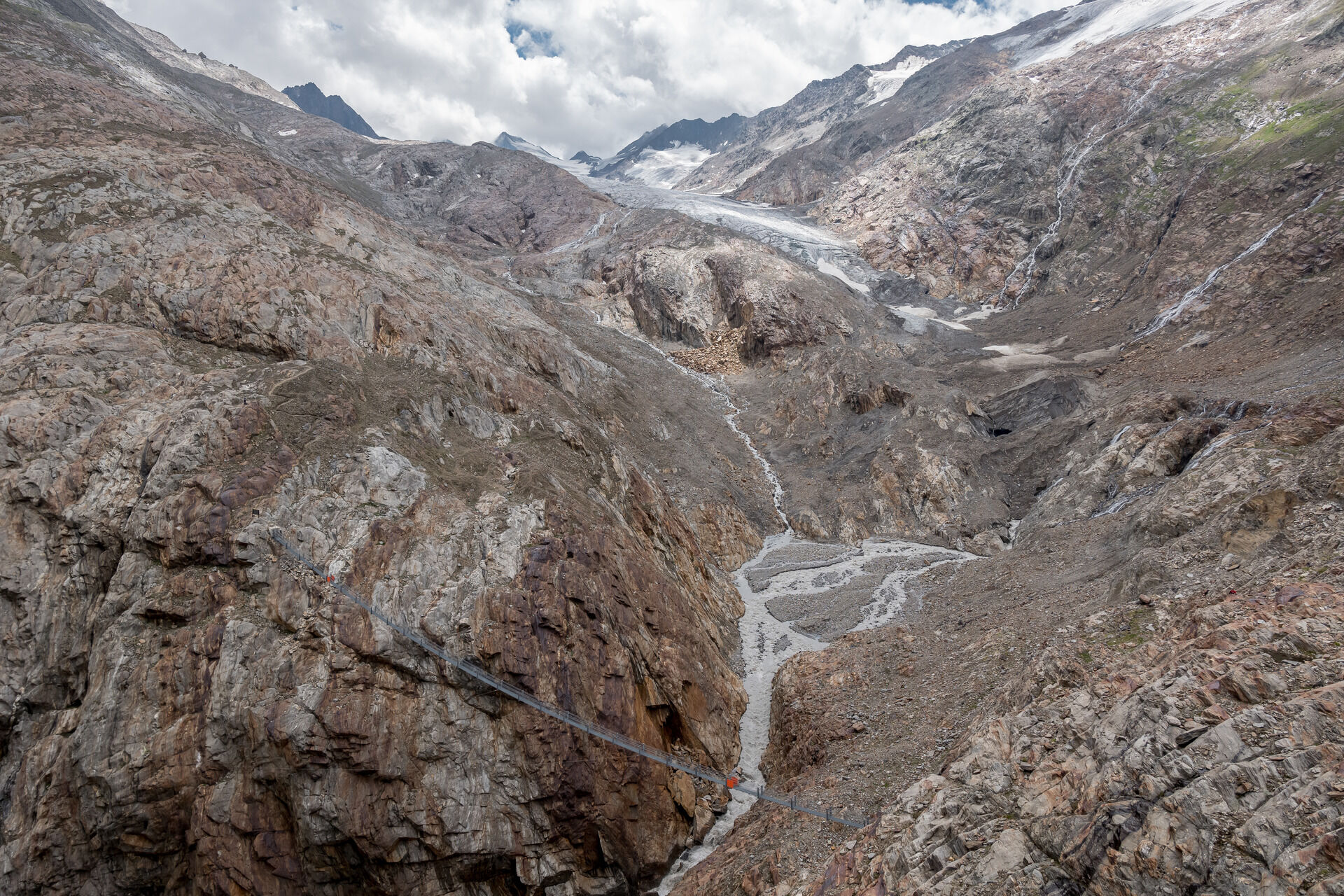
Route: access road, cart track, trail, path Requirements: sure-footedness, no fear of heights, fitness, stamina Alpine trail red Difficulties: easy crossing of the glacier tongue of the Gurgler Ferner...
Route: access road, cart track, trail, path
Requirements: sure-footedness, no fear of heights, fitness, stamina
Alpine trail red
Difficulties: easy crossing of the glacier tongue of the Gurgler Ferner via the Piccard suspension bridge
Equipment: normal hiking gear
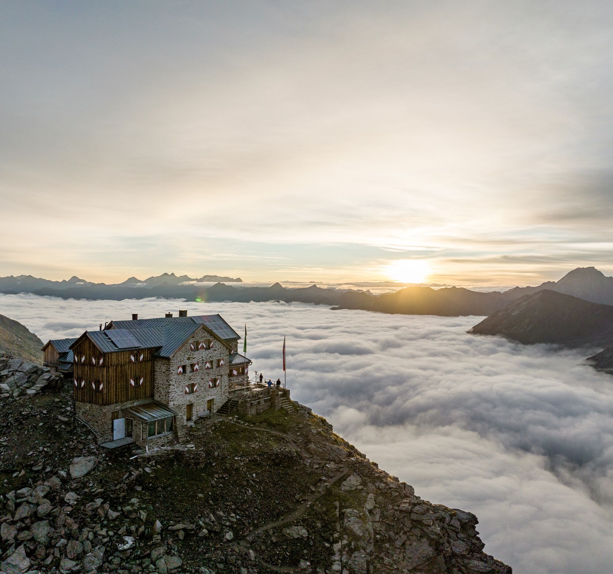
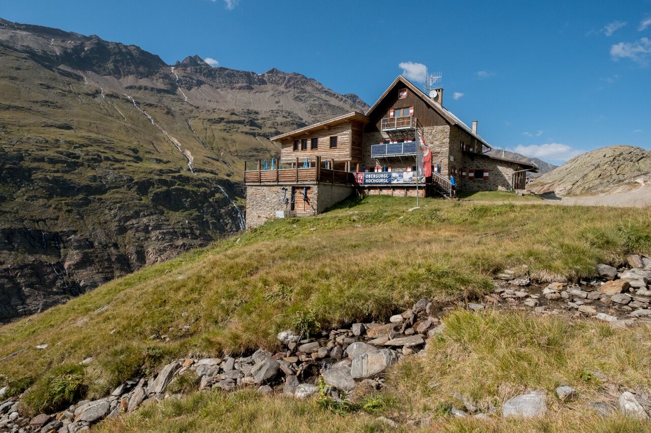
Overnight stays, food stops: Zirben Alm (no overnight stay), Schönwies Hut (no overnight stay), Langtalereck Hut, Ramolhaus
Access and exit: from Obergurgl via the Ramol trail to Ramolhaus (approx. 4 h ascent, approx. 3 h descent)


FROM THE STONE PINE FOREST, PICCARD AND THE EAGLE'S NEST
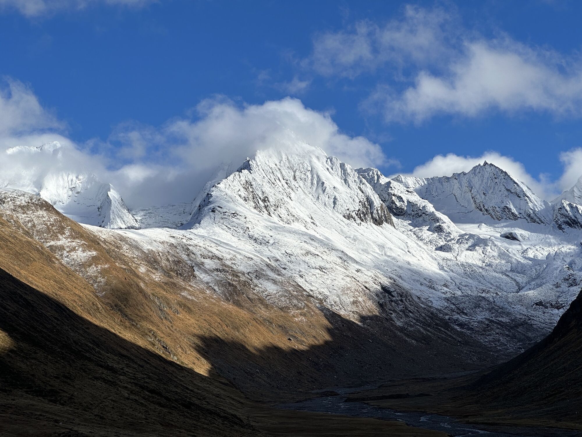
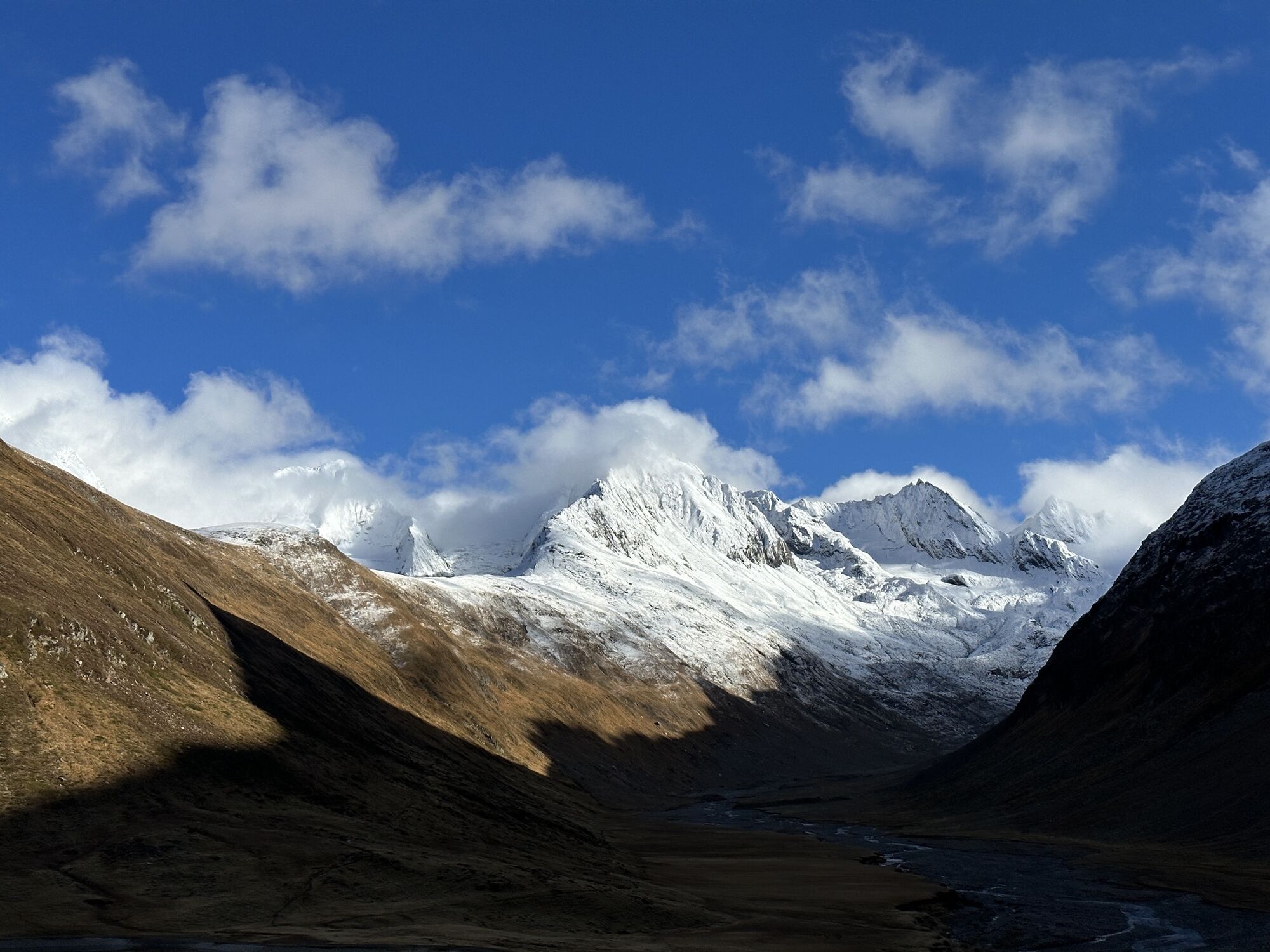
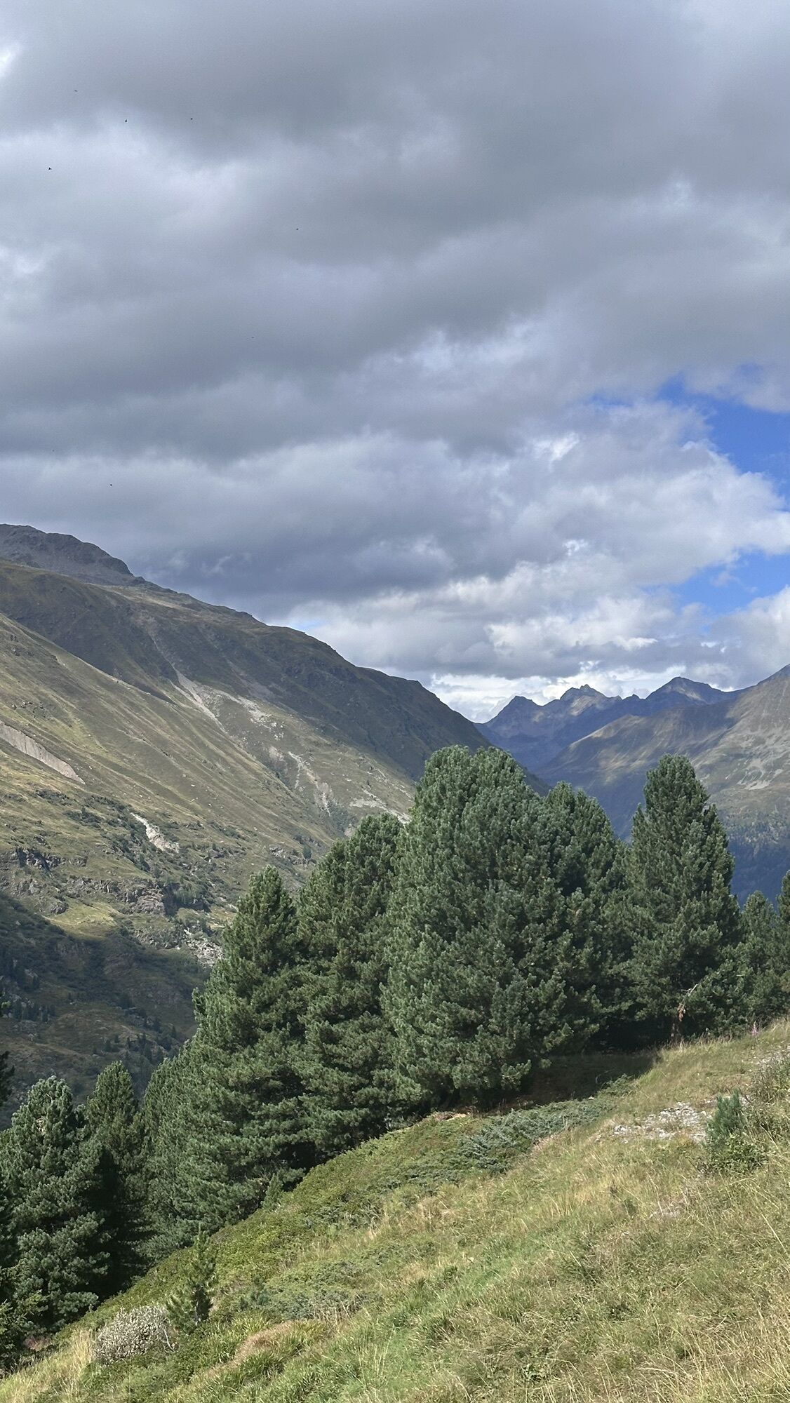
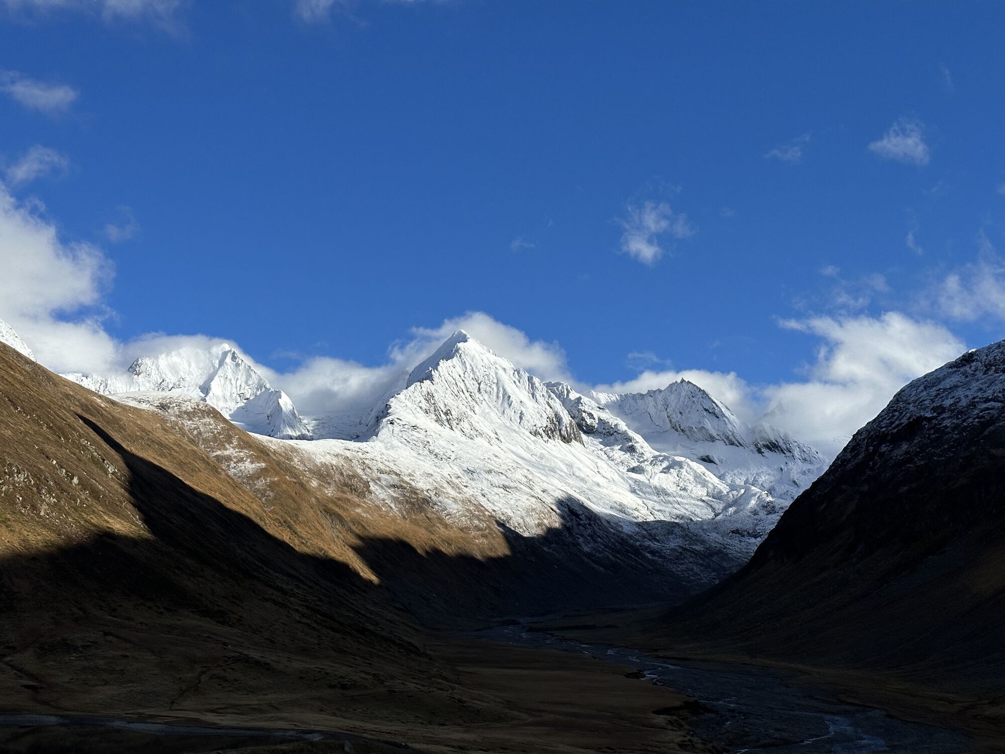
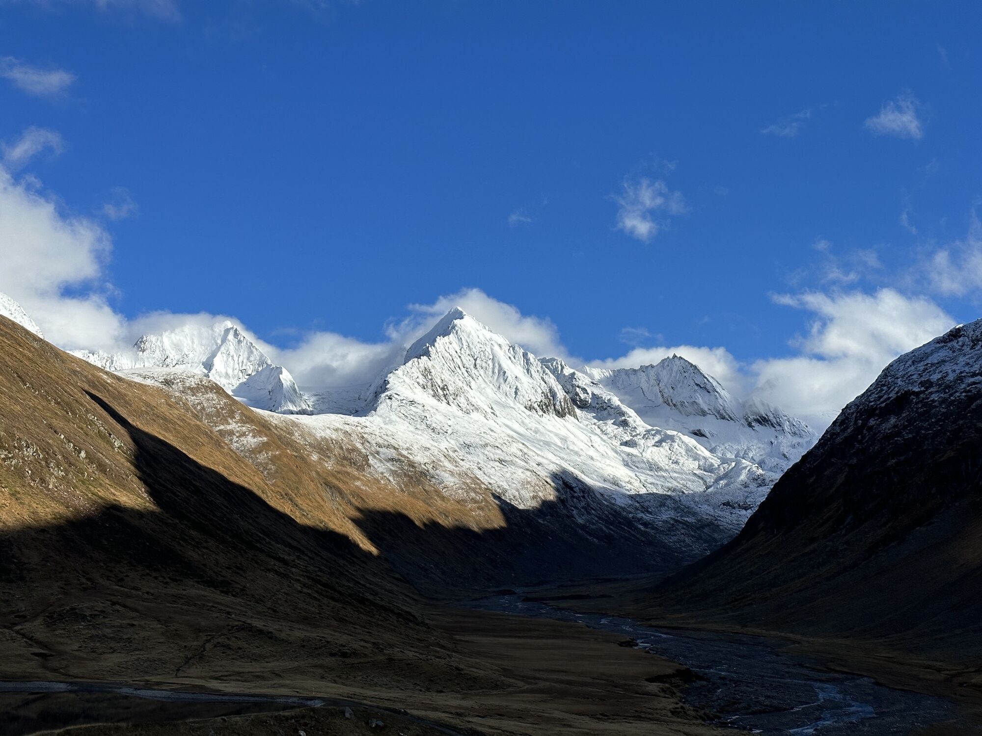
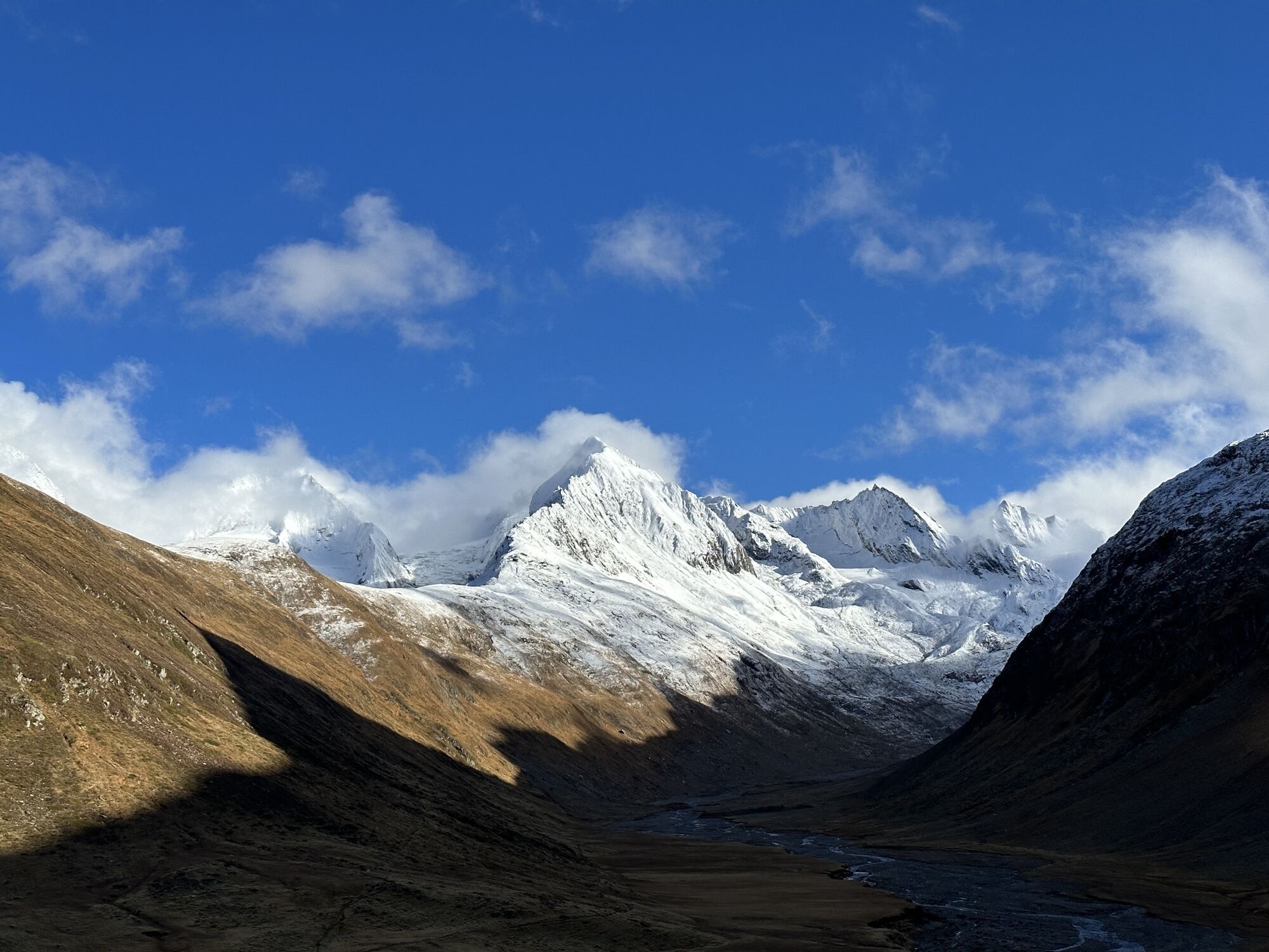
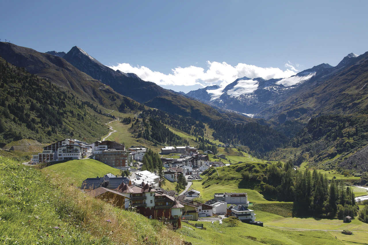
In the center of Obergurgl, you hike inland along the valley and from the Zirben Alm follow the alpine adventure path through the stone pine forest. The route leads into the access road to the Schönwies Hut, which takes a left turn and ascends above the Gurgler Valley to the Langtalereck Hut. Then we follow the signs towards the Piccard Bridge (suspension bridge). At about 2,700 meters, you descend over glacially polished rock plates down to the Piccard Bridge (suspension bridge), which crosses the remains of the glacier tongue of the Gurgler Ferner. You continue along the path up to the Ramolhaus at the Köpfle. In the last section, the trail leads steeply uphill.
Appropriate equipment such as breathable and weather-appropriate outdoor clothing is required for all hikes and routes. Carrying a first aid kit, a mobile phone, and possibly a hiking map, as well as sufficient provisions if there are no opportunities to stop for food, is necessary.
Suitable for those without fear of heights, sure-footed, and alpine-experienced mountaineers; very good physical condition, alpine experience, and mountain equipment (see equipment section), occasionally alpine safety gear, good weather conditions recommended. Please observe the current weather report.
Driving to ÖTZTAL. Located in Tyrol, the Ötztal branches off to the south as the longest side valley of the Eastern Alps. Traveling by car leads visitors via the Inn Valley to the valley entrance and then along the Ötztal. In addition to toll motorways, country roads can also be used. Your trip can be quickly and conveniently planned with the route planner: Route planner: www.google.at/maps
Travel comfortably and safely by train to the Ötztal train station. The final stop or exit point is ÖTZTAL station. Afterwards, you can conveniently and quickly continue by public transport or local taxi companies through the entire valley to your desired destination.
The current bus timetable is available at: http://fahrplan.vvt.at
The following parking options are available in Gurgl:
- Car park in the village center of Obergurgl (down to the right in front of the church) | paid |
- Car park at the village entrance – base station Festkoglbahn | paid | no overnight parking
- Parking lot at the Hochgurglbahn base station, free of charge | no overnight parking
T4
Did you know that…
...Auguste Piccard had to make an emergency landing with his balloon on the Gurgler Ferner in 1931?
More information about hiking in the Ötztal: www.oetztal.com/wandern
Stage 10 as a day route
Obergurgl (1,900 m) – Langtalereck Hut (2,430 m) – Ramolhaus (3,005 m) – Descent back to Obergurgl (1,900 m)
Webcams van de tour
-
Obergurgl
-
Hochgurgl
-
Obergurgl
-
Gaisberg
-
Top Mountain Crosspoint Hochgurgl
-
Top Mountain Crosspoint Hochgurgl
-
Top Mountain Crosspoint Hochgurgl
-
Top Mountain Crosspoint Hochgurgl
-
Top Mountain Crosspoint Hochgurgl
-
Obergurgl
-
Obergurgl
-
Obergurgl
-
Obergurgl
-
Obergurgl
-
Obergurgl
-
Obergurgl
-
Top Mountain Crosspoint Hochgurgl
Populaire rondleidingen in de buurt
-
4,3
Vorderkaser - Eishof / Texelgruppe
lichtWandelen 4,83 km -
4,4
Hochwilde - Pfelders
mediumHigh rope 22,1 km -
5,0
Kreuzspitze
zwaarWandelen 11,6 km -
4,5
Vent - Wilder Mann - Breslauer Hütte - Stableinalm
mediumWandelen 7,25 km -
5,0
From Vent to the Similaun at 3,606 m
zwaarHigh rope 29,2 km -
The Meran High Mountain Road from Leiter Alm hut
zwaarWandelen 92,7 km -
4,5
Nederkogl
zwaarWandelen 6,22 km -
4,8
Vent - Martin Busch Hut - Similaun Hut
mediumWandelen 13,7 km -
5,0
Pfelders - Faltschnaltal - Spronser Seen - Hochmuth
zwaarWandelen 16,7 km -
4,5
Lake Gaislachsee
mediumWandelen 4,04 km
Wandelen en spoorzoeken


Mis geen aanbiedingen en inspiratie voor je volgende vakantie
Uw e-mailadres is toegevoegd aan de mailinglijst.