


Via Ferrata Kühtaier Panorama
Moeilijkheidsgraad: D/E


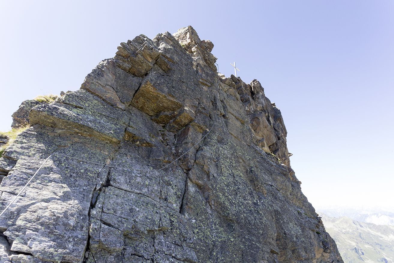
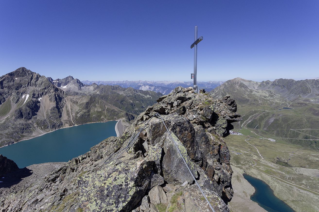
This wonderful via ferrata amid the granite rocks of Sellrain, leads up to 2807-meter high Pockkogel peak. The first section features already a very difficult part graded C+. Most parts of the second section...
This wonderful via ferrata amid the granite rocks of Sellrain, leads up to 2807-meter high Pockkogel peak. The first section features already a very difficult part graded C+. Most parts of the second section are graded D. Please note that there are less step ladders but many natural foot and hand holds in the rock. Especially the last climbing efforts towards the summit and the northern wall are the undisputed highlight of this climbing tour. Due to its high altitude and the quite low temperatures an excellent physical shape is required. Truly breathtaking panoramic views await climbers at the end of the via ferrata.
Trail length and time required
Pitch length 750 m. 3 – 3.5 hours, both ways (incl. descent) approx. 4.5 – 5 hours. Descent via signposted hiking trail leading down to the ridge in south-western direction. Further on past Finstertaler Stausee water reservoir. At the dam you turn-off to the right towards Dreiseenhütte. From here you walk down to the village of Kühtai.


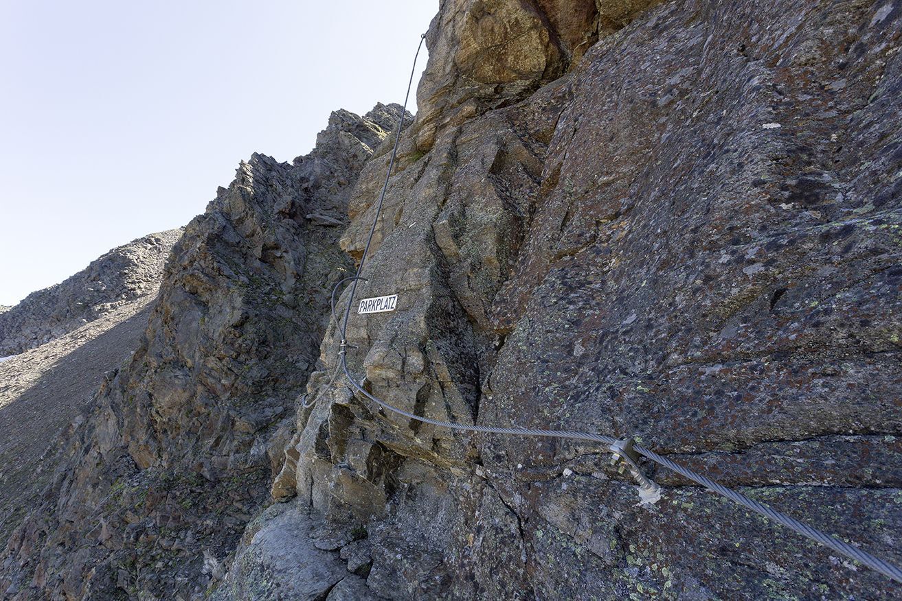

Equipment: helmet, climbing harness and complete via ferrata set, via ferrata gloves, appropriate shoes, hiking poles for the descent (optional).
SAFETY ON THE VIA FERRATA
The Austrian Alpine Club has published 10 recommendations for climbing on via ferratas in order to increase safety:
Plan carefully Destination should correspond to personal abilities Use complete set of professional climbing equipment Don’t access the route in the event of a thunderstorm Check wire rope and anchors accurately and critically Partner check at the access point Maintain sufficient distance Talk clearly when overtaking someone Watch out for falling rocks Respect nature and environment
The car drive to the Ötztal valley. Situated in Tirol, the Ötztal valley set off in southerly direction and is the longest side valley in the Eastern Alps. The journey with the car leads you through the Inntal valley to the entrance of the valley and further on through the valley. Among the toll motorways you can also use the country roads. A route planner will show you the easiest and most convenient way: www.google.at/maps
Enjoy a both comfortable and relaxing train ride to the train station in Ötztal Bahnhof. You get off the train in ÖTZTAL Bahnhof where you change to a public bus or local taxi. The current bus schedule can be found at: http://fahrplan.vvt.at
The following parking facilities are available in Kühtai:
- car park by the cable car Drei-Seen-Bahn; free of charge
D/E
https://www.oetztal.com/climbing
Populaire rondleidingen in de buurt
- 4,6
Faltegartenköpfl peak
mediumWandelen4,04 km - 4,4
Oetz - Lake Piburger See - Oetz
mediumWandelen7,16 km - 5,0
Larstigalm - Niederthai
lichtWandelen3,24 km - 4,7
Umhausen - Stuibenfall - Umhausen
mediumWandelen7,94 km - 4,1
Lampsenspitze, Sellrain, Tirol
mediumToerskitocht4,97 km - 5,0
"Miners trail"
mediumWandelen10,8 km - 3,7
Auerklamm Oetz
mediumWandelen3,46 km - 4,7
Drei-Kogel: Narren, Poschach und Peista in Niederthai
mediumWandelen15,8 km - 4,3
lake Piburger See with platform "Kanzel"
mediumWandelen6,21 km - 4,5
Neunerkogel
mediumWandelen8,90 km
Wandelen en spoorzoeken


Mis geen aanbiedingen en inspiratie voor je volgende vakantie
Uw e-mailadres is toegevoegd aan de mailinglijst.