


🥾 Pinzga Hatscher – Variant D: Zell am See → Saalbach
Moeilijkheidsgraad: T3


Foto's van onze gebruikers

 © JordyGemaakt op 15.08.2025
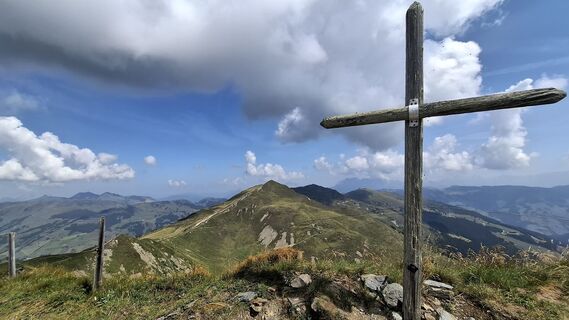 © JordyGemaakt op 15.08.2025
 © JordyGemaakt op 15.08.2025
 © JordyGemaakt op 15.08.2025
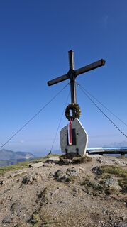 © JordyGemaakt op 15.08.2025
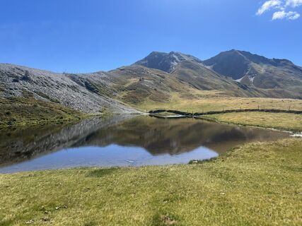
 © Zoran DujakovicGemaakt op 07.09.2024
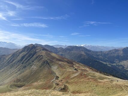
 © firebird 93Gemaakt op 27.09.2023
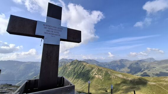 © JordyGemaakt op 15.08.2025
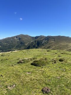 © Zoran DujakovicGemaakt op 07.09.2024
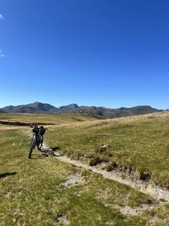 © Zoran DujakovicGemaakt op 07.09.2024
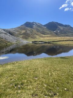 © Zoran DujakovicGemaakt op 07.09.2024
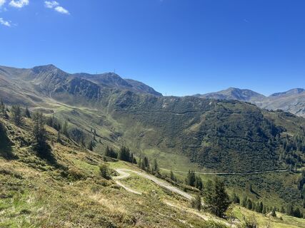 © Zoran DujakovicGemaakt op 07.09.2024
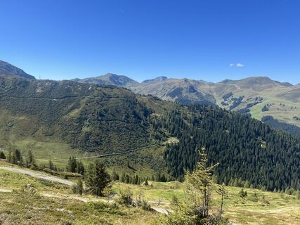 © Zoran DujakovicGemaakt op 07.09.2024
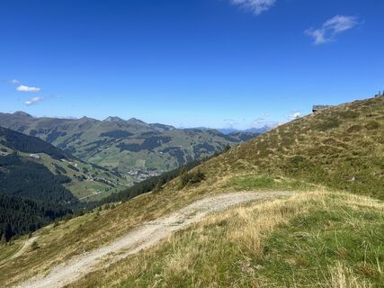 © Zoran DujakovicGemaakt op 07.09.2024
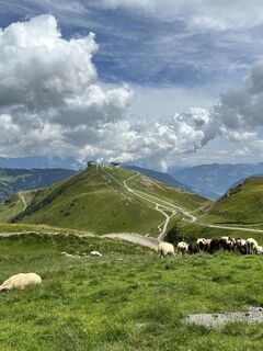
 © Dave BanisGemaakt op 02.08.2024
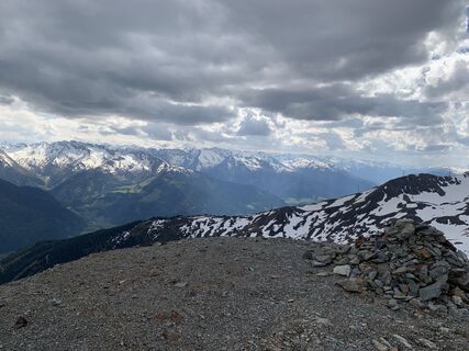
 © Karin WinterGemaakt op 12.05.2024
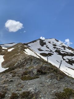 © Karin WinterGemaakt op 12.05.2024
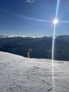 © Maik KramerGemaakt op 16.01.2024
 © Maik KramerGemaakt op 16.01.2024
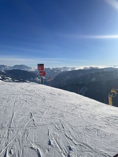 © Maik KramerGemaakt op 16.01.2024
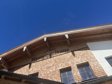 © firebird 93Gemaakt op 27.09.2023
 © firebird 93Gemaakt op 27.09.2023
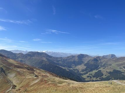 © firebird 93Gemaakt op 27.09.2023
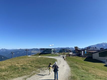
 © Margreth ReiterGemaakt op 05.09.2023
 © Margreth ReiterGemaakt op 05.09.2023
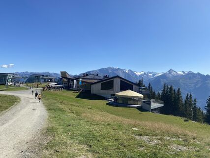 © Margreth ReiterGemaakt op 05.09.2023
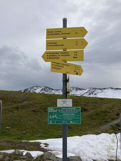
 © Veronika KöppenGemaakt op 24.09.2022


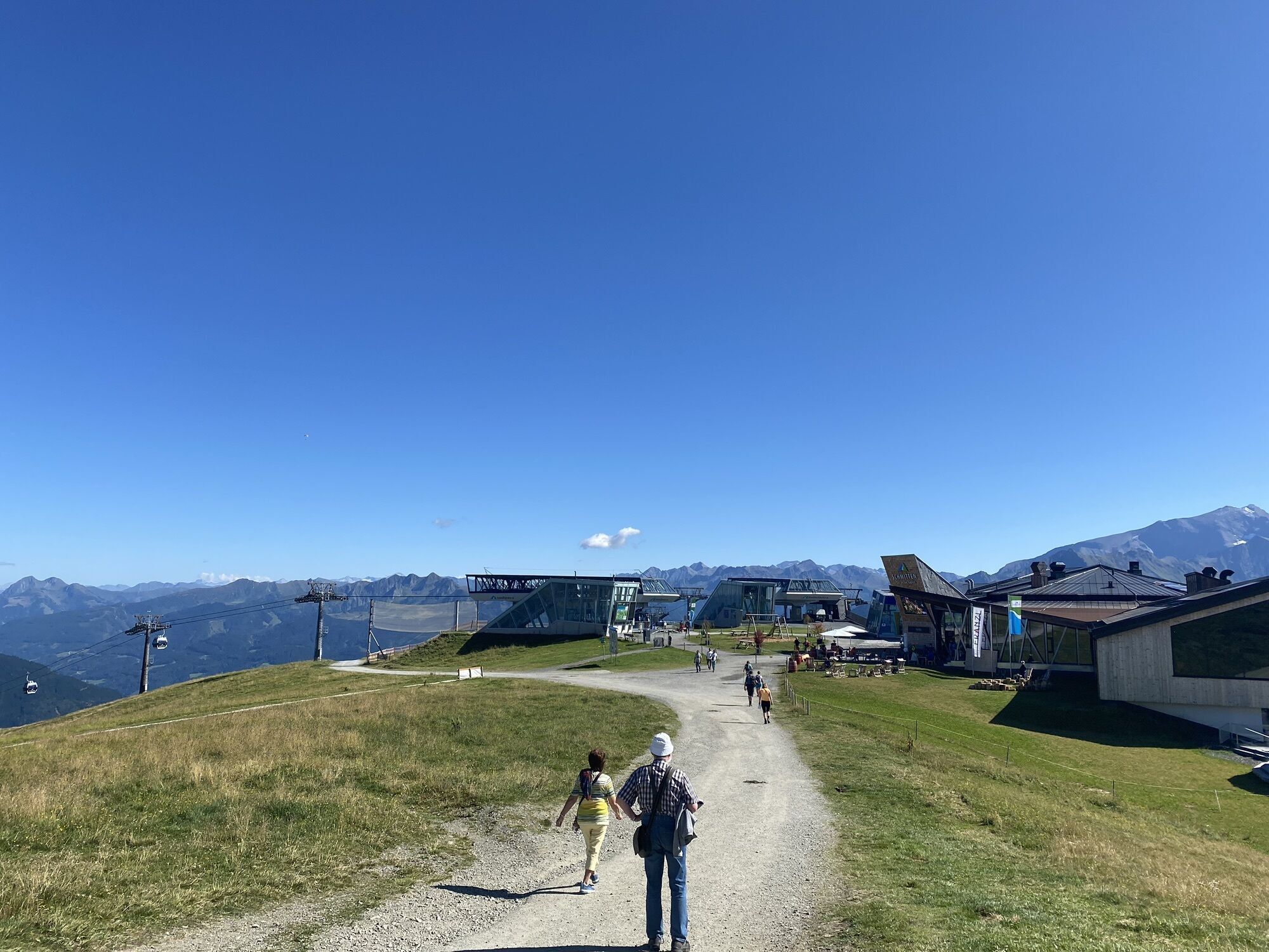


Comfortably ascend with the Schmittenhöhebahn and then hike with great views to Saalbach.
This variant of the long-distance hike "Pinzga Hatscher" starts in Zell am See and uses the Schmittenhöhebahn to...
Comfortably ascend with the Schmittenhöhebahn and then hike with great views to Saalbach.
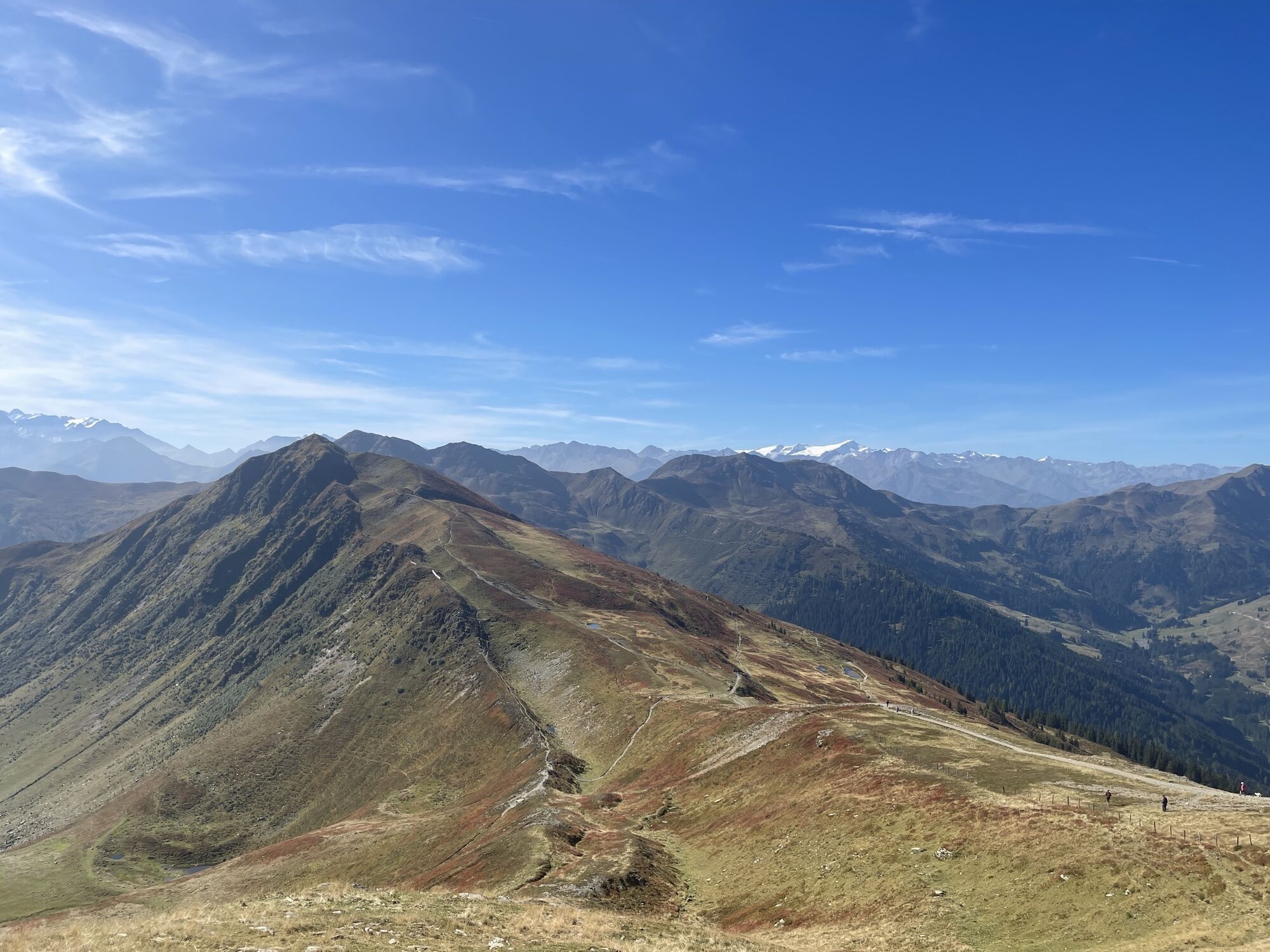
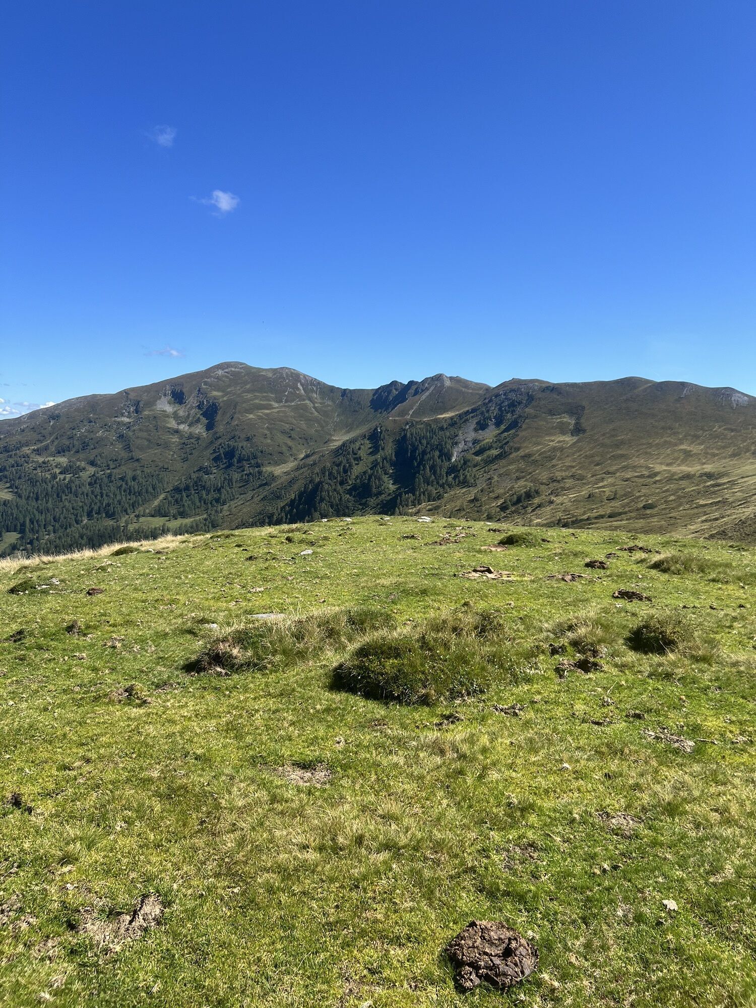
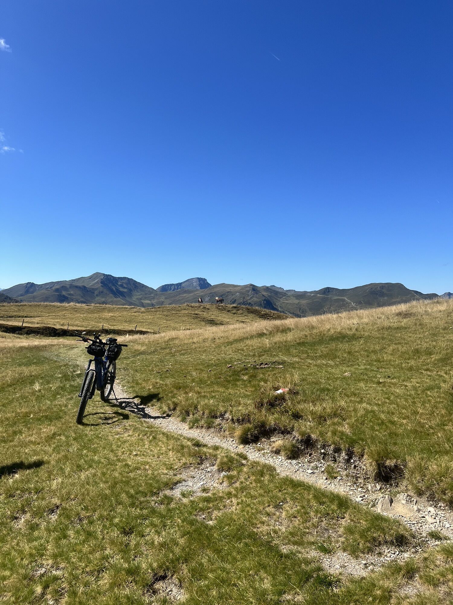
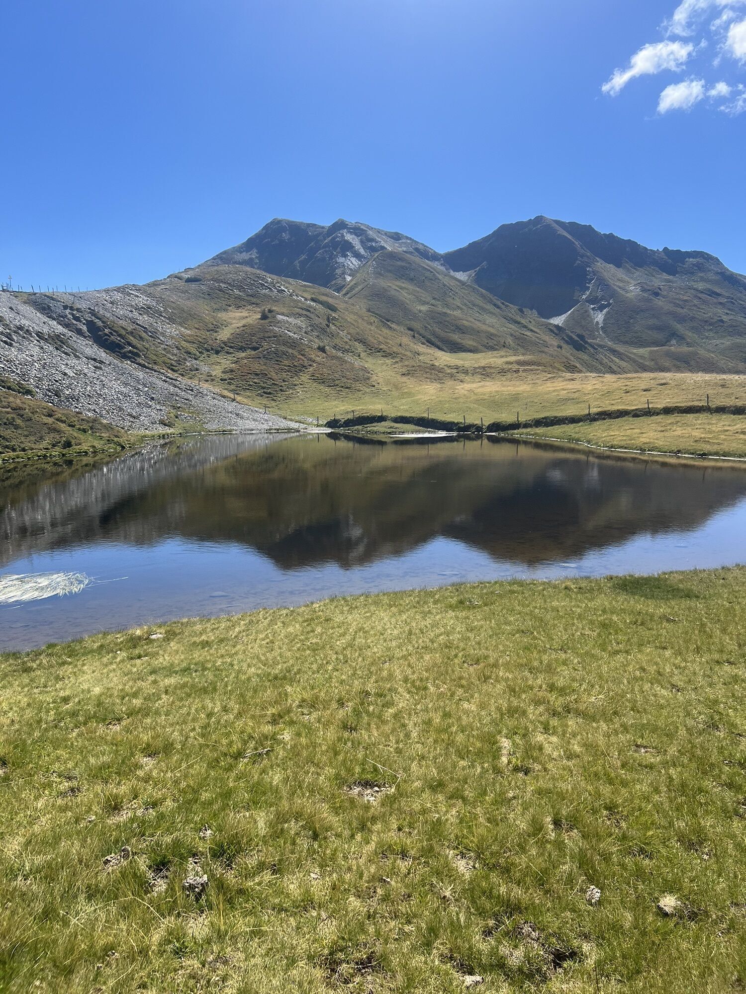
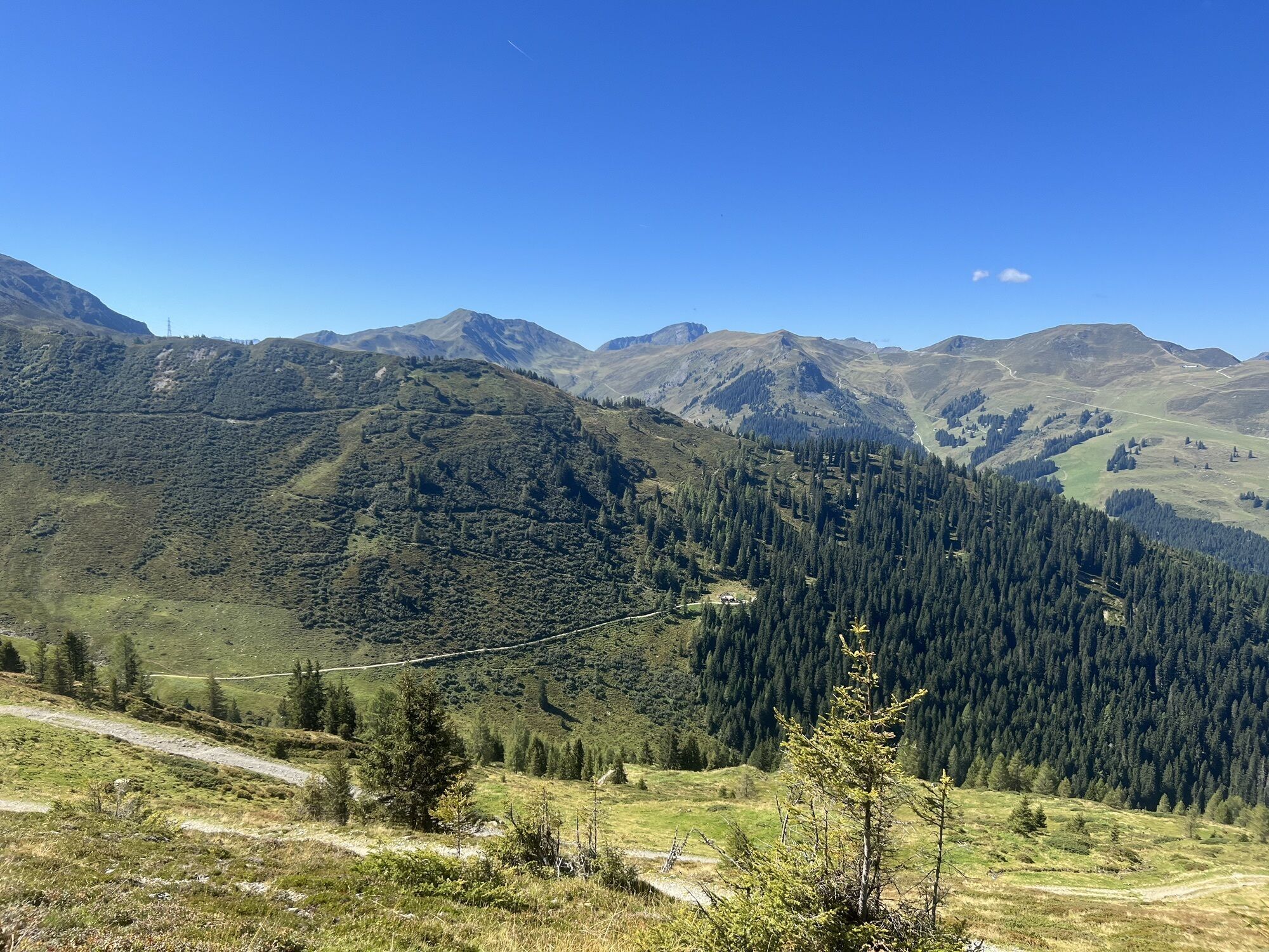
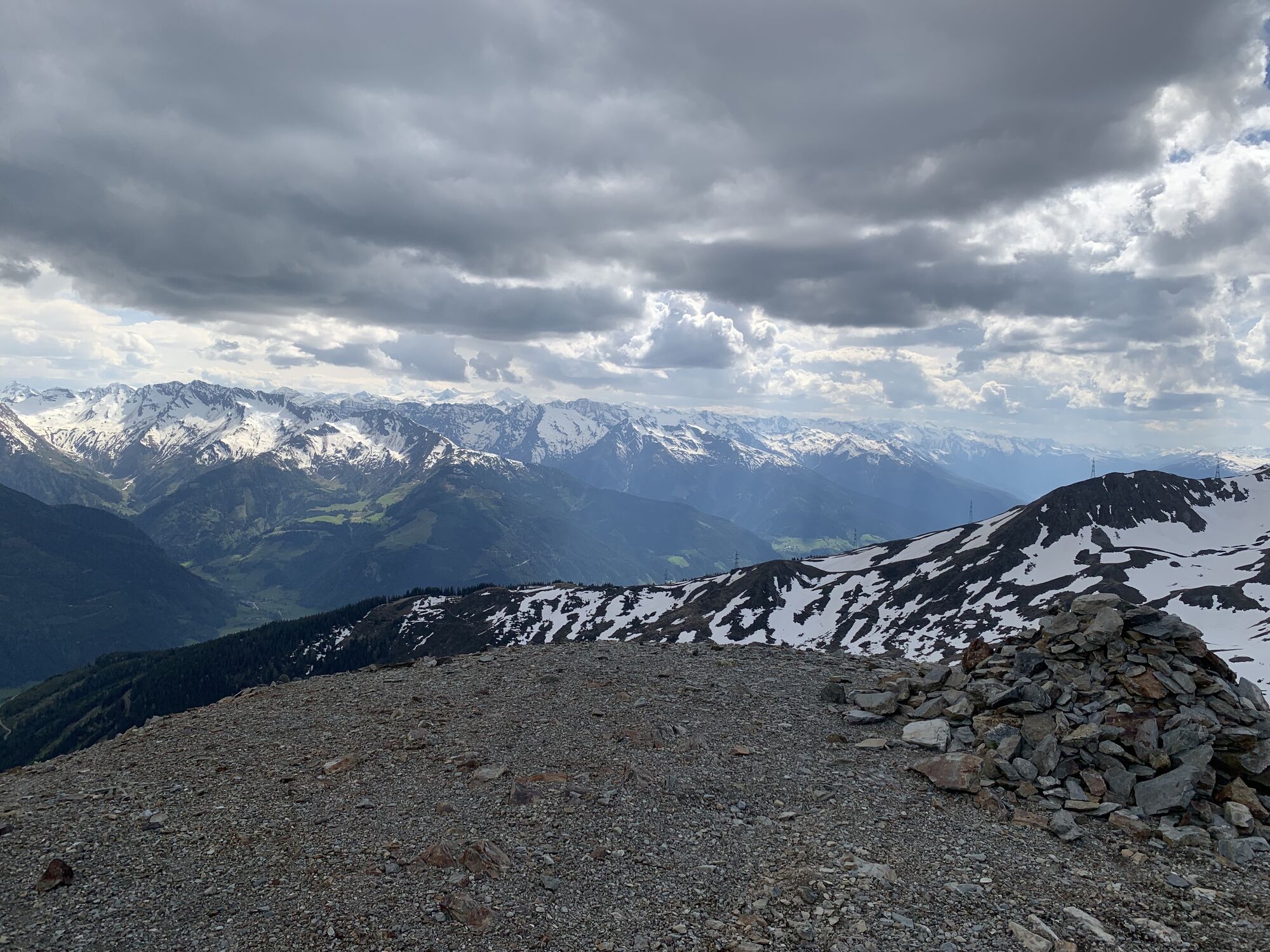
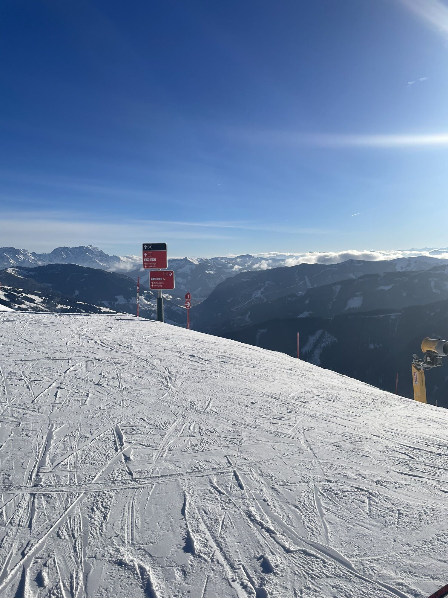
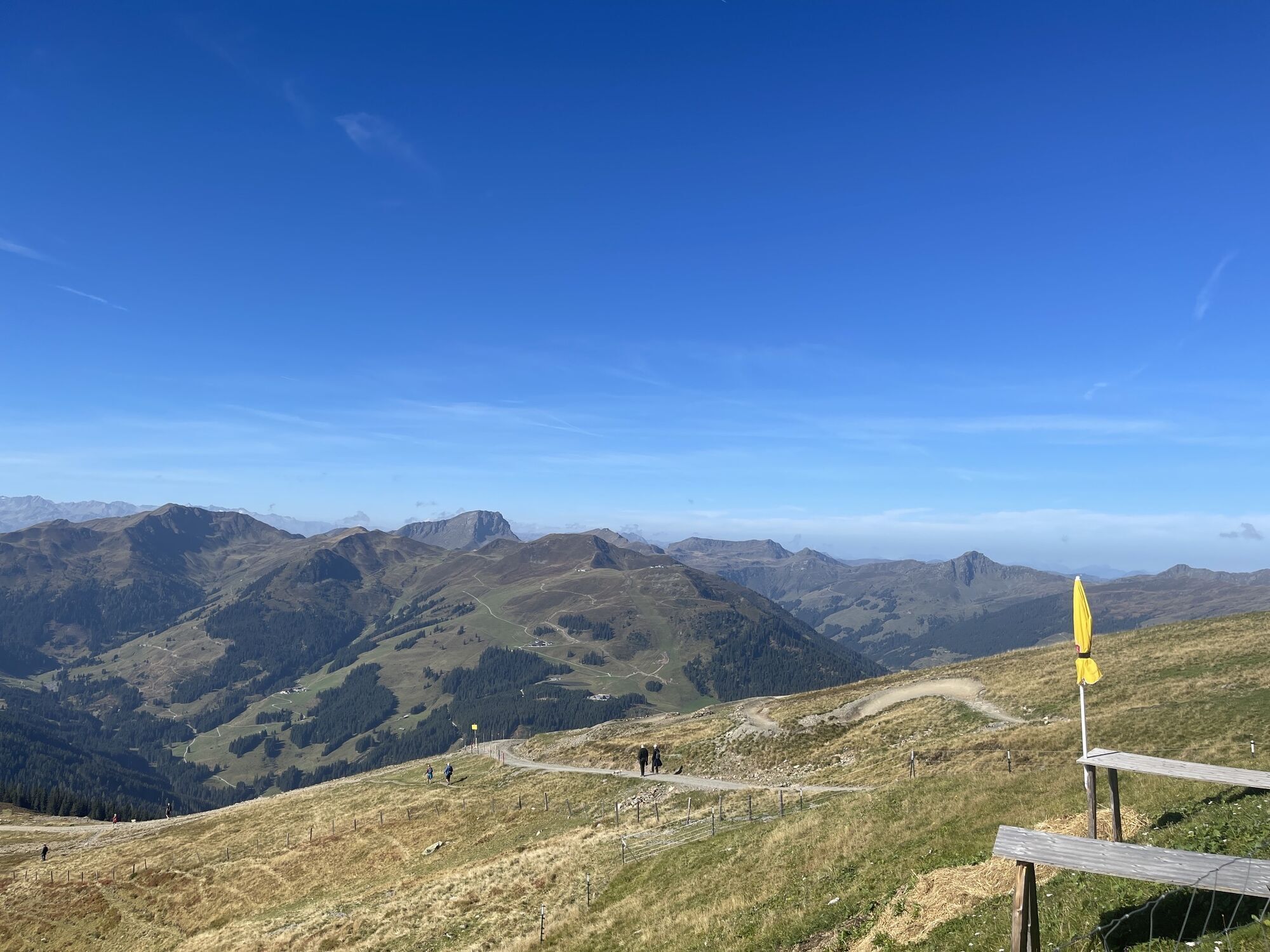
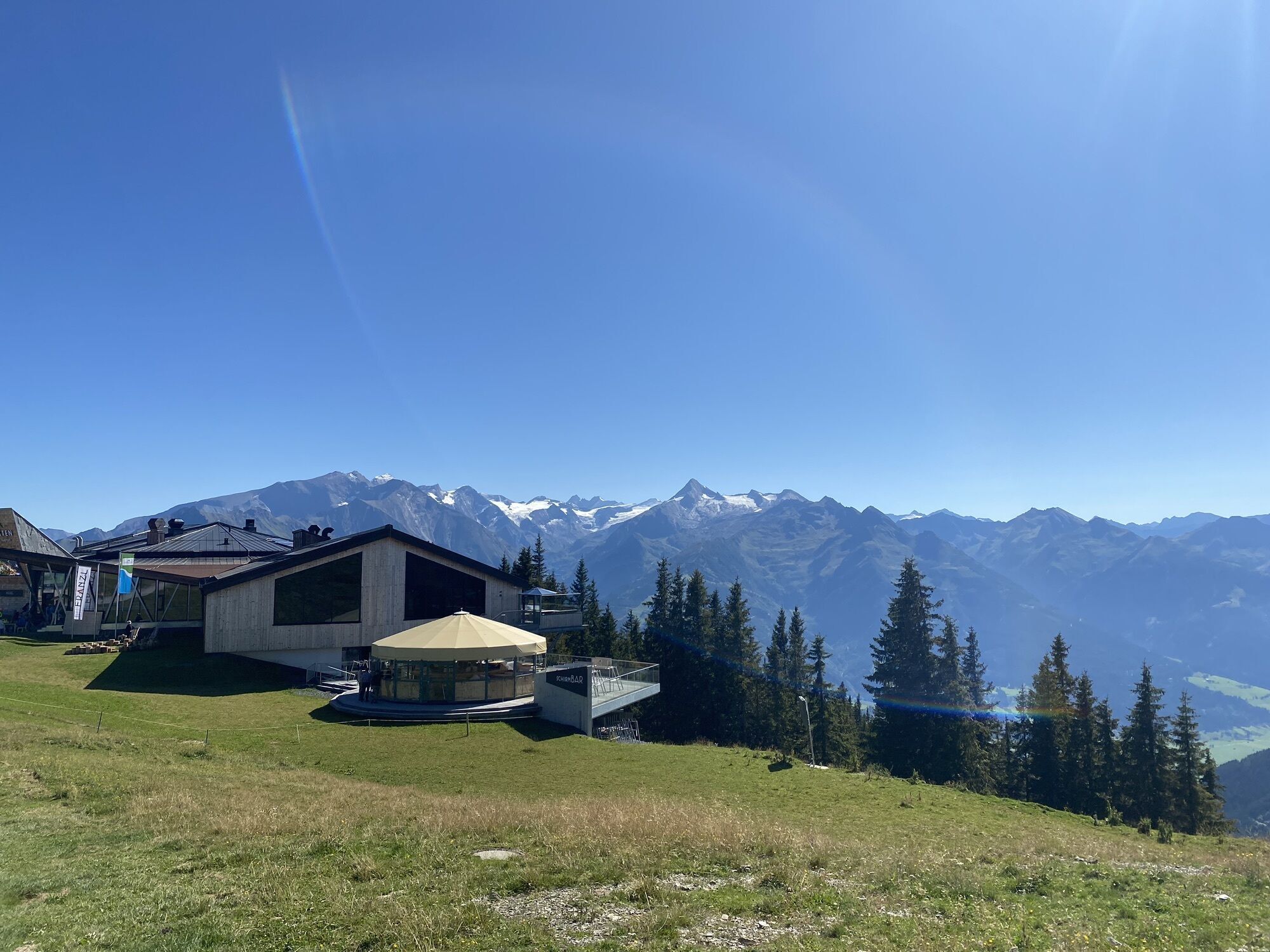
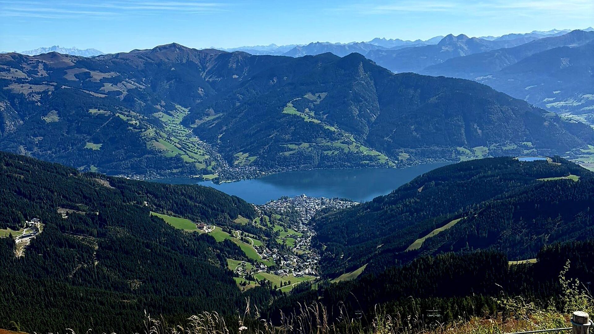
This variant of the long-distance hike "Pinzga Hatscher" starts in Zell am See and uses the Schmittenhöhebahn to facilitate the first ascent. From the mountain station of the Schmittenhöhe (1,965 m), an impressive panorama opens up over the Hohe Tauern and the Steinernes Meer – the perfect starting point for a scenic hike over the gentle grassy mountains in the direction of Glemmtal.
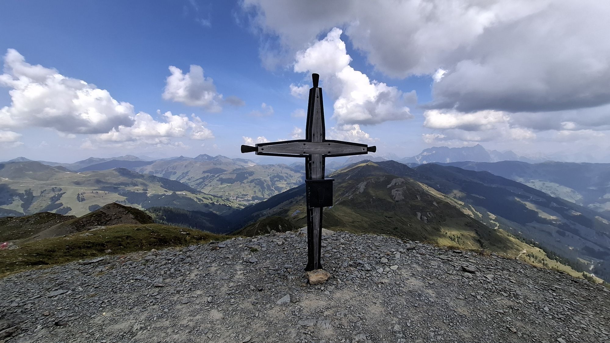
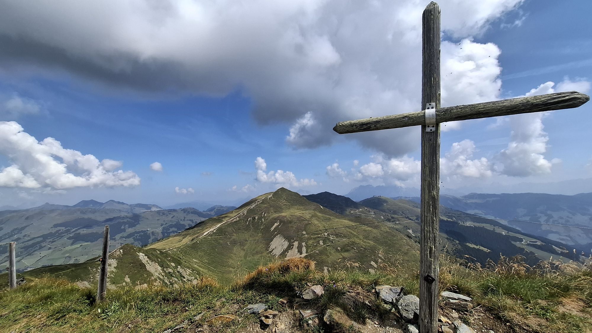
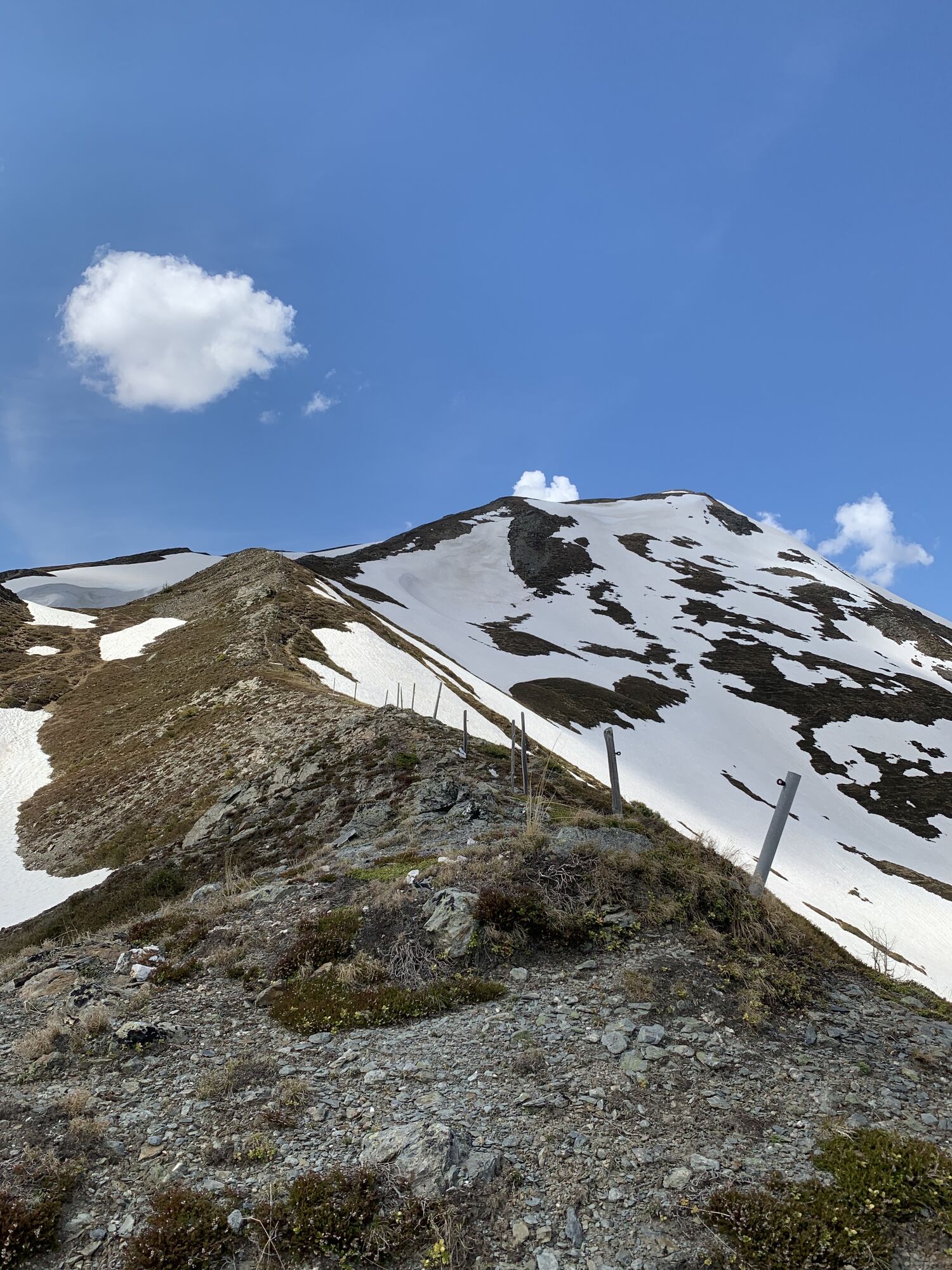
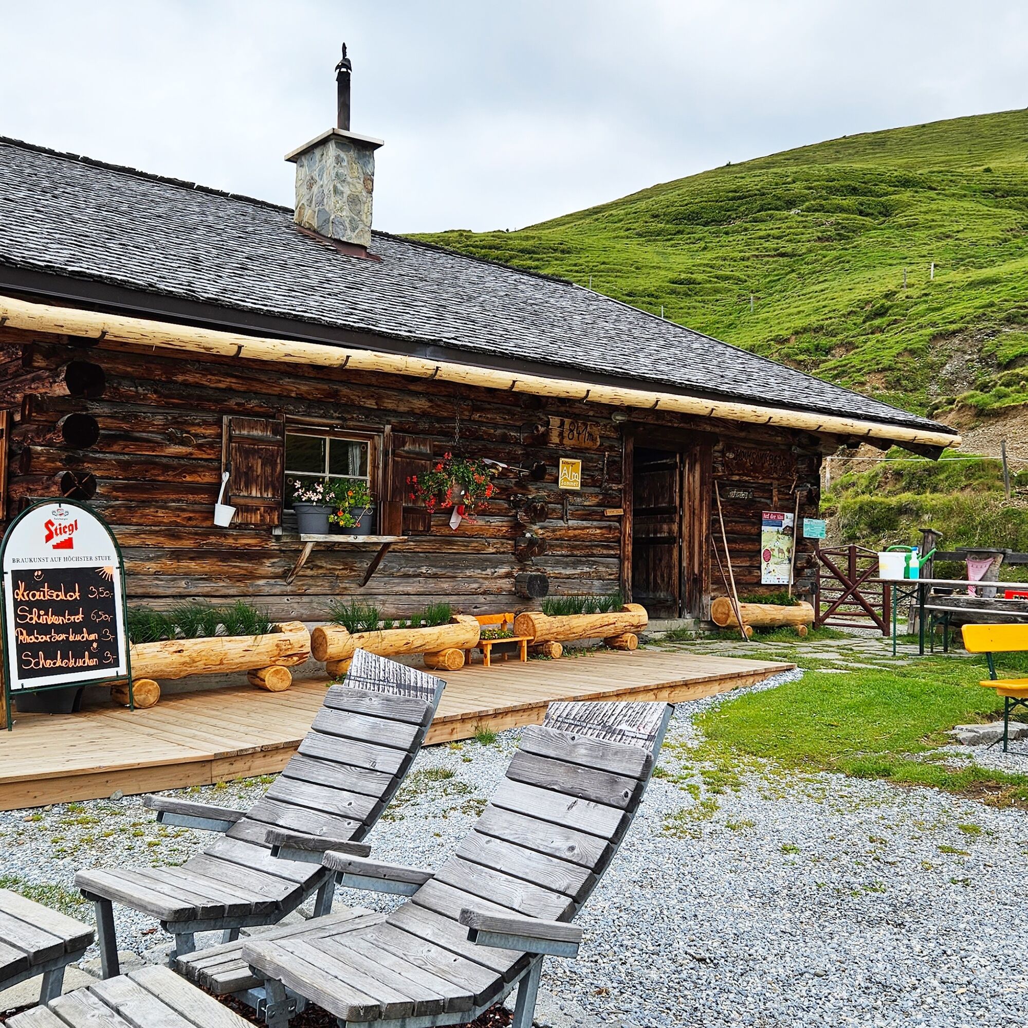
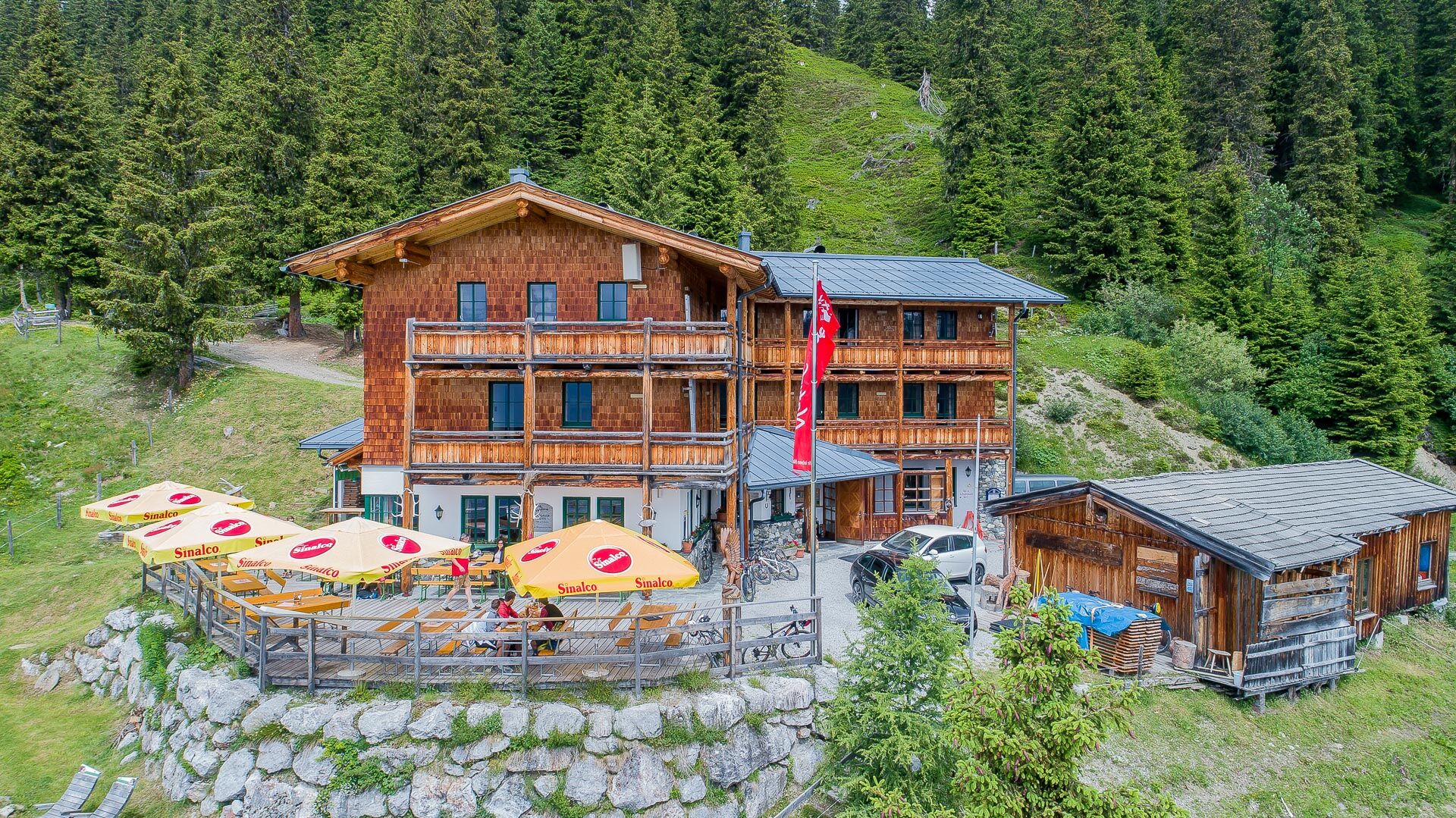
The path runs over well-passable mountain and meadow trails, past rustic alpine huts and blooming mountain meadows. Time and again, panorama points invite you to pause. The destination of this stage is Saalbach, the heart of the Glemmtal.
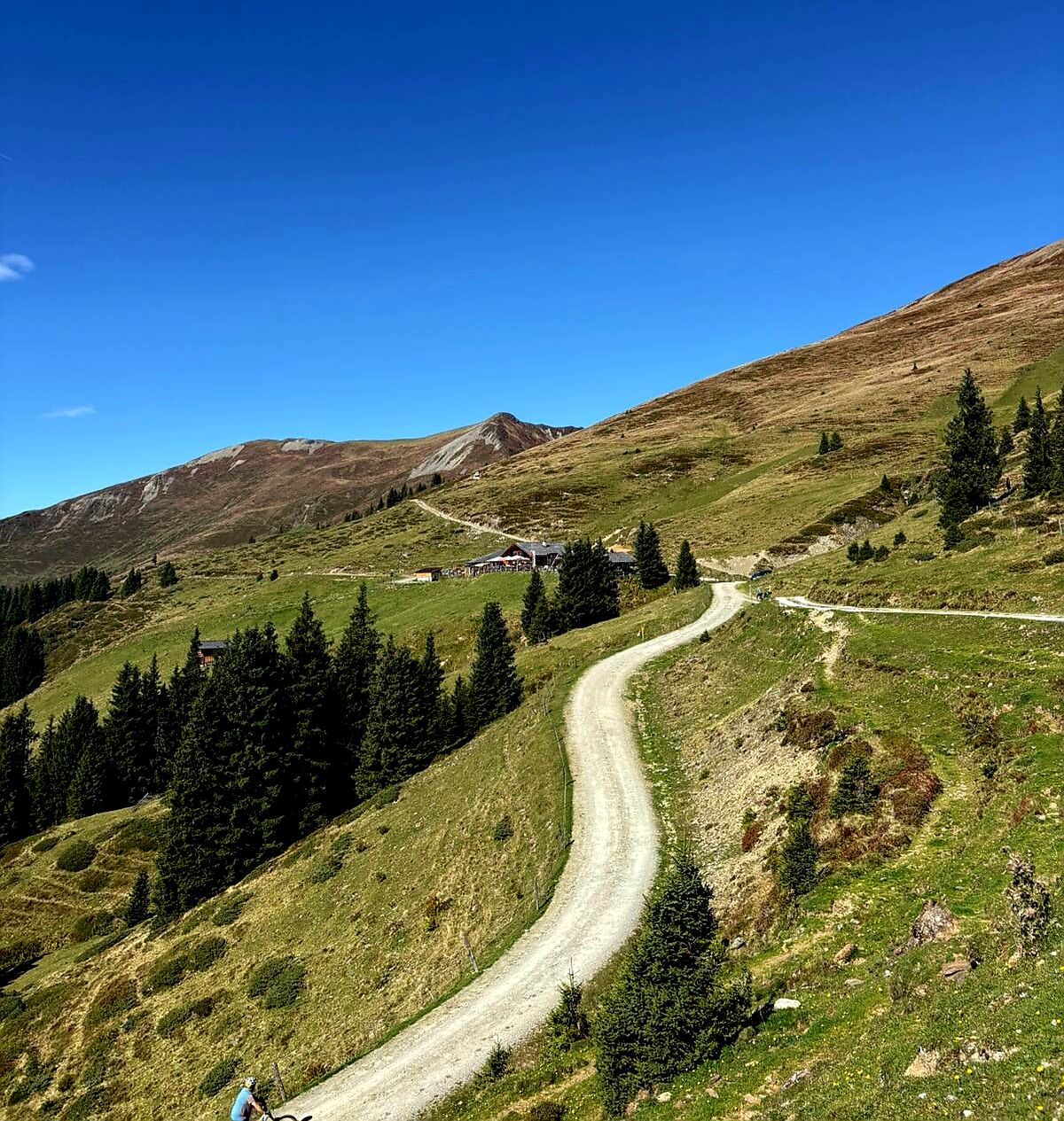
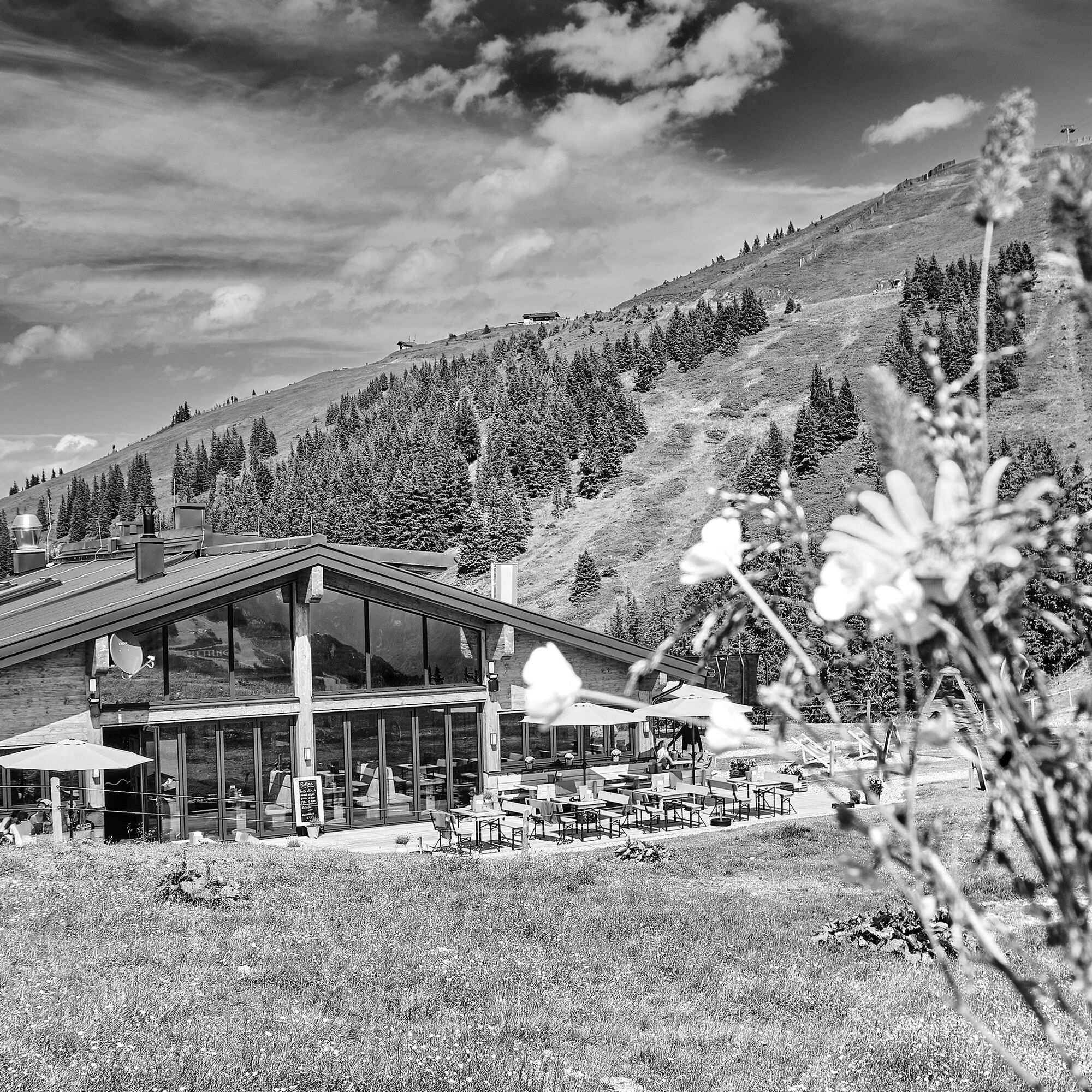
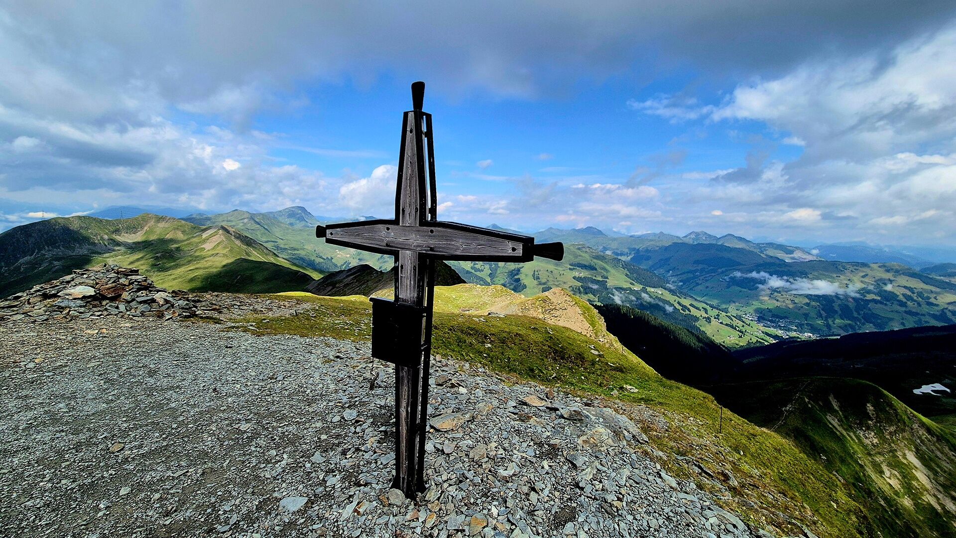
The ascent goes with the Schmittenhöhebahn up to 2,000 m and continues along the Pinzgauer Spaziergang. Past numerous peaks and the West Summit, the hiking route leads to the mountain station of the Schattberg X-press. The descent takes place via the well-known north slope among skiers into the town center of Saalbach or by gondola.
Ja
Sturdy, ankle-high footwear, hiking poles, headwear, sun protection, rain protection, water, necessary medications, first aid kit, detailed hiking map
Self-assessment: Check your physical fitness before each mountain hike and properly assess your strength as well as that of your companions – especially your children! Surefootedness and a head for heights are often very important!
! Caution COWS !
- correct behavior: keep distance, stay calm, keep dogs on a leash, do not pet or feed calves, take warning signals seriously!
Planning and preparation: Plan every intended mountain hike carefully in advance. Hiking maps and guides as well as information from alpine associations and locals such as mountain guides and hut operators can be helpful.
Equipment: You need appropriate equipment and clothing in the mountains, especially sturdy, high footwear with non-slip soles. Weather and cold protection are indispensable, as weather can often change unexpectedly.
Weather forecasts: Check current weather conditions at: www.zamg.at or www.uwz.at
Together: Follow the 10 rules for proper interaction with grazing animals and do not leave any waste in nature!
Do not dislodge stones! Do not dislodge stones, as this can seriously endanger other hikers. Marked areas with risk of falling rocks should be crossed as quickly and carefully as possible.
Turn back in time! This is not a shame but a sign of common sense. It becomes necessary if the weather changes, fog sets in, or if the path is too difficult or not in good condition.
Emergency numbers:
Alpine emergency: 140
International emergency: 122
⇾ More information: https://www.viehhofen.at/de/sommer/wandern/sicher_am_berg
Turnoff Maishofen towards Glemmtal. Follow main road to Viehhofen.
Line 680, bus stop in the town center
By car: parking available in the town center (only for day parkers)
T3
Further information about the Sorglos Package with luggage transport at info@salzburgerland.com or www.viehhofen.at
Shortened hiking time by using the mountain lifts View of the Hohe Tauern, Steinernes Meer, Loferer Steinberger, -> with good visibility the Großvenediger is within "reach"! Along the hike, additional summits (Maurerkogel, Gernkogel, Zirmkogel, Hochkogel) can be reached.
Dining options at the following huts: Eder Alm, Kettingalm, Pinzgauer Hütte, Hochsonnbergalm
Webcams van de tour
Berghotel Seidl-Alm
Schattberg Westgipfel
Hinterglemm Dorf
Schmittenhöhe - Glocknerwiese
Sonnkogel
Schmittenhöhe
Mitterberg bei Thumersbach
Zell am See / Hotel Berner
Schmittenhöhe
Schmittenhöhe
Hinterglemm - Saalbach
Großer Asitz / Gipfelkreuz
Zwölferkogel
Saalbach - Alpinresort Sport & Spa
Maishofen Sausteige
Saalbach-Hinterglemm - Kohlmais
Leogang - Grosser Asitz
Maishofen Dorfplatz
Martenhof
Saalbach-Hinterglemm - Reiterkogel
Wohlfühlhotel-Johanneshof
Eberharthof - Saalbach-Hinterglemm
Populaire rondleidingen in de buurt
- 4,7
Tristkogel
zwaarWandelen15,6 km - 4,5
Birnbachloch Leogang, Österreich
mediumWandelen5,18 km - 4,1
Passauer Hütte
zwaarWandelen4,14 km - 4,5
Sigmund Thun Klamm
lichtWandelen3,10 km - 4,4
Birnbachloch
mediumWandelen6,40 km - 5,0
Leoganger SOUTH
zwaarKlettersteig4,08 km - 4,8
Sigmund Thun Klamm, Klammsee, Bürgkogel
lichtWandelen4,56 km - 4,2
Spielbergalmen
mediumWandelen10 km - 5,0
Manlitzkogel
zwaarWandelen13,4 km - 4,5
Lettlkaser
mediumWandelen4,40 km
Wandelen en spoorzoeken


Mis geen aanbiedingen en inspiratie voor je volgende vakantie
Uw e-mailadres is toegevoegd aan de mailinglijst.